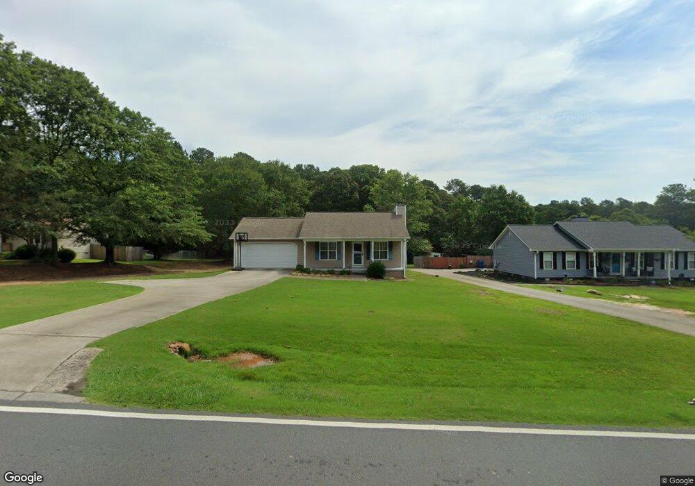
485 Miles Patrick Rd Winder, GA 30680
Estimated Value: $278,196 - $307,000
Studio
2
Baths
1,242
Sq Ft
$233/Sq Ft
Est. Value
About This Home
This home is located at 485 Miles Patrick Rd, Winder, GA 30680 and is currently estimated at $289,299, approximately $232 per square foot. 485 Miles Patrick Rd is a home located in Barrow County with nearby schools including County Line Elementary School, Russell Middle School, and Winder-Barrow High School.
Ownership History
Date
Name
Owned For
Owner Type
Purchase Details
Closed on
Apr 19, 2006
Sold by
Skelton Jeanette P
Bought by
Savage Christopher J
Current Estimated Value
Home Financials for this Owner
Home Financials are based on the most recent Mortgage that was taken out on this home.
Original Mortgage
$121,985
Outstanding Balance
$68,646
Interest Rate
6.29%
Mortgage Type
FHA
Estimated Equity
$220,653
Purchase Details
Closed on
Oct 21, 1996
Sold by
Farmer Daniel B
Bought by
Beard Amy L
Create a Home Valuation Report for This Property
The Home Valuation Report is an in-depth analysis detailing your home's value as well as a comparison with similar homes in the area
Home Values in the Area
Average Home Value in this Area
Purchase History
| Date | Buyer | Sale Price | Title Company |
|---|---|---|---|
| Savage Christopher J | $123,900 | -- | |
| Beard Amy L | $74,000 | -- |
Source: Public Records
Mortgage History
| Date | Status | Borrower | Loan Amount |
|---|---|---|---|
| Open | Savage Christopher J | $121,985 | |
| Closed | Beard Amy L | $0 |
Source: Public Records
Tax History
| Year | Tax Paid | Tax Assessment Tax Assessment Total Assessment is a certain percentage of the fair market value that is determined by local assessors to be the total taxable value of land and additions on the property. | Land | Improvement |
|---|---|---|---|---|
| 2025 | $1,907 | $67,917 | $16,800 | $51,117 |
| 2024 | $1,900 | $66,466 | $16,800 | $49,666 |
| 2023 | $1,894 | $66,466 | $16,800 | $49,666 |
| 2022 | $1,903 | $54,660 | $16,800 | $37,860 |
| 2021 | $1,809 | $48,660 | $10,800 | $37,860 |
| 2020 | $1,729 | $48,660 | $10,800 | $37,860 |
| 2019 | $1,703 | $47,168 | $10,800 | $36,368 |
| 2018 | $1,699 | $47,168 | $10,800 | $36,368 |
| 2017 | $1,098 | $36,807 | $10,800 | $26,007 |
| 2016 | $1,239 | $35,979 | $12,000 | $23,979 |
| 2015 | $1,249 | $36,265 | $12,000 | $24,265 |
| 2014 | $1,072 | $30,716 | $5,880 | $24,836 |
| 2013 | -- | $29,548 | $5,880 | $23,668 |
Source: Public Records
Map
Nearby Homes
- 538 Valleyview Dr
- 128 Northridge Dr
- 27 Creekside Dr
- 2050 Whispering Way
- 421 N 5th Ave
- 845 Idlewood Rd
- 403 Ryan Cir
- 0 E Northcrest Dr Unit 10648147
- 469 Plantation Dr
- 318 Ryan Rd
- 932 Century Oak Dr
- 236 Hidden Ct
- 222 Ryan Rd
- 223 Lacey Ln
- 311 Rockwell Church Rd NW
- 615 Wellington Dr
- 326 Fayette Dr
- 436 Northcrest Dr
- 326 Miles Patrick Rd
- 716 Michael Dr
- 481 Miles Patrick Rd
- 477 Miles Patrick Rd
- 493 Miles Patrick Rd
- 473 Miles Patrick Rd
- 484 Miles Patrick Rd
- 480 Miles Patrick Rd
- 490 Miles Patrick Rd
- 494 Miles Patrick Rd
- 476 Miles Patrick Rd
- 497 Miles Patrick Rd
- 469 Miles Patrick Rd
- 468 Miles Patrick Rd
- 542 Valley View Dr
- 465 Miles Patrick Rd
- 0 Miles Patrick Rd Unit 7468165
- 0 Miles Patrick Rd Unit 7468162
- 0 Miles Patrick Rd Unit 7468160
- 0 Miles Patrick Rd Unit 7468158
- 0 Miles Patrick Rd Unit LOT 4 10391622
- 0 Miles Patrick Rd Unit LOT 3 10391621
Your Personal Tour Guide
Ask me questions while you tour the home.