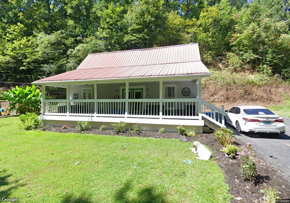
485 Millpond Dr Manchester, KY 40962
Estimated Value: $101,000 - $141,034
2
Beds
2
Baths
1,320
Sq Ft
$85/Sq Ft
Est. Value
About This Home
This home is located at 485 Millpond Dr, Manchester, KY 40962 and is currently estimated at $112,259, approximately $85 per square foot. 485 Millpond Dr is a home with nearby schools including Clay County High School and Manchester Christian Academy.
Ownership History
Date
Name
Owned For
Owner Type
Purchase Details
Closed on
Jan 5, 2015
Sold by
Sowders Paul and Sowders Dinah
Bought by
Sowders Amber
Current Estimated Value
Purchase Details
Closed on
Apr 30, 2014
Sold by
Sowders Paul and Sowders Dinah
Bought by
Sowders Amber J
Home Financials for this Owner
Home Financials are based on the most recent Mortgage that was taken out on this home.
Original Mortgage
$60,000
Interest Rate
4.37%
Mortgage Type
New Conventional
Create a Home Valuation Report for This Property
The Home Valuation Report is an in-depth analysis detailing your home's value as well as a comparison with similar homes in the area
Home Values in the Area
Average Home Value in this Area
Purchase History
| Date | Buyer | Sale Price | Title Company |
|---|---|---|---|
| Sowders Amber | $1,000 | None Available | |
| Sowders Amber J | -- | None Available | |
| Sowders Amber J | $75,000 | None Available |
Source: Public Records
Mortgage History
| Date | Status | Borrower | Loan Amount |
|---|---|---|---|
| Previous Owner | Sowders Amber J | $60,000 |
Source: Public Records
Tax History Compared to Growth
Tax History
| Year | Tax Paid | Tax Assessment Tax Assessment Total Assessment is a certain percentage of the fair market value that is determined by local assessors to be the total taxable value of land and additions on the property. | Land | Improvement |
|---|---|---|---|---|
| 2024 | $896 | $75,000 | $0 | $0 |
| 2023 | $895 | $75,000 | $0 | $0 |
| 2022 | $886 | $75,000 | $0 | $0 |
| 2021 | $885 | $75,000 | $0 | $0 |
| 2020 | $881 | $75,000 | $0 | $0 |
| 2019 | $873 | $70,000 | $0 | $0 |
| 2018 | $856 | $75,000 | $0 | $0 |
| 2017 | $849 | $0 | $0 | $0 |
| 2016 | $804 | $0 | $0 | $0 |
| 2015 | $9 | $0 | $0 | $0 |
| 2014 | $9 | $0 | $0 | $0 |
| 2013 | $9 | $0 | $0 | $0 |
Source: Public Records
Map
Nearby Homes
- 85 Blackwell Dr
- 111 House Ave
- 00 Hwy 421 Richmond Rd
- 0 Kentucky 11
- 215 Colony Rd
- 1 Kentucky 11
- 8549 Us Highway 421
- 9999 Memorial Dr
- 307 River St
- 239 Railroad Ave
- 102 Locust St
- 31, 32, 33 Justice Dr
- 91 Jones St
- 799 Coal Hollow Rd
- 198 Crawford Isom Rd
- 2251 U S 421
- 173 Charlie Sizemore Rd
- 000 Jackson Smith Rd
- 0 Jackson Smith Rd
- 27 Smith Hollow Rd
- 406 Thorn Hill Rd
- 406 Thorn Hill Rd
- 453 Millpond Dr
- 239 Thorn Hill Rd
- 78 Clearview Dr
- 54 Clearview Dr
- 326 Millpond Dr
- 518 Millpond Dr
- 115 Potter Ln
- 160 Potter Ln
- 271 Wallace St
- 199 Wallace St
- 389 Wallace St
- 80 Wallace St
- 130 Singleton Dr
- 242 Wallace St
- 95 Singleton Dr
- 1 Walker Ln
- 60 Singleton Dr
- 31 Walker Ln