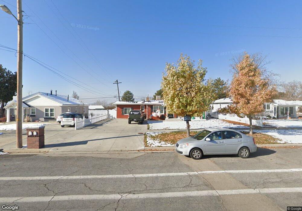
485 N Center St American Fork, UT 84003
Estimated Value: $447,000 - $488,000
3
Beds
2
Baths
1,862
Sq Ft
$250/Sq Ft
Est. Value
About This Home
This home is located at 485 N Center St, American Fork, UT 84003 and is currently estimated at $465,696, approximately $250 per square foot. 485 N Center St is a home located in Utah County with nearby schools including Shelley Elementary School, American Fork Junior High School, and American Fork High School.
Ownership History
Date
Name
Owned For
Owner Type
Purchase Details
Closed on
Feb 22, 2019
Sold by
Lucas Michael Eugene
Bought by
Lucas Michael E
Current Estimated Value
Home Financials for this Owner
Home Financials are based on the most recent Mortgage that was taken out on this home.
Original Mortgage
$239,298
Outstanding Balance
$209,957
Interest Rate
4.4%
Mortgage Type
New Conventional
Estimated Equity
$255,739
Purchase Details
Closed on
Sep 20, 2017
Sold by
Francis Mitchell and Francis Brlanna
Bought by
Lucas Mchael Eugene
Home Financials for this Owner
Home Financials are based on the most recent Mortgage that was taken out on this home.
Original Mortgage
$11,397
Interest Rate
3.86%
Mortgage Type
Stand Alone Second
Purchase Details
Closed on
Aug 22, 2014
Sold by
Francis Mitchell
Bought by
Francis Mitchell and Francis Brianna
Home Financials for this Owner
Home Financials are based on the most recent Mortgage that was taken out on this home.
Original Mortgage
$179,685
Interest Rate
4.4%
Mortgage Type
FHA
Purchase Details
Closed on
Aug 21, 2014
Sold by
Rowett Linzy B and Rowett Brittany
Bought by
Francis Mitchell
Home Financials for this Owner
Home Financials are based on the most recent Mortgage that was taken out on this home.
Original Mortgage
$179,685
Interest Rate
4.4%
Mortgage Type
FHA
Purchase Details
Closed on
May 10, 2010
Sold by
Cooper Shyanne and Cooper Darren
Bought by
Rowett Linzy B and Rowett Brittany
Home Financials for this Owner
Home Financials are based on the most recent Mortgage that was taken out on this home.
Original Mortgage
$164,465
Interest Rate
5.12%
Mortgage Type
FHA
Purchase Details
Closed on
Sep 2, 2005
Sold by
Durrant Brian R and Durrant Brenda B
Bought by
Cooper Darren and Cooper Shyanne
Home Financials for this Owner
Home Financials are based on the most recent Mortgage that was taken out on this home.
Original Mortgage
$132,914
Interest Rate
5.64%
Mortgage Type
FHA
Create a Home Valuation Report for This Property
The Home Valuation Report is an in-depth analysis detailing your home's value as well as a comparison with similar homes in the area
Home Values in the Area
Average Home Value in this Area
Purchase History
| Date | Buyer | Sale Price | Title Company |
|---|---|---|---|
| Lucas Michael E | -- | Metro National Title | |
| Lucas Mchael Eugene | -- | North American Title | |
| Francis Mitchell | -- | First American Title Co Llc | |
| Francis Mitchell | -- | First American Title Co Llc | |
| Rowett Linzy B | -- | First American Draper | |
| Cooper Darren | -- | United Title Services |
Source: Public Records
Mortgage History
| Date | Status | Borrower | Loan Amount |
|---|---|---|---|
| Open | Lucas Michael E | $239,298 | |
| Closed | Lucas Mchael Eugene | $11,397 | |
| Previous Owner | Francis Mitchell | $179,685 | |
| Previous Owner | Rowett Linzy B | $164,465 | |
| Previous Owner | Cooper Darren | $132,914 |
Source: Public Records
Tax History Compared to Growth
Tax History
| Year | Tax Paid | Tax Assessment Tax Assessment Total Assessment is a certain percentage of the fair market value that is determined by local assessors to be the total taxable value of land and additions on the property. | Land | Improvement |
|---|---|---|---|---|
| 2025 | $1,793 | $209,660 | $175,600 | $205,600 |
| 2024 | $1,793 | $199,265 | $0 | $0 |
| 2023 | $1,667 | $196,405 | $0 | $0 |
| 2022 | $1,805 | $209,825 | $0 | $0 |
| 2021 | $1,543 | $280,200 | $126,000 | $154,200 |
| 2020 | $1,442 | $254,000 | $112,500 | $141,500 |
| 2019 | $1,306 | $237,900 | $96,400 | $141,500 |
| 2018 | $1,227 | $213,700 | $86,800 | $126,900 |
| 2017 | $1,053 | $99,000 | $0 | $0 |
| 2016 | $983 | $85,855 | $0 | $0 |
| 2015 | $958 | $79,420 | $0 | $0 |
| 2014 | $950 | $77,660 | $0 | $0 |
Source: Public Records
Map
Nearby Homes
- 374 N Center St
- 414 N 100 E
- 365 N 100 W
- 396 N 100 E
- 621 N 100 W
- 788 N 150 E Unit 3
- 807 N 150 E
- 819 N 150 E Unit 6
- 783 N 150 E
- 793 N 150 E
- 654 N 200 E
- 183 E 760 St N
- 540 N 300 W
- 782 N 200 W
- 774 N 150 E Unit 2
- The Madison Plan at Beck Hillside Estates
- The McKenzie Plan at Beck Hillside Estates
- The Avery Plan at Beck Hillside Estates
- The Annie Plan at Beck Hillside Estates
- The Roosevelt Plan at Beck Hillside Estates