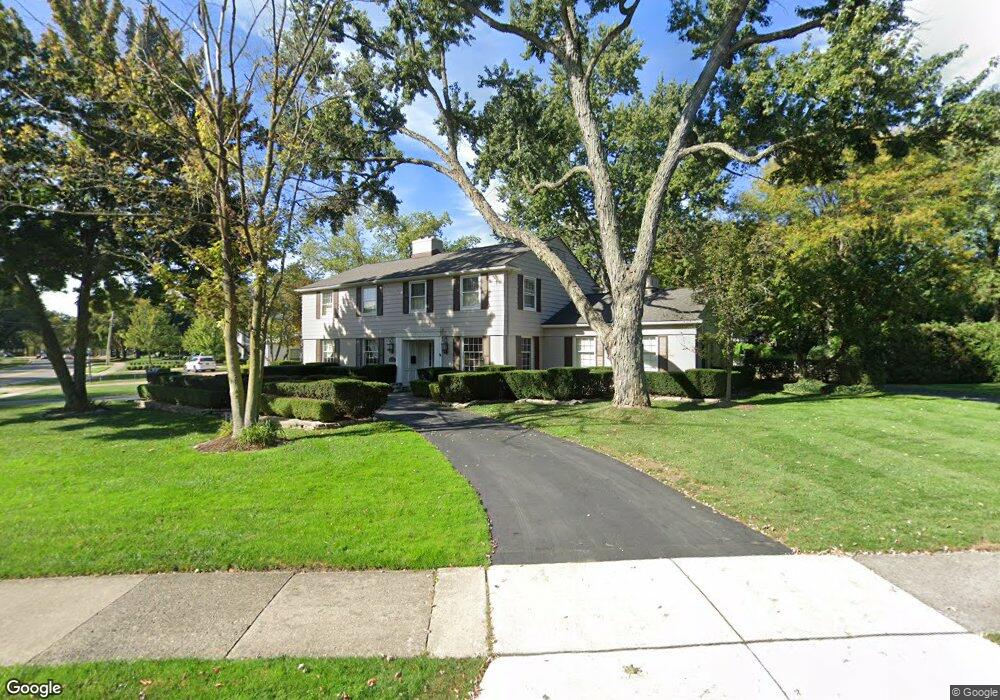
485 N Cranbrook Rd Bloomfield Hills, MI 48301
Estimated Value: $1,381,000 - $1,894,000
4
Beds
4
Baths
3,808
Sq Ft
$422/Sq Ft
Est. Value
About This Home
This home is located at 485 N Cranbrook Rd, Bloomfield Hills, MI 48301 and is currently estimated at $1,607,762, approximately $422 per square foot. 485 N Cranbrook Rd is a home located in Oakland County with nearby schools including Quarton Elementary, Derby Middle School, and Ernest W. Seaholm High School.
Ownership History
Date
Name
Owned For
Owner Type
Purchase Details
Closed on
Jan 17, 1997
Sold by
Blahnick John G
Bought by
Eisenbraun Kenneth D
Current Estimated Value
Home Financials for this Owner
Home Financials are based on the most recent Mortgage that was taken out on this home.
Original Mortgage
$478,000
Outstanding Balance
$52,175
Interest Rate
7.81%
Estimated Equity
$1,555,587
Create a Home Valuation Report for This Property
The Home Valuation Report is an in-depth analysis detailing your home's value as well as a comparison with similar homes in the area
Home Values in the Area
Average Home Value in this Area
Purchase History
| Date | Buyer | Sale Price | Title Company |
|---|---|---|---|
| Eisenbraun Kenneth D | $597,500 | -- |
Source: Public Records
Mortgage History
| Date | Status | Borrower | Loan Amount |
|---|---|---|---|
| Open | Eisenbraun Kenneth D | $478,000 |
Source: Public Records
Tax History Compared to Growth
Tax History
| Year | Tax Paid | Tax Assessment Tax Assessment Total Assessment is a certain percentage of the fair market value that is determined by local assessors to be the total taxable value of land and additions on the property. | Land | Improvement |
|---|---|---|---|---|
| 2024 | $8,993 | $647,570 | $0 | $0 |
| 2023 | $8,631 | $575,130 | $0 | $0 |
| 2022 | $15,217 | $525,260 | $0 | $0 |
| 2021 | $15,343 | $549,820 | $0 | $0 |
| 2020 | $8,290 | $541,290 | $0 | $0 |
| 2019 | $15,296 | $534,720 | $0 | $0 |
| 2018 | $15,133 | $509,660 | $0 | $0 |
| 2017 | $15,133 | $479,880 | $0 | $0 |
| 2016 | $15,219 | $447,720 | $0 | $0 |
| 2015 | -- | $430,940 | $0 | $0 |
| 2014 | -- | $410,350 | $0 | $0 |
| 2011 | -- | $320,000 | $0 | $0 |
Source: Public Records
Map
Nearby Homes
- 2579 Amberly Rd
- 1019 N Cranbrook Rd
- 956 Westwood Dr
- 345 Kimberly St
- 1882 Melbourne St
- 1834 Fairview St
- 120 Westchester Way
- 397 S Cranbrook Rd
- 1120 Lyonhurst St
- 394 S Glenhurst Dr
- 586 Fairfax St
- 1260 Lyonhurst St
- 100 Overhill Rd
- 421 S Williamsbury Rd
- 3320 Morningview Terrace
- 222 Arlington St
- 695 Westchester Way
- 520 Pleasant St
- 2802 Heathfield Rd
- 231 Wadsworth Ln
- 473 N Cranbrook Rd
- 591 Yarmouth Rd
- 527 N Cranbrook Rd
- 528 Covington Rd
- 580 Covington Rd
- 470 N Cranbrook Rd
- 600 Covington Rd
- 641 Yarmouth Rd
- 616 Yarmouth Rd
- 480 Yarmouth Rd
- 559 N Cranbrook Rd
- 450 N Cranbrook Rd
- 650 Covington Rd
- 454 Yarmouth Rd
- 583 N Cranbrook Rd
- 652 Yarmouth Rd
- 495 Tilbury Rd
- 427 Yarmouth Rd
- 2500 Covington Place
- 2515 Endsleigh Dr