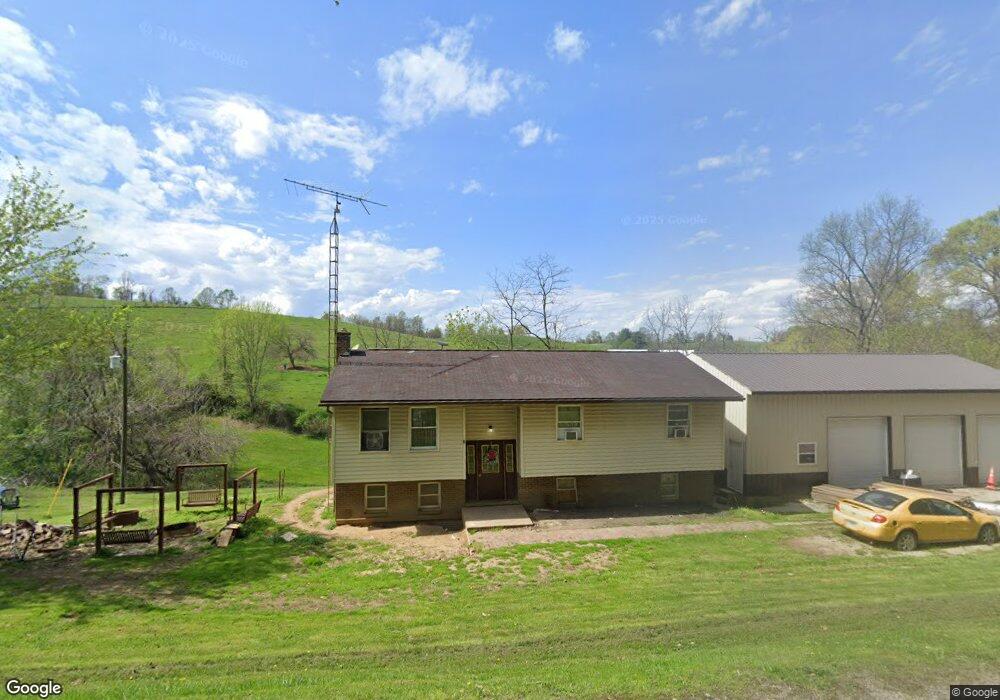
485 S Elliott Rd Stockport, OH 43787
Estimated Value: $205,073 - $279,000
3
Beds
2
Baths
1,704
Sq Ft
$135/Sq Ft
Est. Value
About This Home
This home is located at 485 S Elliott Rd, Stockport, OH 43787 and is currently estimated at $230,518, approximately $135 per square foot. 485 S Elliott Rd is a home with nearby schools including Morgan High School.
Ownership History
Date
Name
Owned For
Owner Type
Purchase Details
Closed on
Dec 4, 2001
Sold by
Fluharty Gregory B and Fluharty Candace M
Bought by
Rittenhouse Michael W
Current Estimated Value
Purchase Details
Closed on
May 2, 2001
Sold by
Fluharty Austin S
Bought by
Fluharty Gregory B and Fluharty Candace M
Purchase Details
Closed on
Jul 3, 2000
Sold by
Endicott William B
Bought by
Fluharty Austin S
Purchase Details
Closed on
Aug 31, 1995
Sold by
Endicott William B
Bought by
Endicott William B
Purchase Details
Closed on
Jan 27, 1995
Sold by
Endicott William B
Bought by
Endicott William B
Create a Home Valuation Report for This Property
The Home Valuation Report is an in-depth analysis detailing your home's value as well as a comparison with similar homes in the area
Home Values in the Area
Average Home Value in this Area
Purchase History
| Date | Buyer | Sale Price | Title Company |
|---|---|---|---|
| Rittenhouse Michael W | $78,500 | -- | |
| Fluharty Gregory B | $49,000 | -- | |
| Fluharty Austin S | -- | -- | |
| Endicott William B | $44,500 | -- | |
| Endicott William B | -- | -- |
Source: Public Records
Tax History Compared to Growth
Tax History
| Year | Tax Paid | Tax Assessment Tax Assessment Total Assessment is a certain percentage of the fair market value that is determined by local assessors to be the total taxable value of land and additions on the property. | Land | Improvement |
|---|---|---|---|---|
| 2024 | $1,726 | $52,120 | $5,710 | $46,410 |
| 2023 | $1,238 | $37,510 | $4,650 | $32,860 |
| 2022 | $1,242 | $37,510 | $4,650 | $32,860 |
| 2021 | $1,089 | $32,540 | $4,650 | $27,890 |
| 2019 | $1,034 | $29,570 | $4,220 | $25,350 |
| 2018 | $970 | $28,780 | $4,220 | $24,560 |
| 2017 | $999 | $28,910 | $3,661 | $25,249 |
| 2016 | $1,003 | $28,910 | $3,661 | $25,249 |
| 2015 | $1,002 | $28,910 | $3,661 | $25,249 |
| 2014 | $1,035 | $28,910 | $3,661 | $25,249 |
| 2013 | $1,024 | $28,910 | $3,661 | $25,249 |
Source: Public Records
Map
Nearby Homes
- 7.38 acres County Road 13
- 643 Townsend Rd
- 3205 Goshen Run Rd
- 581 Butler Rd
- 1673 S State Route 377
- 360 Glass Rd NW
- 0 Coler Rd
- 0 Downing Rd
- 781 Downing Rd
- 8445 Pisgah Church Ln
- 8445 Pigsah Church Ln
- 681 Downing Rd
- 0 Benjamin Rd
- 0 Upper Douda Rd Unit 225030416
- 1445 E Branch Rd
- 1445 E Branch Rd Unit R
- 0 Morganville Rd Unit 225017374
- 0 Morganville Rd Unit 5123894
- 160 N Riverview Rd
- 0 Ohio 555 Unit 5146049