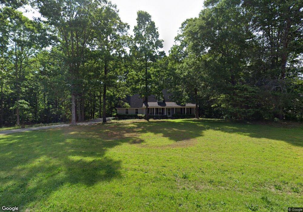
485 S Red Rock Rd Toccoa, GA 30577
Estimated Value: $263,000 - $332,000
3
Beds
2
Baths
1,579
Sq Ft
$184/Sq Ft
Est. Value
About This Home
This home is located at 485 S Red Rock Rd, Toccoa, GA 30577 and is currently estimated at $290,329, approximately $183 per square foot. 485 S Red Rock Rd is a home located in Stephens County with nearby schools including Stephens County High School.
Ownership History
Date
Name
Owned For
Owner Type
Purchase Details
Closed on
Feb 15, 2022
Sold by
Adam Flora
Bought by
Wilson Tammy
Current Estimated Value
Home Financials for this Owner
Home Financials are based on the most recent Mortgage that was taken out on this home.
Original Mortgage
$232,750
Outstanding Balance
$215,679
Interest Rate
3.69%
Mortgage Type
Cash
Estimated Equity
$74,650
Purchase Details
Closed on
Jul 1, 1993
Bought by
<Buyer Info Not Present>
Purchase Details
Closed on
Feb 1, 1991
Bought by
Adams Flora L
Create a Home Valuation Report for This Property
The Home Valuation Report is an in-depth analysis detailing your home's value as well as a comparison with similar homes in the area
Purchase History
| Date | Buyer | Sale Price | Title Company |
|---|---|---|---|
| Wilson Tammy | $245,000 | -- | |
| <Buyer Info Not Present> | $1,000 | -- | |
| Adams Flora L | $64,000 | -- |
Source: Public Records
Mortgage History
| Date | Status | Borrower | Loan Amount |
|---|---|---|---|
| Open | Wilson Tammy | $232,750 |
Source: Public Records
Tax History Compared to Growth
Tax History
| Year | Tax Paid | Tax Assessment Tax Assessment Total Assessment is a certain percentage of the fair market value that is determined by local assessors to be the total taxable value of land and additions on the property. | Land | Improvement |
|---|---|---|---|---|
| 2025 | $1,715 | $76,530 | $4,007 | $72,523 |
| 2024 | $1,546 | $52,787 | $4,007 | $48,780 |
| 2023 | $1,412 | $49,428 | $4,007 | $45,421 |
| 2022 | $1,398 | $46,954 | $4,007 | $42,947 |
| 2021 | $246 | $43,821 | $4,007 | $39,814 |
| 2020 | $244 | $43,663 | $4,007 | $39,656 |
| 2019 | $245 | $43,663 | $4,007 | $39,656 |
| 2018 | $245 | $43,663 | $4,007 | $39,656 |
| 2017 | $249 | $43,663 | $4,007 | $39,656 |
| 2016 | $248 | $43,662 | $4,006 | $39,656 |
| 2015 | $378 | $47,206 | $4,006 | $43,200 |
| 2014 | $384 | $47,207 | $4,007 | $43,200 |
| 2013 | -- | $47,206 | $4,006 | $43,200 |
Source: Public Records
Map
Nearby Homes
- 513 S Red Rock Rd
- 46 Cedar Ridge Dr
- Lot 21 Deer Chase
- 535 Deer Chase
- 56 Crawford Manor Dr
- 5.10 ACRES Hwy 123
- 7 Jottings Dr
- 17 Pinetree Rd
- 451 Defoor Rd
- 3.35 ACRES Keener Rd
- 668 Brookdale Rd
- 0 Celia Dr Unit 10661226
- 151 Rock Creek Rd
- 17 Collier Mill Rd
- 28 Memorial Dr
- 0 Brookhaven Cir Unit 10616964
- 0 E Currahee St Unit 10544607
- 109 Coneflower Ln
- 78 Wards Pond Way
- 68 Wards Pond Way
- 25 Cedar Ridge Dr
- 95 Cedar Ridge Dr
- 580 S Red Rock Rd
- 112 Cedar Ridge Dr
- 975 S Red Rock Rd
- S S Red Rock Rd
- 324 Abby Ln
- 480 S Red Rock Rd
- 372 Abby Ln
- 372 Abby Ln
- 298 Abby Ln
- 203 Abby Ct
- 156 Cedar Ridge Dr
- 400 Abbey Ln
- 400 Abby Ln
- 264 Abby Ln
- 117 S Abby Lane Ct
- S S Abbey Lane Ct
- 155 Cedar Ridge Dr
- 271 Abby Ln