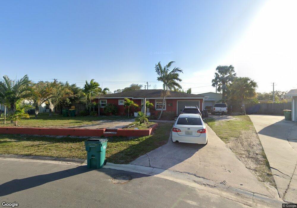
485 Seacrest Ave Merritt Island, FL 32952
Estimated Value: $365,000 - $483,000
3
Beds
2
Baths
2,054
Sq Ft
$207/Sq Ft
Est. Value
About This Home
This home is located at 485 Seacrest Ave, Merritt Island, FL 32952 and is currently estimated at $424,742, approximately $206 per square foot. 485 Seacrest Ave is a home located in Brevard County with nearby schools including Tropical Elementary School, Thomas Jefferson Middle School, and Merritt Island High School.
Ownership History
Date
Name
Owned For
Owner Type
Purchase Details
Closed on
Mar 3, 2025
Sold by
Hanson Jason A S and Hanson Mary E
Bought by
Hanson Family Trust and Hanson
Current Estimated Value
Purchase Details
Closed on
Dec 30, 2024
Sold by
Hanson Jason A S and Hanson Mary E
Bought by
Hanson Family Trust and Hanson
Purchase Details
Closed on
Nov 4, 2016
Sold by
Liv Knutson Andrew D and Liv Dennis G Knutson Revocable
Bought by
Kahlo Vera F and Kahlo Robert M
Home Financials for this Owner
Home Financials are based on the most recent Mortgage that was taken out on this home.
Original Mortgage
$115,000
Interest Rate
2.72%
Mortgage Type
New Conventional
Purchase Details
Closed on
Sep 27, 2016
Sold by
Davis James and Davis Tama
Bought by
Hanson Jason A and Hanson Mary E
Home Financials for this Owner
Home Financials are based on the most recent Mortgage that was taken out on this home.
Original Mortgage
$115,000
Interest Rate
2.72%
Mortgage Type
New Conventional
Purchase Details
Closed on
May 1, 2013
Sold by
Hanson Jason and Hanson Mary E
Bought by
Hanson Jason As and Hanson Mary E
Purchase Details
Closed on
Jun 30, 2004
Sold by
Barber Wayne and Barber Betty
Bought by
Hanson Jason A and Davis Tama
Home Financials for this Owner
Home Financials are based on the most recent Mortgage that was taken out on this home.
Original Mortgage
$91,959
Interest Rate
6.25%
Purchase Details
Closed on
Jun 28, 2002
Sold by
Hatfield B Glenn and Hatfield Lorene W
Bought by
Barber Wayne and Barber Betty
Home Financials for this Owner
Home Financials are based on the most recent Mortgage that was taken out on this home.
Original Mortgage
$52,163
Interest Rate
6.86%
Purchase Details
Closed on
Mar 20, 1995
Sold by
Hatfield B Glenn and Hatfield Alice Trent
Bought by
Hatfield B Glenn and Hatfield Lorene W
Create a Home Valuation Report for This Property
The Home Valuation Report is an in-depth analysis detailing your home's value as well as a comparison with similar homes in the area
Home Values in the Area
Average Home Value in this Area
Purchase History
| Date | Buyer | Sale Price | Title Company |
|---|---|---|---|
| Hanson Family Trust | $100 | None Listed On Document | |
| Hanson Family Trust | $100 | None Listed On Document | |
| Hanson Family Trust | $100 | None Listed On Document | |
| Hanson Family Trust | $100 | None Listed On Document | |
| Hanson Family Trust | $100 | None Listed On Document | |
| Kahlo Vera F | $355,000 | North American Title Co | |
| Hanson Jason A | -- | First American Title | |
| Hanson Jason As | $46,000 | None Available | |
| Hanson Jason A | $100,600 | Fidelity Natl Title Ins Co | |
| Barber Wayne | $67,142 | -- | |
| Hatfield B Glenn | $14,500 | -- |
Source: Public Records
Mortgage History
| Date | Status | Borrower | Loan Amount |
|---|---|---|---|
| Previous Owner | Hanson Jason A | $115,000 | |
| Previous Owner | Hanson Jason A | $91,959 | |
| Previous Owner | Barber Wayne | $52,163 |
Source: Public Records
Tax History Compared to Growth
Tax History
| Year | Tax Paid | Tax Assessment Tax Assessment Total Assessment is a certain percentage of the fair market value that is determined by local assessors to be the total taxable value of land and additions on the property. | Land | Improvement |
|---|---|---|---|---|
| 2025 | $2,038 | $153,880 | -- | -- |
| 2024 | $2,002 | $149,550 | -- | -- |
| 2023 | $2,002 | $145,200 | $0 | $0 |
| 2022 | $1,869 | $140,980 | $0 | $0 |
| 2021 | $1,915 | $136,880 | $0 | $0 |
| 2020 | $1,495 | $108,790 | $0 | $0 |
| 2019 | $1,432 | $106,350 | $0 | $0 |
| 2018 | $1,380 | $101,300 | $0 | $0 |
| 2017 | $1,372 | $99,220 | $0 | $0 |
| 2016 | $1,379 | $97,180 | $17,600 | $79,580 |
| 2015 | $1,399 | $96,510 | $17,600 | $78,910 |
| 2014 | $1,376 | $94,160 | $16,000 | $78,160 |
Source: Public Records
Map
Nearby Homes
- 476 Nancie Ave
- 489 Kennwood Ave
- 90 S Tropical Way
- 66 Moore Ave
- 95 Peck Ave
- 185 Moore Ave
- 115 Carib Dr
- 140 Brandy Ln
- 180 Brandy Ln
- 220 Bel Aire Dr S
- 3190 S Courtenay Pkwy
- 270 W Lauren Ct
- 280 Andros Dr
- 30 Victoria St
- 230 Andros Dr
- 355 Aztec Ave
- 455 Catamaran Dr Unit 48
- 106 Victoria St
- 327 S Tropical Trail
- 435 Catamaran Dr Unit 49
- 0 Ocean St
- 0 Ocean St Unit 651708
- 8 Ocean St
- 487 Seacrest Ave
- 9 Ocean St
- 489 Seacrest Ave Unit ID1325661P
- 21 Corriente St
- 10 Ocean St
- 488 Seacrest Ave
- 215 Cone Rd
- 19 Corriente St
- 491 Seacrest Ave
- 475 Nancie Ave
- 12 Ocean St
- 477 Nancie Ave
- 17 Corriente St
- 493 Seacrest Ave
- 479 Nancie Ave
- 492 Seacrest Ave
- 14 Ocean St