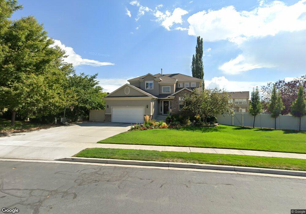
485 W 600 N American Fork, UT 84003
Estimated Value: $711,000 - $779,000
4
Beds
4
Baths
3,573
Sq Ft
$206/Sq Ft
Est. Value
About This Home
This home is located at 485 W 600 N, American Fork, UT 84003 and is currently estimated at $736,312, approximately $206 per square foot. 485 W 600 N is a home located in Utah County with nearby schools including Shelley Elementary School, American Fork Junior High School, and American Fork High School.
Ownership History
Date
Name
Owned For
Owner Type
Purchase Details
Closed on
Apr 5, 2019
Sold by
Jones Justin D
Bought by
Jones Justin Darrel and Jones Maryann Cherry
Current Estimated Value
Home Financials for this Owner
Home Financials are based on the most recent Mortgage that was taken out on this home.
Original Mortgage
$377,200
Outstanding Balance
$333,738
Interest Rate
4.62%
Mortgage Type
FHA
Estimated Equity
$402,574
Purchase Details
Closed on
Nov 18, 2013
Sold by
Giles Gregory Kenneth and Giles Melissa Collette
Bought by
Jones Justin D
Home Financials for this Owner
Home Financials are based on the most recent Mortgage that was taken out on this home.
Original Mortgage
$348,650
Interest Rate
4.18%
Mortgage Type
New Conventional
Purchase Details
Closed on
Oct 27, 2010
Sold by
Giles Gregory Kenneth and Giles Melissa Collette
Bought by
Giles Gregory Kenneth and Giles Melissa Collette
Home Financials for this Owner
Home Financials are based on the most recent Mortgage that was taken out on this home.
Original Mortgage
$105,000
Interest Rate
4.27%
Mortgage Type
New Conventional
Purchase Details
Closed on
Oct 24, 2008
Sold by
Giles Gregory K and Giles Melissa C
Bought by
Giles Gregory Kenneth and Giles Melissa Collette
Purchase Details
Closed on
Apr 13, 2004
Sold by
Ivory Homes Ltd
Bought by
Giles Gregory K and Giles Melissa C
Home Financials for this Owner
Home Financials are based on the most recent Mortgage that was taken out on this home.
Original Mortgage
$190,000
Interest Rate
5.57%
Mortgage Type
Purchase Money Mortgage
Purchase Details
Closed on
Dec 2, 1997
Sold by
Dickerson Bruce R and Bankhead Lou
Bought by
Anderson Nora S
Purchase Details
Closed on
Apr 14, 1997
Sold by
Turnberry Park L C
Bought by
Anderson Nora S
Purchase Details
Closed on
Jul 22, 1996
Sold by
Dickerson Bruce R
Bought by
Anderson Nora S
Create a Home Valuation Report for This Property
The Home Valuation Report is an in-depth analysis detailing your home's value as well as a comparison with similar homes in the area
Home Values in the Area
Average Home Value in this Area
Purchase History
| Date | Buyer | Sale Price | Title Company |
|---|---|---|---|
| Jones Justin Darrel | -- | Capstone T&E Inc | |
| Jones Justin D | -- | Title One | |
| Giles Gregory Kenneth | -- | Wasatch Title Insurance Age | |
| Giles Gregory Kenneth | -- | Wasatch Title Insurance Age | |
| Giles Gregory Kenneth | -- | Title West Title Company | |
| Giles Gregory K | -- | Cottonwood Title | |
| Anderson Nora S | -- | -- | |
| Anderson Nora S | -- | -- | |
| Anderson Nora S | -- | -- | |
| Anderson Nora S | -- | Mountain West Title Company | |
| Anderson Nora S | -- | Mountain West Title Company | |
| Anderson Nora S | -- | -- |
Source: Public Records
Mortgage History
| Date | Status | Borrower | Loan Amount |
|---|---|---|---|
| Open | Jones Justin Darrel | $377,200 | |
| Closed | Jones Justin D | $348,650 | |
| Previous Owner | Giles Gregory Kenneth | $105,000 | |
| Previous Owner | Giles Gregory K | $190,000 |
Source: Public Records
Tax History
| Year | Tax Paid | Tax Assessment Tax Assessment Total Assessment is a certain percentage of the fair market value that is determined by local assessors to be the total taxable value of land and additions on the property. | Land | Improvement |
|---|---|---|---|---|
| 2025 | $3,121 | $379,940 | -- | -- |
| 2024 | $3,121 | $346,775 | $0 | $0 |
| 2023 | $2,944 | $346,830 | $0 | $0 |
| 2022 | $3,034 | $352,660 | $0 | $0 |
| 2021 | $2,607 | $473,300 | $167,400 | $305,900 |
| 2020 | $2,442 | $430,100 | $149,500 | $280,600 |
| 2019 | $2,299 | $418,800 | $138,200 | $280,600 |
| 2018 | $2,235 | $389,300 | $130,800 | $258,500 |
| 2017 | $2,136 | $200,750 | $0 | $0 |
| 2016 | $2,104 | $183,755 | $0 | $0 |
| 2015 | $2,216 | $183,645 | $0 | $0 |
| 2014 | $2,056 | $168,080 | $0 | $0 |
Source: Public Records
Map
Nearby Homes
- 530 N 420 W
- 423 W 700 North St
- 445 N 570 W
- 414 N 580 W
- 599 W 860 N
- 831 N 600 W
- 621 N 100 W
- 777 W State Rd
- 672 W 900 N
- 164 N 450 W
- 822 W 800 St N Unit LOT319
- 764 W 880 North St Unit 308
- 822 N 860 W Unit 317
- 568 W 990 N
- 1016 N 250 W
- 1029 N 250 W
- 1056 N 300 W
- 120 N 350 W Unit 133
- 120 N 350 W Unit 130
- 120 N 350 W Unit 129
Your Personal Tour Guide
Ask me questions while you tour the home.