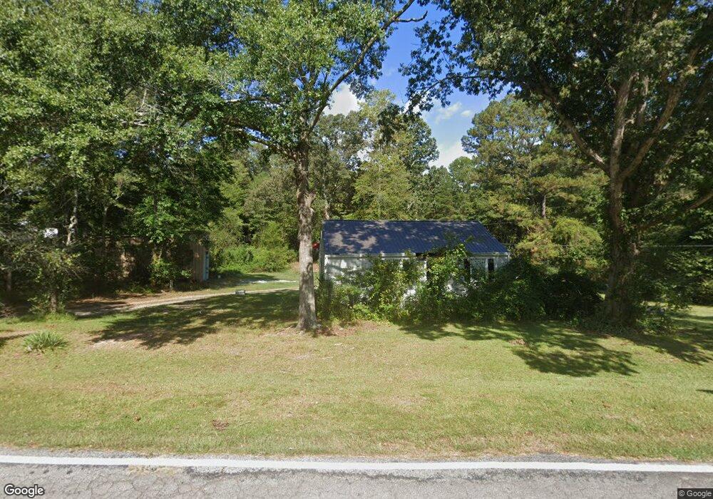
485 W Mandeville Rd Carrollton, GA 30117
Estimated Value: $172,371 - $186,000
2
Beds
1
Bath
925
Sq Ft
$193/Sq Ft
Est. Value
About This Home
This home is located at 485 W Mandeville Rd, Carrollton, GA 30117 and is currently estimated at $178,343, approximately $192 per square foot. 485 W Mandeville Rd is a home with nearby schools including Mt. Zion Elementary School, Mt. Zion Middle School, and Mt. Zion High School.
Ownership History
Date
Name
Owned For
Owner Type
Purchase Details
Closed on
May 3, 2013
Sold by
Farmer Reaford A
Bought by
Ferguson Sandra E
Current Estimated Value
Purchase Details
Closed on
Dec 3, 2009
Sold by
Farmer Johnny C
Bought by
Farmer Reaford A
Purchase Details
Closed on
Sep 25, 2009
Sold by
Farmer Mattie Sue
Bought by
Farmer Reaford A
Purchase Details
Closed on
May 14, 2009
Sold by
Farmer Bobby and Farmer Jane
Bought by
Farmer Mattie Sue Estate
Purchase Details
Closed on
Apr 3, 1982
Sold by
Farmer Jesse
Bought by
Farmer Mattie Sue
Purchase Details
Closed on
Jan 1, 1956
Sold by
Bowen Lish
Bought by
Farmer Jesse
Create a Home Valuation Report for This Property
The Home Valuation Report is an in-depth analysis detailing your home's value as well as a comparison with similar homes in the area
Home Values in the Area
Average Home Value in this Area
Purchase History
| Date | Buyer | Sale Price | Title Company |
|---|---|---|---|
| Ferguson Sandra E | $7,000 | -- | |
| Farmer Reaford A | $500 | -- | |
| Farmer Reaford A | -- | -- | |
| Farmer Mattie Sue Estate | -- | -- | |
| Farmer Mattie Sue | -- | -- | |
| Farmer Jesse | -- | -- |
Source: Public Records
Tax History Compared to Growth
Tax History
| Year | Tax Paid | Tax Assessment Tax Assessment Total Assessment is a certain percentage of the fair market value that is determined by local assessors to be the total taxable value of land and additions on the property. | Land | Improvement |
|---|---|---|---|---|
| 2024 | $900 | $38,026 | $6,652 | $31,374 |
| 2023 | $900 | $33,924 | $5,322 | $28,602 |
| 2022 | $804 | $30,471 | $2,018 | $28,453 |
| 2021 | $708 | $26,065 | $1,614 | $24,451 |
| 2020 | $638 | $23,285 | $1,468 | $21,817 |
| 2019 | $104 | $2,468 | $1,468 | $1,000 |
| 2018 | $105 | $2,468 | $1,468 | $1,000 |
| 2017 | $125 | $3,222 | $1,276 | $1,946 |
| 2016 | $125 | $3,222 | $1,276 | $1,946 |
| 2015 | $295 | $9,122 | $3,593 | $5,529 |
| 2014 | $119 | $9,122 | $3,593 | $5,529 |
Source: Public Records
Map
Nearby Homes
- 174 Katie Ln
- The Thomas 2 Plan at Lambert Overlook
- The Thomas Plan at Lambert Overlook
- The Brook Plan at Lambert Overlook
- 266 Lambert Overlook Cir
- 676 Hog Liver Rd
- 898 Bowdon Junction Rd
- 68 Tyler Ln
- 142 Tyler Ln
- 14 Cole Lake Rd
- 00 Hog Liver Rd Unit 346
- 0 Hog Liver Rd Unit 148331
- 0 Hog Liver Rd Unit 10630257
- 0 Hog Liver Rd Unit 7671087
- 0 Hog Liver Rd Unit 10614601
- 0 Hog Liver Rd Unit 10630818
- 313 Lucy Ln
- 206 Randall Dr
- 141 Anita Blvd
- 153 Anita Blvd
- 465 W Mandeville Rd
- 270 Hog Liver Rd
- 282 Hog Liver Rd
- 451 W Mandeville Rd
- 499 W Mandeville Rd
- 256 Hog Liver Rd
- 433 W Mandeville Rd
- 342 Hog Liver Rd
- 240 Hog Liver Rd
- 539 W Mandeville Rd
- 265 Hog Liver Rd
- 419 W Mandeville Rd
- 430 W Mandeville Rd
- 245 Hog Liver Rd
- 228 Hog Liver Rd
- 348 Hog Liver Rd
- 395 W Mandeville Rd
- 253 Hog Liver Rd
- 214 Hog Liver Rd
- 221 Hog Liver Rd