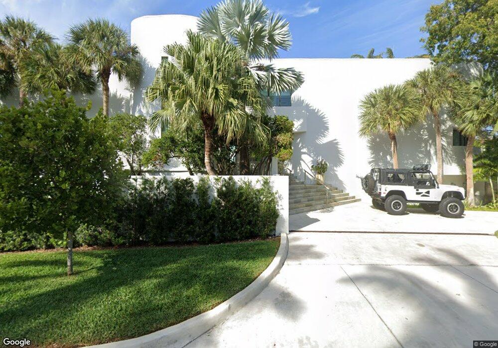
485 W Matheson Dr Key Biscayne, FL 33149
Village of Key Biscayne NeighborhoodEstimated Value: $5,779,000 - $33,716,256
5
Beds
8
Baths
10,801
Sq Ft
$1,828/Sq Ft
Est. Value
About This Home
This home is located at 485 W Matheson Dr, Key Biscayne, FL 33149 and is currently estimated at $19,747,628, approximately $1,828 per square foot. 485 W Matheson Dr is a home located in Miami-Dade County with nearby schools including Key Biscayne K-8 Center, Ponce de Leon Middle School, and Coral Gables Senior High School.
Ownership History
Date
Name
Owned For
Owner Type
Purchase Details
Closed on
Mar 1, 2004
Sold by
Perkins Caroline T and Perkins Frederick G
Bought by
United Real Estate Ventures Inc
Current Estimated Value
Create a Home Valuation Report for This Property
The Home Valuation Report is an in-depth analysis detailing your home's value as well as a comparison with similar homes in the area
Home Values in the Area
Average Home Value in this Area
Purchase History
| Date | Buyer | Sale Price | Title Company |
|---|---|---|---|
| United Real Estate Ventures Inc | $15,000,000 | -- |
Source: Public Records
Tax History Compared to Growth
Tax History
| Year | Tax Paid | Tax Assessment Tax Assessment Total Assessment is a certain percentage of the fair market value that is determined by local assessors to be the total taxable value of land and additions on the property. | Land | Improvement |
|---|---|---|---|---|
| 2025 | $424,191 | $29,497,022 | -- | -- |
| 2024 | $394,041 | $26,815,475 | -- | -- |
| 2023 | $394,041 | $24,377,705 | $0 | $0 |
| 2022 | $361,416 | $22,161,550 | $0 | $0 |
| 2021 | $332,651 | $20,146,864 | $17,653,882 | $2,492,982 |
| 2020 | $333,116 | $20,172,463 | $17,653,882 | $2,518,581 |
| 2019 | $334,369 | $20,198,061 | $17,653,882 | $2,544,179 |
| 2018 | $323,890 | $20,223,661 | $17,653,882 | $2,569,779 |
| 2017 | $341,814 | $21,159,478 | $0 | $0 |
| 2016 | $343,872 | $20,486,522 | $0 | $0 |
| 2015 | $318,827 | $18,624,111 | $0 | $0 |
| 2014 | $292,798 | $16,931,010 | $0 | $0 |
Source: Public Records
Map
Nearby Homes
- 425 Harbor Dr
- 545 Sabal Palm Dr
- 610 Harbor Cir
- 355 Redwood Ln
- 600 Allendale Rd
- 285 W Enid Dr
- 670 Allendale Rd
- 280 Harbor Dr
- 261 Greenwood Dr
- 250 Greenwood Dr
- 699 N Mashta Dr
- 401 Warren Ln
- 200 W Mcintyre St
- 631 N Mashta Dr
- 677 Hampton Ln
- 230 Harbor Dr
- 691 Ridgewood Rd
- 475 Woodcrest Rd
- 640 S Mashta Dr
- 250 Buttonwood Dr