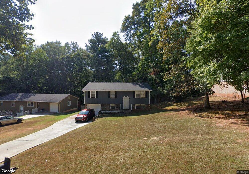
4851 Lost Colony Ct Unit 2 Stone Mountain, GA 30088
Estimated Value: $181,743 - $195,000
3
Beds
2
Baths
1,040
Sq Ft
$180/Sq Ft
Est. Value
About This Home
This home is located at 4851 Lost Colony Ct Unit 2, Stone Mountain, GA 30088 and is currently estimated at $187,686, approximately $180 per square foot. 4851 Lost Colony Ct Unit 2 is a home located in DeKalb County with nearby schools including Woodridge Elementary School, Miller Grove Middle School, and Miller Grove High School.
Ownership History
Date
Name
Owned For
Owner Type
Purchase Details
Closed on
Aug 30, 2000
Sold by
Campbell Clifton L
Bought by
Smith Wanda L
Current Estimated Value
Home Financials for this Owner
Home Financials are based on the most recent Mortgage that was taken out on this home.
Original Mortgage
$84,850
Outstanding Balance
$30,809
Interest Rate
8.24%
Mortgage Type
FHA
Estimated Equity
$156,877
Purchase Details
Closed on
Oct 31, 1994
Sold by
Secretary Of Hud
Bought by
Campbell Clifton L
Home Financials for this Owner
Home Financials are based on the most recent Mortgage that was taken out on this home.
Original Mortgage
$63,400
Interest Rate
8.78%
Mortgage Type
FHA
Purchase Details
Closed on
Jul 25, 1994
Sold by
Laikam James A Diana
Bought by
Amsouth Mtg Co
Purchase Details
Closed on
Jul 5, 1994
Sold by
Amsouth Mtg Co
Bought by
Secretary Of Hud
Create a Home Valuation Report for This Property
The Home Valuation Report is an in-depth analysis detailing your home's value as well as a comparison with similar homes in the area
Home Values in the Area
Average Home Value in this Area
Purchase History
| Date | Buyer | Sale Price | Title Company |
|---|---|---|---|
| Smith Wanda L | $85,000 | -- | |
| Campbell Clifton L | -- | -- | |
| Amsouth Mtg Co | $37,351 | -- | |
| Secretary Of Hud | -- | -- |
Source: Public Records
Mortgage History
| Date | Status | Borrower | Loan Amount |
|---|---|---|---|
| Open | Smith Wanda L | $84,850 | |
| Previous Owner | Campbell Clifton L | $63,400 |
Source: Public Records
Tax History Compared to Growth
Tax History
| Year | Tax Paid | Tax Assessment Tax Assessment Total Assessment is a certain percentage of the fair market value that is determined by local assessors to be the total taxable value of land and additions on the property. | Land | Improvement |
|---|---|---|---|---|
| 2025 | $2,259 | $79,760 | $12,000 | $67,760 |
| 2024 | $2,182 | $74,560 | $10,000 | $64,560 |
| 2023 | $2,182 | $76,280 | $14,000 | $62,280 |
| 2022 | $1,842 | $63,400 | $8,000 | $55,400 |
| 2021 | $1,180 | $35,760 | $2,880 | $32,880 |
| 2020 | $1,065 | $32,280 | $2,880 | $29,400 |
| 2019 | $1,175 | $35,800 | $2,880 | $32,920 |
| 2018 | $872 | $30,920 | $2,880 | $28,040 |
| 2017 | $829 | $25,040 | $2,880 | $22,160 |
| 2016 | $729 | $22,640 | $2,880 | $19,760 |
| 2014 | $601 | $18,720 | $2,880 | $15,840 |
Source: Public Records
Map
Nearby Homes
- 4909 Woodhurst Way
- 4854 Terrace Green Trace Unit 11D
- 1406 Crooked Tree Cir
- 1479 Crooked Tree Cir
- 4938 Terrace Green Trace
- 4831 Oak Path
- 1559 Fieldgreen Overlook
- 1690 Briarbend Ct
- 1512 S Hairston Rd
- 1485 Fieldgreen Overlook
- 4734 White Oak Trail
- 1414 Golf Link Dr
- 4970 Clubgreen Summit
- 1491 S Hairston Rd
- 4933 Clubgreen Summit
- 4640 Elm Ridge Ct
- 1420 Fieldgreen Overlook
- 1513 Spruce Ridge Way
- 4889 Wedgewood Way
- 1603 Golf Link Dr
- 4843 Lost Colony Ct
- 4859 Lost Colony Ct
- 4867 Lost Colony Ct
- 4835 Lost Colony Ct
- 1620 Canberra Dr
- 4876 Lost Colony Ct
- 4852 Lost Colony Ct
- 4844 Lost Colony Ct
- 1624 Canberra Dr
- 4860 Lost Colony Ct
- 4827 Lost Colony Ct Unit 2
- 1616 Canberra Dr
- 4868 Lost Colony Ct
- 1628 Canberra Dr
- 1612 Canberra Dr
- 4819 Lost Colony Ct
- 1634 Canberra Dr
- 4861 Woodhurst Way
- 4820 Lost Colony Ct
- 4869 Woodhurst Way Unit 1