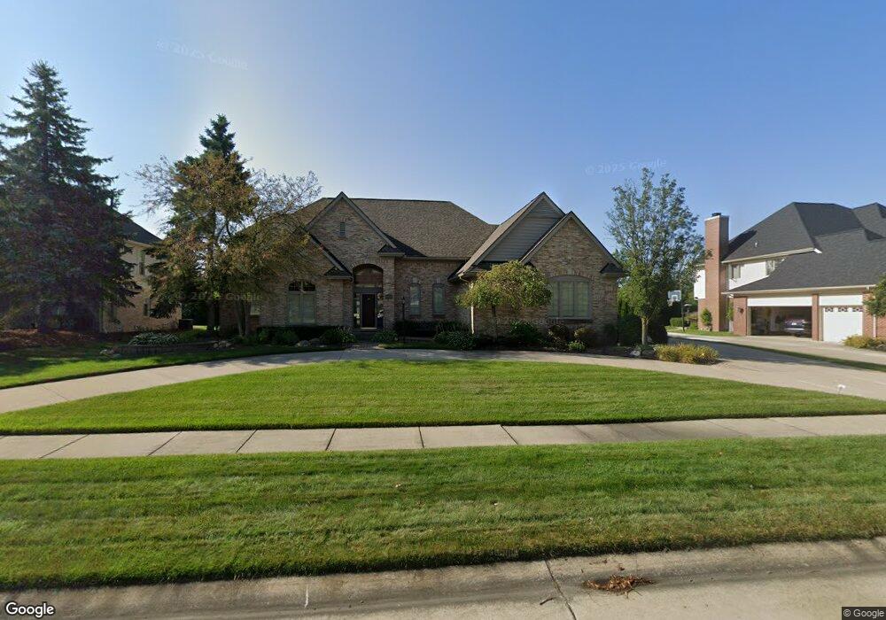
48511 Hilltop Dr W Plymouth, MI 48170
Estimated Value: $661,000 - $716,000
--
Bed
1
Bath
2,822
Sq Ft
$244/Sq Ft
Est. Value
About This Home
This home is located at 48511 Hilltop Dr W, Plymouth, MI 48170 and is currently estimated at $689,013, approximately $244 per square foot. 48511 Hilltop Dr W is a home located in Wayne County with nearby schools including Canton High School, Bird Elementary School, and West Middle School.
Ownership History
Date
Name
Owned For
Owner Type
Purchase Details
Closed on
Aug 14, 2020
Sold by
Scarpace Frederick W and Scarpace Mary E
Bought by
The Frederick W Scarpace Trust
Current Estimated Value
Purchase Details
Closed on
Apr 6, 2009
Sold by
Scarpace Frederick W and Scarpace Mary E
Bought by
Scarpace Frederick W
Home Financials for this Owner
Home Financials are based on the most recent Mortgage that was taken out on this home.
Original Mortgage
$300,000
Interest Rate
5.05%
Mortgage Type
New Conventional
Create a Home Valuation Report for This Property
The Home Valuation Report is an in-depth analysis detailing your home's value as well as a comparison with similar homes in the area
Home Values in the Area
Average Home Value in this Area
Purchase History
| Date | Buyer | Sale Price | Title Company |
|---|---|---|---|
| The Frederick W Scarpace Trust | -- | None Available | |
| Scarpace Frederick W | -- | None Available |
Source: Public Records
Mortgage History
| Date | Status | Borrower | Loan Amount |
|---|---|---|---|
| Closed | Scarpace Frederick W | $300,000 |
Source: Public Records
Tax History Compared to Growth
Tax History
| Year | Tax Paid | Tax Assessment Tax Assessment Total Assessment is a certain percentage of the fair market value that is determined by local assessors to be the total taxable value of land and additions on the property. | Land | Improvement |
|---|---|---|---|---|
| 2025 | $5,209 | $317,700 | $0 | $0 |
| 2024 | $5,209 | $296,200 | $0 | $0 |
| 2023 | $4,963 | $249,200 | $0 | $0 |
| 2022 | $6,597 | $234,200 | $0 | $0 |
| 2021 | $6,401 | $230,900 | $0 | $0 |
| 2019 | $6,209 | $216,530 | $0 | $0 |
| 2018 | $4,247 | $207,720 | $0 | $0 |
| 2017 | $2,965 | $50,000 | $0 | $0 |
| 2016 | $5,556 | $205,600 | $0 | $0 |
| 2015 | $17,781 | $201,220 | $0 | $0 |
| 2013 | $17,226 | $179,380 | $0 | $0 |
| 2012 | -- | $168,610 | $45,000 | $123,610 |
Source: Public Records
Map
Nearby Homes
- B1 Tall Timber Unit B1
- 48434 Hill Top Dr E
- 48441 N Territorial Rd
- 49451 Plymouth Way Unit 26
- 49667 Draper Cir Unit 74
- 49582 Main Dr
- 14180 F Dr
- 47443 Verona Ct
- 50492 Beechwood Ct
- 50501 Elmwood Ct Unit 11
- 50511 Beechwood Ct Unit 1112
- 50520 Elmwood Ct
- 13881 Emrick Dr
- 50536 Cottonwood Ct
- 11809 Amherst Ct
- 12812 Drury Ln
- 49238 Plum Tree Dr
- 0 E Ann Arbor Trail Unit 20251048195
- 48100 Powell Rd
- 46701 N Territorial Rd
- 48543 Hilltop Dr W
- 48495 Hilltop Dr W
- 13933 Pleasant View Ct
- 48565 Hilltop Dr W
- 48479 Hilltop Dr E
- 13934 Oakland Ct
- 13932 Pleasant View Ct
- 48581 Hilltop Dr W
- 48457 Hilltop Dr E
- 13955 Pleasant View Ct
- 48610 N Territorial Rd
- 13956 Oakland Ct
- 13954 Pleasant View Ct
- 48435 Hilltop Dr E
- 48588 Hilltop Dr W
- 48603 Hilltop Dr W
- 13969 Pleasant View Ct
- 13900 Apple Crest Ct
- 48434 Hilltop Dr E
- 13970 Oakland Ct