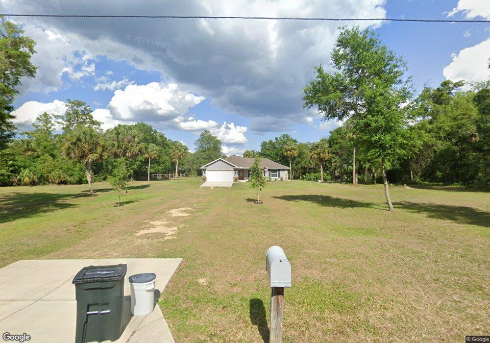
4853 N Sandy Path Crystal River, FL 34428
Estimated Value: $347,000 - $502,000
3
Beds
2
Baths
1,455
Sq Ft
$295/Sq Ft
Est. Value
About This Home
This home is located at 4853 N Sandy Path, Crystal River, FL 34428 and is currently estimated at $428,659, approximately $294 per square foot. 4853 N Sandy Path is a home with nearby schools including Crystal River High School, Crystal River Primary School, and Crystal River Middle School.
Ownership History
Date
Name
Owned For
Owner Type
Purchase Details
Closed on
Jun 28, 2016
Sold by
Cates Terry R and Cates Monnie L
Bought by
Cates Jason R and Cates Christina M
Current Estimated Value
Purchase Details
Closed on
Oct 1, 1991
Bought by
Cates Jason R and Cates Christina M
Purchase Details
Closed on
Jun 1, 1991
Bought by
Cates Jason R and Cates Christina M
Purchase Details
Closed on
Aug 1, 1986
Bought by
Cates Jason R and Cates Christina M
Create a Home Valuation Report for This Property
The Home Valuation Report is an in-depth analysis detailing your home's value as well as a comparison with similar homes in the area
Home Values in the Area
Average Home Value in this Area
Purchase History
| Date | Buyer | Sale Price | Title Company |
|---|---|---|---|
| Cates Jason R | -- | None Available | |
| Cates Jason R | $22,000 | -- | |
| Cates Jason R | $10,000 | -- | |
| Cates Jason R | $100 | -- |
Source: Public Records
Tax History Compared to Growth
Tax History
| Year | Tax Paid | Tax Assessment Tax Assessment Total Assessment is a certain percentage of the fair market value that is determined by local assessors to be the total taxable value of land and additions on the property. | Land | Improvement |
|---|---|---|---|---|
| 2024 | $2,367 | $193,594 | -- | -- |
| 2023 | $2,367 | $187,955 | $0 | $0 |
| 2022 | $2,177 | $179,947 | $0 | $0 |
| 2021 | $2,089 | $174,706 | $0 | $0 |
| 2020 | $2,030 | $180,025 | $29,420 | $150,605 |
| 2019 | $2,003 | $168,420 | $29,420 | $139,000 |
| 2018 | $1,991 | $166,245 | $29,420 | $136,825 |
| 2017 | $551 | $35,540 | $35,540 | $0 |
| 2016 | $25 | $1,358 | $1,358 | $0 |
| 2015 | $25 | $1,358 | $1,358 | $0 |
| 2014 | $28 | $1,470 | $1,470 | $0 |
Source: Public Records
Map
Nearby Homes
- 10264 W Springtree Ln
- 4599 N Williams Ave
- 5204 N Tumblewood Dr
- 10475 W Edgar Ln
- 9480 W Caravan Path
- 5198 N Sierra Vista Dr
- 5230 N Whetstone Point
- 9415 W Green Bay Ln
- 5573 N Larue Denise Terrace
- 5499 N Gonzo Point
- 9782 W Woodhaven Dr
- 4401 N Suncoast Blvd Unit 24
- 4401 N Suncoast Blvd Unit 38
- 5018 N Andri Dr
- 3900 N Bay Ave Unit 572
- 4579 N Lenethe Point
- 9942 W Hawthorne St
- 9461 W Tall Pines Ct
- 2365 NW Us Highway 19
- 4494 N Tallahassee Rd
- 4905 N Sandy Path
- 4781 N Sandy Path
- 4715 N Sandy Path
- 4955 N Sandy Path
- 10139 W Springtree Ln
- 9926 W Tom Mason Dr
- 4726 N Sandy Path
- 10140 W Springtree Ln
- 10161 W Springtree Ln Unit C-A
- 10161 W Springtree Ln
- 9844 W Tom Mason Dr
- 10099 W Tom Mason Dr
- 10025 W Tom Mason Dr
- 4650 N Ladybug Dr
- 10185 W Springtree Ln
- 5057 N Honeycreek Terrace
- 4700 N Ladybug Dr
- 4798 N Ladybug Dr
- 10220 W Springtree Ln
- 4995 N Tumblewood Dr