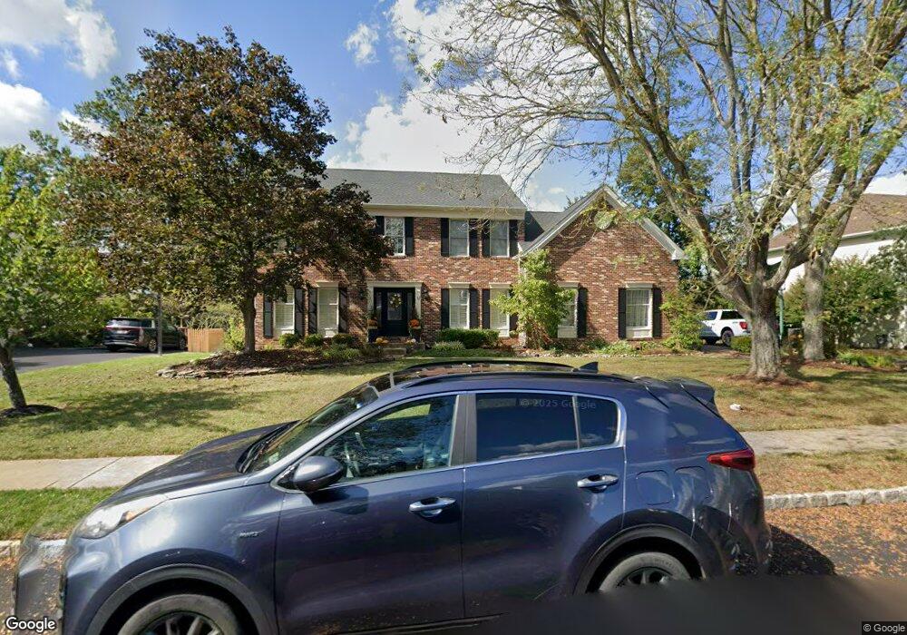
4856 Mead Dr Doylestown, PA 18902
Estimated Value: $876,242 - $1,004,000
4
Beds
3
Baths
2,908
Sq Ft
$317/Sq Ft
Est. Value
About This Home
This home is located at 4856 Mead Dr, Doylestown, PA 18902 and is currently estimated at $922,061, approximately $317 per square foot. 4856 Mead Dr is a home located in Bucks County with nearby schools including Cold Spring Elementary School, Holicong Middle School, and Central Bucks High School - East.
Ownership History
Date
Name
Owned For
Owner Type
Purchase Details
Closed on
Oct 29, 1999
Sold by
Brown Bernard and Brown Lorna S
Bought by
Mysza Dean P and Mysza Jill B
Current Estimated Value
Home Financials for this Owner
Home Financials are based on the most recent Mortgage that was taken out on this home.
Original Mortgage
$240,000
Interest Rate
7.73%
Mortgage Type
Balloon
Purchase Details
Closed on
Jun 28, 1996
Sold by
Cold Spring Hunt Lp
Bought by
Brown Bernard and Brown Lorna S
Home Financials for this Owner
Home Financials are based on the most recent Mortgage that was taken out on this home.
Original Mortgage
$268,000
Interest Rate
5.87%
Create a Home Valuation Report for This Property
The Home Valuation Report is an in-depth analysis detailing your home's value as well as a comparison with similar homes in the area
Home Values in the Area
Average Home Value in this Area
Purchase History
| Date | Buyer | Sale Price | Title Company |
|---|---|---|---|
| Mysza Dean P | $325,000 | -- | |
| Brown Bernard | $290,112 | -- |
Source: Public Records
Mortgage History
| Date | Status | Borrower | Loan Amount |
|---|---|---|---|
| Closed | Mysza Dean P | $240,000 | |
| Previous Owner | Brown Bernard | $268,000 |
Source: Public Records
Tax History Compared to Growth
Tax History
| Year | Tax Paid | Tax Assessment Tax Assessment Total Assessment is a certain percentage of the fair market value that is determined by local assessors to be the total taxable value of land and additions on the property. | Land | Improvement |
|---|---|---|---|---|
| 2025 | $9,502 | $58,360 | $10,120 | $48,240 |
| 2024 | $9,502 | $58,360 | $10,120 | $48,240 |
| 2023 | $9,179 | $58,360 | $10,120 | $48,240 |
| 2022 | $9,070 | $58,360 | $10,120 | $48,240 |
| 2021 | $8,961 | $58,360 | $10,120 | $48,240 |
| 2020 | $8,961 | $58,360 | $10,120 | $48,240 |
| 2019 | $8,903 | $58,360 | $10,120 | $48,240 |
| 2018 | $8,903 | $58,360 | $10,120 | $48,240 |
| 2017 | $8,830 | $58,360 | $10,120 | $48,240 |
| 2016 | $8,917 | $58,360 | $10,120 | $48,240 |
| 2015 | -- | $58,360 | $10,120 | $48,240 |
| 2014 | -- | $58,360 | $10,120 | $48,240 |
Source: Public Records
Map
Nearby Homes
- 4925 Redfield Rd
- 4936 Davis Dr
- 4250 Aly Dr
- 4542 Deep Creek Way
- 4221 Sir Andrew Cir
- 4605 Twinbrook Cir
- 4190 Milords Ln
- 3975 Amberton Ct
- 5063 Sagewood Ct
- 3865 Burnt House Hill Rd
- 3689 Hancock Ln
- 5115 Sugar Hill Ct
- 5184 Lovering Dr
- 4964 Point Pleasant Pike
- 5281 Harrington Ct
- 5182 Point Pleasant Pike
- 4221 Enders Way
- 6680 Point Pleasant Pike
- 3479 Durham Rd
- 3455 Durham Rd