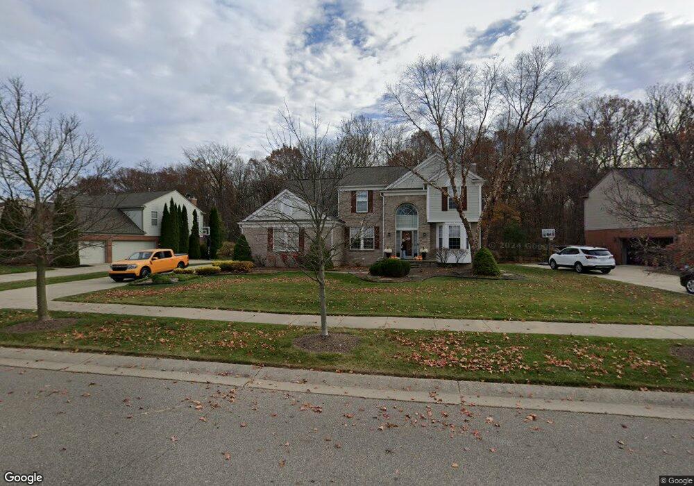
48581 Rockefeller Dr Canton, MI 48188
Estimated Value: $638,618 - $679,000
Studio
4
Baths
2,516
Sq Ft
$260/Sq Ft
Est. Value
About This Home
This home is located at 48581 Rockefeller Dr, Canton, MI 48188 and is currently estimated at $654,155, approximately $259 per square foot. 48581 Rockefeller Dr is a home located in Wayne County with nearby schools including Canton High School, Workman Elementary School, and Plymouth High School.
Ownership History
Date
Name
Owned For
Owner Type
Purchase Details
Closed on
Apr 10, 2025
Sold by
Nosay Michael E and Nosay Kimberly L
Bought by
Nosay Michael E and Nosay Kimberly L
Current Estimated Value
Purchase Details
Closed on
Jan 23, 2007
Sold by
Tolderlund Jason D and Tolderlund Maura L
Bought by
Nosay Michael E
Purchase Details
Closed on
Mar 31, 2004
Sold by
Long Johnny R and Long Tammy K
Bought by
Tolderlund Jason D
Purchase Details
Closed on
Dec 17, 2001
Sold by
Pulte Land Development C
Bought by
Long Johnny R
Create a Home Valuation Report for This Property
The Home Valuation Report is an in-depth analysis detailing your home's value as well as a comparison with similar homes in the area
Home Values in the Area
Average Home Value in this Area
Purchase History
| Date | Buyer | Sale Price | Title Company |
|---|---|---|---|
| Nosay Michael E | -- | None Listed On Document | |
| Nosay Michael E | -- | None Listed On Document | |
| Nosay Michael E | $367,500 | Fidelity National Title | |
| Tolderlund Jason D | $394,000 | Metropolitan Title Company | |
| Long Johnny R | $111,500 | -- |
Source: Public Records
Tax History
| Year | Tax Paid | Tax Assessment Tax Assessment Total Assessment is a certain percentage of the fair market value that is determined by local assessors to be the total taxable value of land and additions on the property. | Land | Improvement |
|---|---|---|---|---|
| 2025 | $3,850 | $296,100 | $0 | $0 |
| 2024 | $3,740 | $279,900 | $0 | $0 |
| 2023 | $3,566 | $240,500 | $0 | $0 |
| 2022 | $7,689 | $229,200 | $0 | $0 |
| 2021 | $7,461 | $220,800 | $0 | $0 |
| 2020 | $7,373 | $218,900 | $0 | $0 |
| 2019 | $7,237 | $205,960 | $0 | $0 |
| 2018 | $3,031 | $201,820 | $0 | $0 |
| 2017 | $7,273 | $198,800 | $0 | $0 |
| 2016 | $6,569 | $203,100 | $0 | $0 |
| 2015 | $16,652 | $186,190 | $0 | $0 |
| 2013 | $16,132 | $182,590 | $0 | $0 |
| 2010 | -- | $151,320 | $73,364 | $77,956 |
Source: Public Records
Map
Nearby Homes
- 48893 Fifth Ave
- 2780 Denton Rd
- 3410 Niagara Ave
- 3540 Empire State Dr
- 3571 Brooklyn Dr
- 2832 Wakefield Dr
- 464 Waterview Ct
- 48318 Manhattan Cir
- 392 Lenox Dr
- 49035 Geddes Rd
- 3928 Cornerstone Dr Unit 566
- 3956 Cornerstone Dr Unit 568
- 48474 Bridge Way Unit 569
- 48480 Bridge Way Unit 570
- 48486 Bridge Way Unit 560
- 48492 Bridge Way Unit 559
- 48504 Bridge Way Unit 562
- 48510 Bridge Way Unit 563
- 48516 Bridge Way Unit 564
- 379 Springfield Dr
- 48535 Rockefeller Dr
- 48625 Rockefeller Dr
- 48491 Rockefeller Dr
- 48580 Rockefeller Dr
- 48445 Rockefeller Dr
- 48624 Rockefeller Dr
- 48502 Greenwich Cir
- 48662 Rockefeller Dr
- 48682 Rockefeller Dr
- 48393 Rockefeller Dr Unit 12
- 48515 Greenwich Cir
- 48516 Greenwich Cir
- 48715 Rockefeller Dr
- 48714 Rockefeller Dr
- 48841 Greenwich Cir
- 48367 Rockefeller Dr Unit 11
- 48530 Greenwich Cir
- 48531 Greenwich Cir
- 48855 Greenwich Cir
- 48829 Greenwich Cir
Your Personal Tour Guide
Ask me questions while you tour the home.