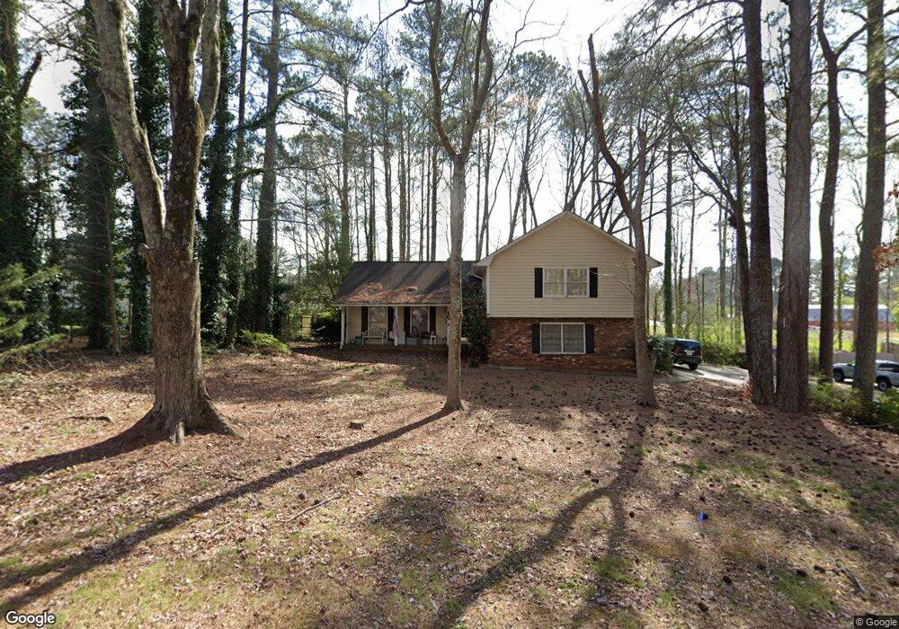
486 Benson Hurst Dr SW Mableton, GA 30126
Estimated Value: $324,507 - $373,000
3
Beds
2
Baths
1,600
Sq Ft
$216/Sq Ft
Est. Value
About This Home
This home is located at 486 Benson Hurst Dr SW, Mableton, GA 30126 and is currently estimated at $346,377, approximately $216 per square foot. 486 Benson Hurst Dr SW is a home located in Cobb County with nearby schools including Mableton Elementary School, Floyd Middle School, and Connection Pointe Christian Academy.
Ownership History
Date
Name
Owned For
Owner Type
Purchase Details
Closed on
Jun 30, 2014
Sold by
Elizon Housing 2012 A1 Llc
Bought by
Sfr 2014 Ga Llc
Current Estimated Value
Purchase Details
Closed on
Jan 2, 2013
Sold by
Wells Steven M
Bought by
Elizon Housing 2012 Al Llc
Purchase Details
Closed on
Sep 27, 1993
Sold by
Garrett Chan C Ju Deane
Bought by
Wells Steven M
Home Financials for this Owner
Home Financials are based on the most recent Mortgage that was taken out on this home.
Original Mortgage
$115,425
Interest Rate
7%
Mortgage Type
VA
Create a Home Valuation Report for This Property
The Home Valuation Report is an in-depth analysis detailing your home's value as well as a comparison with similar homes in the area
Home Values in the Area
Average Home Value in this Area
Purchase History
| Date | Buyer | Sale Price | Title Company |
|---|---|---|---|
| Sfr 2014 Ga Llc | -- | -- | |
| Elizon Housing 2012 Al Llc | $95,500 | -- | |
| Wells Steven M | $114,000 | -- |
Source: Public Records
Mortgage History
| Date | Status | Borrower | Loan Amount |
|---|---|---|---|
| Previous Owner | Wells Steven M | $115,425 |
Source: Public Records
Tax History Compared to Growth
Tax History
| Year | Tax Paid | Tax Assessment Tax Assessment Total Assessment is a certain percentage of the fair market value that is determined by local assessors to be the total taxable value of land and additions on the property. | Land | Improvement |
|---|---|---|---|---|
| 2025 | $4,203 | $139,492 | $30,000 | $109,492 |
| 2024 | $3,916 | $129,896 | $24,000 | $105,896 |
| 2023 | $3,916 | $129,896 | $24,000 | $105,896 |
| 2022 | $2,549 | $84,000 | $20,000 | $64,000 |
| 2021 | $2,549 | $84,000 | $20,000 | $64,000 |
| 2020 | $2,578 | $84,940 | $20,000 | $64,940 |
| 2019 | $2,414 | $79,536 | $20,000 | $59,536 |
| 2018 | $1,947 | $64,160 | $20,000 | $44,160 |
| 2017 | $1,845 | $64,160 | $20,000 | $44,160 |
| 2016 | $1,941 | $67,520 | $20,000 | $47,520 |
| 2015 | $1,765 | $59,900 | $18,000 | $41,900 |
| 2014 | $1,134 | $38,176 | $0 | $0 |
Source: Public Records
Map
Nearby Homes
- 647 Shannon Green Cir SW
- 680 Sundial Ln
- 684 Sundial Ln
- 450 Dorset Way SW
- 637 Carlouetta Rd SW
- Jasper-Townhome Plan at Park View Reserve - Hometown Series
- Madeline-Townhome Plan at Park View Reserve - Hometown Series
- 4672 Vernon Dr SW
- 221 Shady Ln SW
- 639 Concord Rd SW
- 4800 Timberland Dr SW
- 768 Ironhorse Ln SW
- 4167 Waratah Way
- 4487 S Springwood Dr SW
- 414 Landers Dr SW Unit 1
- 875 Joseph Club Dr SW
- 470 Pineland Rd SW
- 854 Joseph Club Dr SW
- 482 Benson Hurst Dr SW Unit 4
- 482 Benson Hurst Dr SW
- 490 Benson Hurst Dr SW
- 478 Benson Hurst Dr SW
- 493 Benson Hurst Dr SW
- 485 Benson Hurst Dr SW
- 500 Benson Hurst Dr SW
- 510 Nickajack Rd SW
- 570 Nickajack Rd SW
- 541 Nickajack Rd SW
- 501 Benson Hurst Dr SW
- 474 Benson Hurst Dr SW
- 4777 Mckee Ct SW
- 721 Shannon Green Cir SW
- 480 Nickajack Rd SW
- 0 Mckee Ct SW Unit 7094828
- 0 Mckee Ct SW Unit 7003192
- 0 Mckee Ct SW Unit 8501049
- 0 Mckee Ct SW Unit 7246279
- 0 Mckee Ct SW