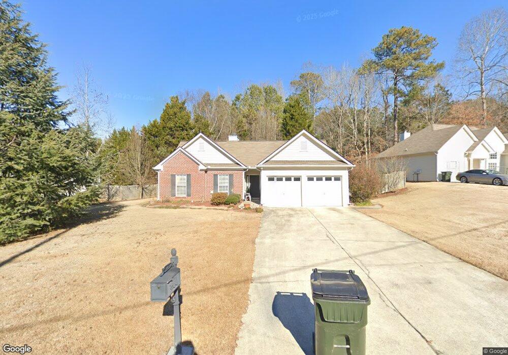
486 Brooks Rd Dallas, GA 30132
East Paulding County NeighborhoodEstimated Value: $305,000 - $336,000
3
Beds
2
Baths
1,473
Sq Ft
$218/Sq Ft
Est. Value
About This Home
This home is located at 486 Brooks Rd, Dallas, GA 30132 and is currently estimated at $321,283, approximately $218 per square foot. 486 Brooks Rd is a home located in Paulding County with nearby schools including Northside Elementary School, Lena Mae Moses Middle School, and East Paulding High School.
Ownership History
Date
Name
Owned For
Owner Type
Purchase Details
Closed on
Apr 13, 2022
Sold by
Delice Yorline
Bought by
Arvm 5 Llc
Current Estimated Value
Purchase Details
Closed on
Mar 19, 2004
Sold by
Parker Homes Inc
Bought by
Maney Tonita
Home Financials for this Owner
Home Financials are based on the most recent Mortgage that was taken out on this home.
Original Mortgage
$115,101
Interest Rate
5.62%
Mortgage Type
VA
Create a Home Valuation Report for This Property
The Home Valuation Report is an in-depth analysis detailing your home's value as well as a comparison with similar homes in the area
Home Values in the Area
Average Home Value in this Area
Purchase History
| Date | Buyer | Sale Price | Title Company |
|---|---|---|---|
| Arvm 5 Llc | $253,000 | -- | |
| Maney Tonita | $125,900 | -- |
Source: Public Records
Mortgage History
| Date | Status | Borrower | Loan Amount |
|---|---|---|---|
| Previous Owner | Maney Tonita | $115,101 |
Source: Public Records
Tax History Compared to Growth
Tax History
| Year | Tax Paid | Tax Assessment Tax Assessment Total Assessment is a certain percentage of the fair market value that is determined by local assessors to be the total taxable value of land and additions on the property. | Land | Improvement |
|---|---|---|---|---|
| 2024 | $1,887 | $127,028 | $12,000 | $115,028 |
| 2023 | $3,186 | $124,732 | $12,000 | $112,732 |
| 2022 | $2,672 | $104,368 | $12,000 | $92,368 |
| 2021 | $2,343 | $82,488 | $12,000 | $70,488 |
| 2020 | $2,174 | $75,064 | $12,000 | $63,064 |
| 2019 | $1,976 | $67,452 | $12,000 | $55,452 |
| 2018 | $1,801 | $61,636 | $12,000 | $49,636 |
| 2017 | $1,693 | $57,296 | $12,000 | $45,296 |
| 2016 | $1,559 | $53,436 | $12,000 | $41,436 |
| 2015 | $1,471 | $49,640 | $12,000 | $37,640 |
| 2014 | $1,192 | $39,608 | $12,000 | $27,608 |
| 2013 | -- | $33,960 | $12,000 | $21,960 |
Source: Public Records
Map
Nearby Homes
- 32 Stable Ln
- 443 Brooks Rd
- 68 Wagon Trail Cir
- 70 Stallion Run
- 181 Beckett Dr
- 16 Riders Ridge
- 74 Riders Ridge
- 791 Brooks Rd
- The McGinnis Plan at Jones Ridge
- The Langford Plan at Jones Ridge
- The Ellijay Plan at Jones Ridge
- The Palmer Plan at Jones Ridge
- The James Plan at Jones Ridge
- The Lancaster Plan at Jones Ridge
- The Avery Plan at Jones Ridge
- 57 Saddle Brooke Dr
- 222 River Run Dr
- 222 River Run Dr Unit 82
- 214 River Run Dr
- 214 River Run Dr Unit 83
- 14 Stable Ln
- 452 Brooks Rd
- 0 Trotter Way Unit 7339462
- 0 Trotter Way Unit 8506059
- 0 Trotter Way Unit 7452925
- 0 Trotter Way Unit 7343531
- 0 Trotter Way Unit 7262132
- 0 Trotter Way Unit 7004835
- 0 Trotter Way Unit 7014339
- 371 Trotters Way
- 491 Brooks Rd
- 507 Brooks Rd
- 507 Brooks Rd Unit 275
- 46 Stable Ln
- 523 Brooks Rd
- 15 Stable Ln
- 349 Trotters Way
- 60 Stable Ln
- 539 Brooks Rd
- 354 Trotter Way