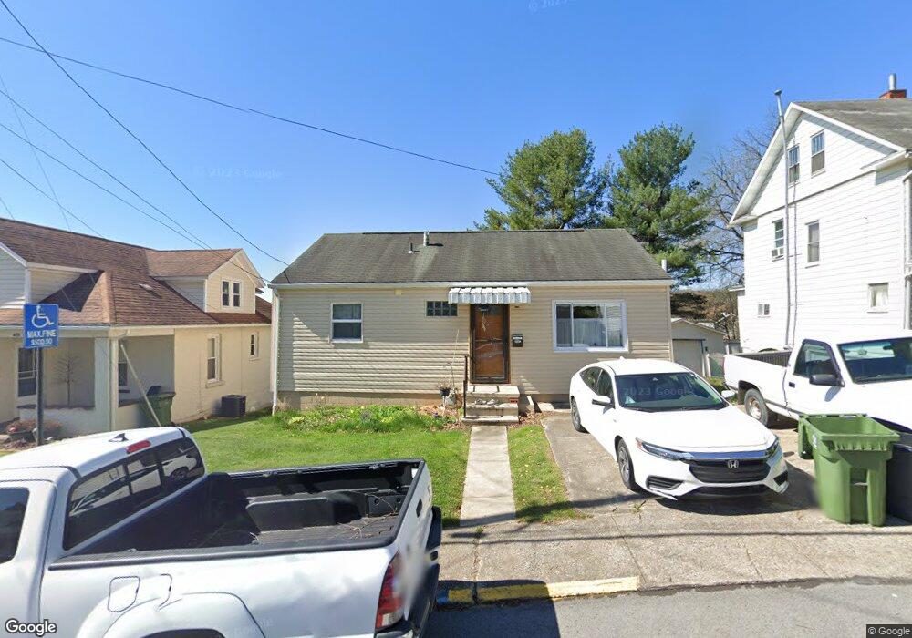
486 Hite St Morgantown, WV 26501
First Ward NeighborhoodEstimated Value: $189,000 - $224,000
4
Beds
2
Baths
1,400
Sq Ft
$152/Sq Ft
Est. Value
About This Home
This home is located at 486 Hite St, Morgantown, WV 26501 and is currently estimated at $212,500, approximately $151 per square foot. 486 Hite St is a home located in Monongalia County with nearby schools including Mountainview Elementary School, South Middle School, and Morgantown High School.
Ownership History
Date
Name
Owned For
Owner Type
Purchase Details
Closed on
Oct 8, 2018
Sold by
Lioi Stephanie L
Bought by
Mcconnell Catherine Dianneq
Current Estimated Value
Purchase Details
Closed on
Jul 8, 2016
Sold by
Mcmullen Daniel
Bought by
Lioi Stephanie L
Home Financials for this Owner
Home Financials are based on the most recent Mortgage that was taken out on this home.
Original Mortgage
$143,450
Interest Rate
3.64%
Mortgage Type
New Conventional
Purchase Details
Closed on
Jun 23, 2006
Sold by
Hammer Fink Leah W and Hammer Leah W
Bought by
Mcmullen Daniel
Home Financials for this Owner
Home Financials are based on the most recent Mortgage that was taken out on this home.
Original Mortgage
$106,400
Interest Rate
6.6%
Mortgage Type
New Conventional
Create a Home Valuation Report for This Property
The Home Valuation Report is an in-depth analysis detailing your home's value as well as a comparison with similar homes in the area
Home Values in the Area
Average Home Value in this Area
Purchase History
| Date | Buyer | Sale Price | Title Company |
|---|---|---|---|
| Mcconnell Catherine Dianneq | $162,000 | None Available | |
| Lioi Stephanie L | $151,000 | Old Republic National Title | |
| Mcmullen Daniel | $112,000 | None Available |
Source: Public Records
Mortgage History
| Date | Status | Borrower | Loan Amount |
|---|---|---|---|
| Previous Owner | Lioi Stephanie L | $143,450 | |
| Previous Owner | Mcmullen Daniel | $106,400 |
Source: Public Records
Tax History Compared to Growth
Tax History
| Year | Tax Paid | Tax Assessment Tax Assessment Total Assessment is a certain percentage of the fair market value that is determined by local assessors to be the total taxable value of land and additions on the property. | Land | Improvement |
|---|---|---|---|---|
| 2025 | $2,123 | $80,520 | $25,980 | $54,540 |
| 2024 | $2,123 | $80,520 | $25,980 | $54,540 |
| 2023 | $1,059 | $80,520 | $25,980 | $54,540 |
| 2022 | $1,014 | $79,560 | $25,980 | $53,580 |
| 2021 | $1,018 | $79,560 | $25,980 | $53,580 |
| 2020 | $1,022 | $79,560 | $25,980 | $53,580 |
| 2019 | $1,028 | $79,560 | $25,980 | $53,580 |
| 2018 | $1,030 | $79,560 | $25,980 | $53,580 |
| 2017 | $960 | $73,800 | $24,480 | $49,320 |
| 2016 | $940 | $71,940 | $22,560 | $49,380 |
| 2015 | $884 | $70,140 | $20,760 | $49,380 |
| 2014 | $949 | $78,120 | $19,920 | $58,200 |
Source: Public Records
Map
Nearby Homes
- 541 Hess St
- 636 Madison Ave
- 653 Madigan Ave
- 670 Elysian Ave
- 5 Maple Ave
- 712 W Virginia Ave
- 503 Don Knotts Blvd
- 265 Waitman St
- 328 S High St
- 313 Ford St
- 200 Logan Ave
- 975 Dorsey Ave
- 200 Webster Ave
- 417 Elm St
- 422 Grand St
- 338 Jackson Ave
- 134 Birds Eye View Dr
- 421 Ash St
- 105 Birds Eye View Dr
- TBD Charleston Ave