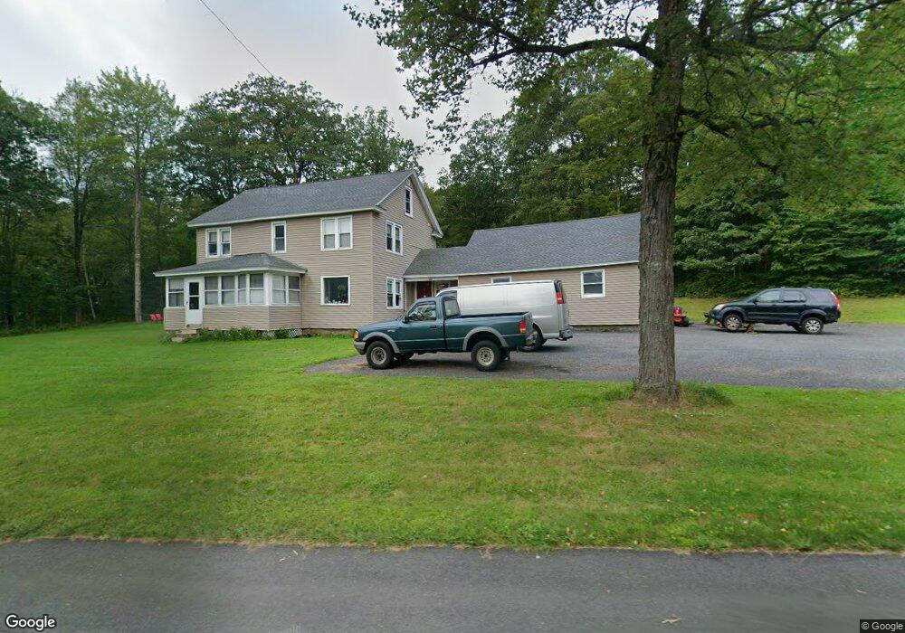
486 Mohawk Trail Drury, MA 01343
Estimated Value: $276,000 - $372,000
1
Bed
2
Baths
2,208
Sq Ft
$148/Sq Ft
Est. Value
About This Home
This home is located at 486 Mohawk Trail, Drury, MA 01343 and is currently estimated at $327,244, approximately $148 per square foot. 486 Mohawk Trail is a home located in Berkshire County with nearby schools including Gabriel Abbott Memorial School.
Ownership History
Date
Name
Owned For
Owner Type
Purchase Details
Closed on
Sep 11, 2002
Sold by
Department Of Housing & Urban Dev
Bought by
Spencer Lori
Current Estimated Value
Home Financials for this Owner
Home Financials are based on the most recent Mortgage that was taken out on this home.
Original Mortgage
$62,080
Outstanding Balance
$25,382
Interest Rate
6.48%
Mortgage Type
Purchase Money Mortgage
Estimated Equity
$301,862
Purchase Details
Closed on
Jun 30, 1995
Sold by
Biucher Norma J
Bought by
Mahoney Timothy J and Mahoney Debbie V
Create a Home Valuation Report for This Property
The Home Valuation Report is an in-depth analysis detailing your home's value as well as a comparison with similar homes in the area
Home Values in the Area
Average Home Value in this Area
Purchase History
| Date | Buyer | Sale Price | Title Company |
|---|---|---|---|
| Spencer Lori | $64,000 | -- | |
| Mahoney Timothy J | $52,500 | -- |
Source: Public Records
Mortgage History
| Date | Status | Borrower | Loan Amount |
|---|---|---|---|
| Open | Mahoney Timothy J | $62,080 | |
| Previous Owner | Mahoney Timothy J | $31,252 | |
| Previous Owner | Mahoney Timothy J | $29,400 | |
| Previous Owner | Mahoney Timothy J | $16,500 |
Source: Public Records
Tax History
| Year | Tax Paid | Tax Assessment Tax Assessment Total Assessment is a certain percentage of the fair market value that is determined by local assessors to be the total taxable value of land and additions on the property. | Land | Improvement |
|---|---|---|---|---|
| 2025 | $1,693 | $217,900 | $33,800 | $184,100 |
| 2023 | $1,448 | $171,100 | $28,700 | $142,400 |
| 2022 | $1,460 | $165,500 | $28,000 | $137,500 |
| 2021 | $1,397 | $164,200 | $26,700 | $137,500 |
| 2019 | $4,678 | $155,300 | $26,200 | $129,100 |
| 2018 | $1,614 | $155,300 | $26,200 | $129,100 |
| 2017 | $1,457 | $152,900 | $26,100 | $126,800 |
| 2016 | $1,425 | $152,900 | $26,100 | $126,800 |
| 2015 | $1,460 | $161,700 | $26,100 | $135,600 |
Source: Public Records
Map
Nearby Homes
- 477 Mohawk Trail
- 0 Tunnel Rd
- 7 Poirot Rd
- 0 Monroe Rd Unit 248567
- 0 Central Shaft Rd
- 214 Mohawk Trail
- 140 Strykers Rd
- 0 Moores Rd Unit 247336
- 0 Strykers Rd
- 132 Harwood Rd
- 70 Mohawk Trail
- 00 Mohawk Trail
- 559 Tea St
- Past 400 East Hoosac St
- Upper East Hoosac St
- 0 Manley Phelps Rd Unit 247636
- 0 Manley Phelps Rd Unit 246215
- 0 Manley Phelps Rd Unit 73427346
- 4 Seminole Dr
- 350 Mohawk Trail
- 494 Mohawk Trail
- 463 Mohawk Trail
- 344 Mohawk Trail
- 455 Mohawk Trail
- 223 S County Rd
- 179 S County Rd
- 2 South St
- 209 S County Rd
- 254 S County Rd
- 0 South Rd Unit 244142
- 247 S County Rd
- 231 S County Rd
- 436 Mohawk Trail
- 241 S County Rd
- 253 S County Rd
- 20 South St
- 3 Whitcomb Hill Rd
- 185 S County Rd
- 22 South St
Your Personal Tour Guide
Ask me questions while you tour the home.