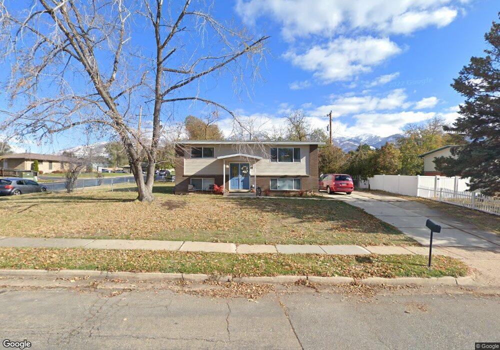
486 N 850 E Layton, UT 84041
Estimated Value: $429,000 - $515,000
4
Beds
2
Baths
1,836
Sq Ft
$250/Sq Ft
Est. Value
About This Home
This home is located at 486 N 850 E, Layton, UT 84041 and is currently estimated at $458,315, approximately $249 per square foot. 486 N 850 E is a home located in Davis County with nearby schools including Whitesides Elementary School, Central Davis Junior High School, and Layton High School.
Ownership History
Date
Name
Owned For
Owner Type
Purchase Details
Closed on
Apr 27, 2017
Sold by
Alejandre Koryn
Bought by
Dandy Tyler and Dandy Breeanna
Current Estimated Value
Home Financials for this Owner
Home Financials are based on the most recent Mortgage that was taken out on this home.
Original Mortgage
$212,578
Outstanding Balance
$178,282
Interest Rate
4.5%
Mortgage Type
FHA
Estimated Equity
$280,033
Purchase Details
Closed on
Feb 25, 2015
Sold by
Etitle Insurance Agency
Bought by
Safe Investments Llc
Purchase Details
Closed on
Apr 16, 1998
Sold by
Mutschall Karen
Bought by
Barningham Ron A and Barningham Carol E
Home Financials for this Owner
Home Financials are based on the most recent Mortgage that was taken out on this home.
Original Mortgage
$97,169
Interest Rate
7.18%
Mortgage Type
FHA
Create a Home Valuation Report for This Property
The Home Valuation Report is an in-depth analysis detailing your home's value as well as a comparison with similar homes in the area
Home Values in the Area
Average Home Value in this Area
Purchase History
| Date | Buyer | Sale Price | Title Company |
|---|---|---|---|
| Dandy Tyler | -- | For Title | |
| Safe Investments Llc | $62,100 | Inwest Title Services Inc | |
| Barningham Ron A | -- | Associated Title Company |
Source: Public Records
Mortgage History
| Date | Status | Borrower | Loan Amount |
|---|---|---|---|
| Open | Dandy Tyler | $212,578 | |
| Previous Owner | Barningham Ron A | $97,169 | |
| Closed | Safe Investments Llc | $0 |
Source: Public Records
Tax History
| Year | Tax Paid | Tax Assessment Tax Assessment Total Assessment is a certain percentage of the fair market value that is determined by local assessors to be the total taxable value of land and additions on the property. | Land | Improvement |
|---|---|---|---|---|
| 2025 | $2,070 | $217,250 | $101,787 | $115,463 |
| 2024 | $1,982 | $209,550 | $118,303 | $91,247 |
| 2023 | $1,964 | $366,000 | $137,897 | $228,103 |
| 2022 | $2,043 | $206,800 | $73,725 | $133,075 |
| 2021 | $1,934 | $292,000 | $105,609 | $186,391 |
| 2020 | $1,768 | $256,000 | $87,935 | $168,065 |
| 2019 | $1,664 | $236,000 | $82,681 | $153,319 |
| 2018 | $1,517 | $216,000 | $82,681 | $133,319 |
| 2016 | $1,218 | $89,431 | $27,014 | $62,417 |
| 2015 | $1,111 | $77,496 | $27,014 | $50,482 |
| 2014 | $1,202 | $82,782 | $27,014 | $55,768 |
| 2013 | -- | $77,505 | $18,612 | $58,893 |
Source: Public Records
Map
Nearby Homes
- 556 N Fairfield Rd Unit A2
- 556 N Fairfield Rd Unit D1
- 556 N Fairfield Rd Unit D2
- 556 N Fairfield Rd Unit A3
- 556 N Fairfield Rd Unit D3
- 556 N Fairfield Rd Unit D4
- 556 N Fairfield Rd Unit A1
- 556 N Fairfield Rd Unit A4
- 861 E 575 N
- 508 N Adamswood Rd
- 187 N Talbot Dr
- 109 Beacon Ave
- 9 Colonial Ave
- 997 E 825 N
- 479 N 1375 E
- 149 N Fort Ln Unit 1D
- 1033 E 825 N
- 1503 E 530 N
- 86 Mill Rd
- 1515 E Gentile St
Your Personal Tour Guide
Ask me questions while you tour the home.