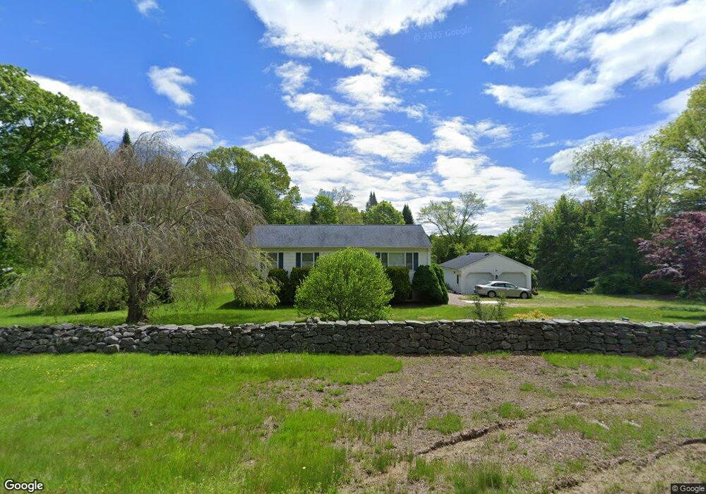
486 N Stonington Rd Stonington, CT 06378
Estimated Value: $394,284 - $464,000
3
Beds
3
Baths
1,184
Sq Ft
$351/Sq Ft
Est. Value
About This Home
This home is located at 486 N Stonington Rd, Stonington, CT 06378 and is currently estimated at $415,821, approximately $351 per square foot. 486 N Stonington Rd is a home located in New London County with nearby schools including Stonington Middle School and Stonington High School.
Ownership History
Date
Name
Owned For
Owner Type
Purchase Details
Closed on
Jun 17, 2002
Sold by
Burdick Thomas E and Burdick Jacqueline A
Bought by
Dicioccio Tina M
Current Estimated Value
Home Financials for this Owner
Home Financials are based on the most recent Mortgage that was taken out on this home.
Original Mortgage
$104,000
Interest Rate
6.8%
Create a Home Valuation Report for This Property
The Home Valuation Report is an in-depth analysis detailing your home's value as well as a comparison with similar homes in the area
Home Values in the Area
Average Home Value in this Area
Purchase History
| Date | Buyer | Sale Price | Title Company |
|---|---|---|---|
| Dicioccio Tina M | $205,000 | -- | |
| Dicioccio Tina M | $205,000 | -- |
Source: Public Records
Mortgage History
| Date | Status | Borrower | Loan Amount |
|---|---|---|---|
| Closed | Dicioccio Tina M | $104,000 | |
| Previous Owner | Dicioccio Tina M | $105,000 |
Source: Public Records
Tax History Compared to Growth
Tax History
| Year | Tax Paid | Tax Assessment Tax Assessment Total Assessment is a certain percentage of the fair market value that is determined by local assessors to be the total taxable value of land and additions on the property. | Land | Improvement |
|---|---|---|---|---|
| 2025 | $4,388 | $212,200 | $66,400 | $145,800 |
| 2024 | $4,233 | $212,200 | $66,400 | $145,800 |
| 2023 | $4,212 | $212,200 | $66,400 | $145,800 |
| 2022 | $4,226 | $160,300 | $66,400 | $93,900 |
| 2021 | $4,288 | $160,300 | $66,400 | $93,900 |
| 2020 | $4,209 | $160,300 | $66,400 | $93,900 |
| 2019 | $4,209 | $160,300 | $66,400 | $93,900 |
| 2018 | $4,100 | $160,300 | $66,400 | $93,900 |
| 2017 | $3,783 | $145,900 | $62,300 | $83,600 |
| 2016 | $3,685 | $145,900 | $62,300 | $83,600 |
| 2015 | $3,534 | $145,900 | $62,300 | $83,600 |
| 2014 | $3,389 | $145,900 | $62,300 | $83,600 |
Source: Public Records
Map
Nearby Homes
- 1 Circle Dr
- 15 Circle Dr
- 130 Stephen Dr
- 137 Stephen Dr
- 55 Wolf Neck Rd
- 41 Wolf Neck Rd
- 69 Wolf Neck Rd
- 188 Wolf Neck Rd
- 355 N Stonington Rd
- 362 Lantern Hill Rd
- 411 Lantern Hill Rd
- 332 Lantern Hill Rd
- 22 Oak Ln
- 360 New London Turnpike
- 508 Al Harvey Rd
- 45R Long Pond Rd S
- 587 Taugwonk Rd
- 579 Taugwonk Rd
- 153 Meeting House Ln
- 216 Al Harvey Rd