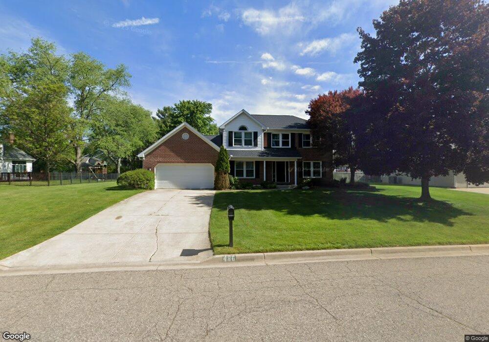
486 Tuscany Dr Portage, MI 49024
Estimated Value: $427,000 - $447,000
4
Beds
4
Baths
2,096
Sq Ft
$207/Sq Ft
Est. Value
About This Home
This home is located at 486 Tuscany Dr, Portage, MI 49024 and is currently estimated at $434,034, approximately $207 per square foot. 486 Tuscany Dr is a home located in Kalamazoo County with nearby schools including Central Elementary School, Portage Central Middle School, and Portage Central High School.
Ownership History
Date
Name
Owned For
Owner Type
Purchase Details
Closed on
Jan 16, 2009
Sold by
Thurlo Keith and Thurlo Betsey D
Bought by
Dodge N P and National Equity Inc
Current Estimated Value
Purchase Details
Closed on
Mar 15, 2006
Sold by
Heintz Mark J and Heintz Michele R
Bought by
Thurio Keith and Thurio Betsey D
Home Financials for this Owner
Home Financials are based on the most recent Mortgage that was taken out on this home.
Original Mortgage
$194,400
Interest Rate
6.38%
Mortgage Type
Fannie Mae Freddie Mac
Create a Home Valuation Report for This Property
The Home Valuation Report is an in-depth analysis detailing your home's value as well as a comparison with similar homes in the area
Home Values in the Area
Average Home Value in this Area
Purchase History
| Date | Buyer | Sale Price | Title Company |
|---|---|---|---|
| Dodge N P | $211,500 | Stewart Title Guaranty Co | |
| Thurio Keith | $243,000 | Chicago Title |
Source: Public Records
Mortgage History
| Date | Status | Borrower | Loan Amount |
|---|---|---|---|
| Previous Owner | Thurio Keith | $194,400 |
Source: Public Records
Tax History Compared to Growth
Tax History
| Year | Tax Paid | Tax Assessment Tax Assessment Total Assessment is a certain percentage of the fair market value that is determined by local assessors to be the total taxable value of land and additions on the property. | Land | Improvement |
|---|---|---|---|---|
| 2025 | $6,637 | $210,200 | $0 | $0 |
| 2024 | $5,843 | $206,900 | $0 | $0 |
| 2023 | $5,569 | $180,100 | $0 | $0 |
| 2022 | $6,018 | $160,400 | $0 | $0 |
| 2021 | $5,816 | $155,400 | $0 | $0 |
| 2020 | $5,689 | $144,300 | $0 | $0 |
| 2019 | $512 | $139,500 | $0 | $0 |
| 2018 | $0 | $138,700 | $0 | $0 |
| 2017 | $0 | $137,200 | $0 | $0 |
| 2016 | -- | $139,400 | $0 | $0 |
| 2015 | -- | $128,400 | $0 | $0 |
| 2014 | -- | $119,300 | $0 | $0 |
Source: Public Records
Map
Nearby Homes
- 10010 Lloy St
- 9766 S Westnedge Ave
- 9625 Oakview Dr
- 404 Pimlico Ct
- 9744 Chambray St
- 341 Cliffwood Ave
- 442 Pinewood Cir
- 550 Ludington Ave
- 580 Ludington Ave
- 775 Chloe Jane Ave
- 739 Chloe Jane Ave
- 10545 Sharon Lee Ln
- 729 Chloe Jane Ave
- 721 Briella Ct
- 10631 Gracie Ln Unit 6
- 735 Briella Ct
- 10565 Pierport Dr
- 821 Janelle Ct
- 705 Briella Ct
- 560 Sand Pointe Trail
- 454 Tuscany Dr
- 9949 Wexford Dr
- 487 Brittany Dr
- 457 Brittany Dr
- 9937 Wexford Dr
- 424 Tuscany Dr
- 479 Tuscany Dr
- 515 Tuscany Dr
- 425 Brittany Dr
- 423 Tuscany Dr
- 9942 Wexford Dr
- 9950 Wexford Dr
- 394 Tuscany Dr
- 10010 Tuscany Ct
- 397 Brittany Dr
- 9922 Wexford Dr
- 539 Tuscany Dr
- 482 Brittany Dr
- 9887 Wexford Dr
- 393 Tuscany Dr