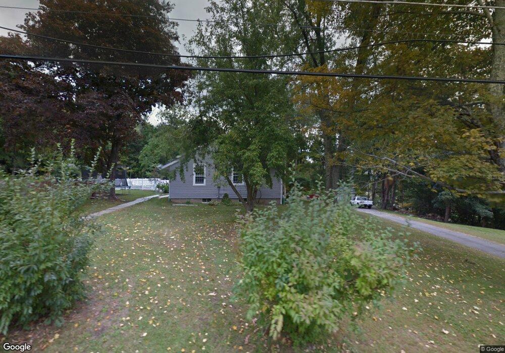
486 University Dr Torrington, CT 06790
Estimated Value: $417,635 - $520,000
4
Beds
3
Baths
2,294
Sq Ft
$206/Sq Ft
Est. Value
About This Home
This home is located at 486 University Dr, Torrington, CT 06790 and is currently estimated at $473,659, approximately $206 per square foot. 486 University Dr is a home located in Litchfield County with nearby schools including Torrington Middle School, Torrington High School, and St. John Paul the Great Academy.
Ownership History
Date
Name
Owned For
Owner Type
Purchase Details
Closed on
Oct 26, 2000
Sold by
Kissane Deborah
Bought by
Kulesza John and Kulesza Gisella
Current Estimated Value
Home Financials for this Owner
Home Financials are based on the most recent Mortgage that was taken out on this home.
Original Mortgage
$100,000
Interest Rate
5.5%
Create a Home Valuation Report for This Property
The Home Valuation Report is an in-depth analysis detailing your home's value as well as a comparison with similar homes in the area
Home Values in the Area
Average Home Value in this Area
Purchase History
| Date | Buyer | Sale Price | Title Company |
|---|---|---|---|
| Kulesza John | $126,000 | -- |
Source: Public Records
Mortgage History
| Date | Status | Borrower | Loan Amount |
|---|---|---|---|
| Open | Kulesza John | $67,000 | |
| Closed | Kulesza John | $100,000 |
Source: Public Records
Tax History Compared to Growth
Tax History
| Year | Tax Paid | Tax Assessment Tax Assessment Total Assessment is a certain percentage of the fair market value that is determined by local assessors to be the total taxable value of land and additions on the property. | Land | Improvement |
|---|---|---|---|---|
| 2025 | $11,894 | $309,330 | $33,880 | $275,450 |
| 2024 | $8,772 | $182,870 | $33,960 | $148,910 |
| 2023 | $8,770 | $182,870 | $33,960 | $148,910 |
| 2022 | $8,620 | $182,870 | $33,960 | $148,910 |
| 2021 | $8,443 | $182,870 | $33,960 | $148,910 |
| 2020 | $8,443 | $182,870 | $33,960 | $148,910 |
| 2019 | $9,138 | $197,920 | $37,630 | $160,290 |
| 2018 | $9,138 | $197,920 | $37,630 | $160,290 |
| 2017 | $9,055 | $197,920 | $37,630 | $160,290 |
| 2016 | $9,055 | $197,920 | $37,630 | $160,290 |
| 2015 | $9,055 | $197,920 | $37,630 | $160,290 |
| 2014 | $8,522 | $234,640 | $61,160 | $173,480 |
Source: Public Records
Map
Nearby Homes
- 111 Mill Ln
- 79 Brass Mill Dam Rd
- 187 Lovers Ln Unit 61
- 68 Westledge Terrace
- 0 Stoneridge Dr
- 213 Spring St
- 69 McGuinness St
- 58 Eggleston St
- 721 Marshall Lake Rd
- 70 Greenfield Dr
- 118 Bannon St
- 75 Hunter Ct Unit 75
- 80 Baron Ln
- 839 Main St Unit 65
- 839 Main St Unit 12
- 839 Main St Unit 104
- 38 Surrey Ln Unit 38
- 27 Surrey Ln Unit d27
- 39 Baron Ln
- 0 Meyer Rd
- 0 486 University Dr Unit L147116
- 450 University Dr
- 540 University Dr
- 424 University Dr
- 514 University Dr
- 413 University Dr
- 429 University Dr
- 404 University Dr
- 557 University Dr
- 505 University Dr
- 480 University Dr
- 377 University Dr
- 380 University Dr
- 568 University Dr
- 393 University Dr
- 357 University Dr
- 608 University Dr
- 12 University Dr
- 333 University Dr
- 5 John Brown Rd