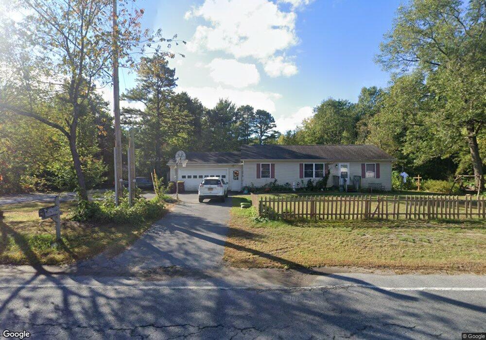
486 Upper Sherman Ave Queensbury, NY 12804
Estimated Value: $315,000 - $351,000
3
Beds
2
Baths
1,200
Sq Ft
$283/Sq Ft
Est. Value
About This Home
This home is located at 486 Upper Sherman Ave, Queensbury, NY 12804 and is currently estimated at $339,694, approximately $283 per square foot. 486 Upper Sherman Ave is a home located in Warren County with nearby schools including Queensbury Elementary School, William H. Barton Intermediate School, and Queensbury Middle School.
Ownership History
Date
Name
Owned For
Owner Type
Purchase Details
Closed on
Sep 30, 2014
Sold by
Roberts Corey A
Bought by
Roberts Corey A
Current Estimated Value
Purchase Details
Closed on
Mar 24, 2014
Sold by
King Matthew R
Bought by
Roberts Corey
Home Financials for this Owner
Home Financials are based on the most recent Mortgage that was taken out on this home.
Original Mortgage
$161,500
Outstanding Balance
$121,992
Interest Rate
4.25%
Mortgage Type
New Conventional
Estimated Equity
$217,703
Purchase Details
Closed on
Jan 31, 2000
Sold by
Combs Sandra J
Bought by
Dkc Holding Inc
Purchase Details
Closed on
Feb 1, 1999
Sold by
Combs Sandra J
Bought by
King Matthew R and King Karin R
Purchase Details
Closed on
Nov 20, 1998
Sold by
Combs Sandra J
Bought by
King Matthew R and King Karin R
Purchase Details
Closed on
Aug 11, 1998
Sold by
Combs Glenn E and Combs Sandra
Bought by
Combs Sandra J
Create a Home Valuation Report for This Property
The Home Valuation Report is an in-depth analysis detailing your home's value as well as a comparison with similar homes in the area
Home Values in the Area
Average Home Value in this Area
Purchase History
| Date | Buyer | Sale Price | Title Company |
|---|---|---|---|
| Roberts Corey A | -- | Michael S. Martin | |
| Roberts Corey | $170,000 | Timothy Shuler | |
| Dkc Holding Inc | $190,000 | Stan L Pritzker | |
| King Matthew R | -- | -- | |
| King Matthew R | $17,000 | -- | |
| Combs Sandra J | -- | -- |
Source: Public Records
Mortgage History
| Date | Status | Borrower | Loan Amount |
|---|---|---|---|
| Open | Roberts Corey | $161,500 |
Source: Public Records
Tax History Compared to Growth
Tax History
| Year | Tax Paid | Tax Assessment Tax Assessment Total Assessment is a certain percentage of the fair market value that is determined by local assessors to be the total taxable value of land and additions on the property. | Land | Improvement |
|---|---|---|---|---|
| 2024 | $5,194 | $273,000 | $42,000 | $231,000 |
| 2023 | $5,053 | $217,900 | $36,000 | $181,900 |
| 2022 | $4,841 | $217,900 | $36,000 | $181,900 |
| 2021 | $4,775 | $217,900 | $36,000 | $181,900 |
| 2020 | $1,204 | $191,400 | $31,800 | $159,600 |
| 2019 | $3,744 | $191,400 | $31,800 | $159,600 |
| 2018 | $3,744 | $191,400 | $31,800 | $159,600 |
| 2017 | $3,411 | $174,600 | $31,800 | $142,800 |
| 2016 | $3,365 | $174,600 | $31,800 | $142,800 |
| 2015 | -- | $174,600 | $31,800 | $142,800 |
| 2014 | -- | $128,000 | $27,400 | $100,600 |
Source: Public Records
Map
Nearby Homes
- 4 Leo St
- 29 Howard St
- 13 Eisenhower Ave
- 9 Wintergreen Rd
- 243 Luzerne Rd
- 17 Queen Ann Ct
- 34 Margaret Dr
- 51 Minnesota Ave
- 54 Michigan Ave
- 37 Stephanie Ln
- 14 Elizabeth Ln
- 47 Pinewood Rd
- 32 Pinewood Rd
- 41 Hidden Hills Dr
- 377 Corinth Rd
- 26 Hidden Hills Dr
- 455 Luzerne Rd
- 15 Hidden Hills Dr
- 21 Northway Ln
- 37 Zenas Dr
- 486 Upper Sherman Ave
- 484 Upper Sherman Ave
- 488 Upper Sherman Ave
- 498 Upper Sherman Ave
- 482 Upper Sherman Ave
- 498 Upper Sherman Ave
- 496 Upper Sherman Ave
- 8 Burnt Hill Dr
- 12 Burnt Hill Dr
- 2 Burnt Hills Dr
- 10 Burnt Hills Dr
- 489 Upper Sherman Ave
- 8 Burnt Hills Dr
- 474 Upper Sherman Ave
- 495 Upper Sherman Ave
- 497 Upper Sherman Ave
- 500 Upper Sherman Ave
- 481 Upper Sherman Ave
- 42 Burnt Hill Dr
- 489 Upper Sherman Ave