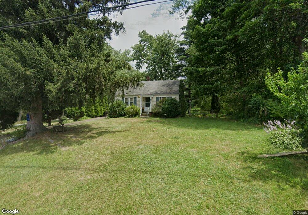
4860 Stoner Ave Louisville, OH 44641
Estimated Value: $141,000 - $183,000
2
Beds
1
Bath
1,248
Sq Ft
$129/Sq Ft
Est. Value
About This Home
This home is located at 4860 Stoner Ave, Louisville, OH 44641 and is currently estimated at $160,467, approximately $128 per square foot. 4860 Stoner Ave is a home located in Stark County with nearby schools including Louisville High School and St. Thomas Aquinas High School & Middle School.
Ownership History
Date
Name
Owned For
Owner Type
Purchase Details
Closed on
Aug 6, 2003
Sold by
Keirn Robert L
Bought by
Stipe Kenneth A and Stipe Kathy Rhea
Current Estimated Value
Home Financials for this Owner
Home Financials are based on the most recent Mortgage that was taken out on this home.
Original Mortgage
$98,800
Interest Rate
8.5%
Mortgage Type
Purchase Money Mortgage
Create a Home Valuation Report for This Property
The Home Valuation Report is an in-depth analysis detailing your home's value as well as a comparison with similar homes in the area
Home Values in the Area
Average Home Value in this Area
Purchase History
| Date | Buyer | Sale Price | Title Company |
|---|---|---|---|
| Stipe Kenneth A | $98,800 | -- |
Source: Public Records
Mortgage History
| Date | Status | Borrower | Loan Amount |
|---|---|---|---|
| Closed | Stipe Kenneth A | $98,800 |
Source: Public Records
Tax History Compared to Growth
Tax History
| Year | Tax Paid | Tax Assessment Tax Assessment Total Assessment is a certain percentage of the fair market value that is determined by local assessors to be the total taxable value of land and additions on the property. | Land | Improvement |
|---|---|---|---|---|
| 2025 | -- | $31,860 | $10,470 | $21,390 |
| 2024 | -- | $31,860 | $10,470 | $21,390 |
| 2023 | $959 | $28,850 | $7,390 | $21,460 |
| 2022 | $984 | $28,850 | $7,390 | $21,460 |
| 2021 | $987 | $28,850 | $7,390 | $21,460 |
| 2020 | $792 | $25,770 | $6,690 | $19,080 |
| 2019 | $795 | $25,770 | $6,690 | $19,080 |
| 2018 | $793 | $25,770 | $6,690 | $19,080 |
| 2017 | $730 | $23,700 | $6,230 | $17,470 |
| 2016 | $714 | $23,700 | $6,230 | $17,470 |
| 2015 | $716 | $23,700 | $6,230 | $17,470 |
| 2014 | $617 | $20,660 | $5,430 | $15,230 |
| 2013 | $551 | $20,660 | $5,430 | $15,230 |
Source: Public Records
Map
Nearby Homes
- 2015 E Main St
- 5495 Meese Rd NE
- 1812 E Broad St
- 1413 Washington Blvd
- 0 Michigan Blvd
- 2110 Edmar St
- 6052 N Nickelplate St
- 308 Superior St
- 910 Crosswyck Cir
- 520 S Silver St
- 5765 Maplegrove St
- 8896 Rue Helena St
- 728 E Broad St
- 325 Lincoln Ave
- 344 E Reno Dr
- 316 E Reno Dr
- 5990 Meese Rd NE
- 3390 Meese Rd NE
- 210 E Gorgas St
- 428 Honeycrisp Dr NE
- 4870 Stoner Ave
- 4894 Stoner Ave
- 4855 Stoner Ave
- 4847 Stoner Ave
- 4942 Stoner Ave
- 4833 Stoner Ave
- 4885 Stoner Ave
- 4903 Stoner Ave
- 4950 Stoner Ave
- 8990 Transit St
- 4943 Stoner Ave
- 4958 Stoner Ave
- 4775 Stoner Ave
- 8964 Transit St
- 4765 Stoner Ave
- 9104 Scott St
- 4984 Stoner Ave
- 4755 Stoner Ave
- 4874 Stoner Ave
- 4887 Eshelman St