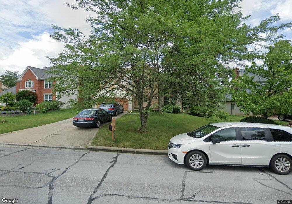
4861 Saint Andrews Dr Westerville, OH 43082
Genoa NeighborhoodEstimated Value: $582,000 - $662,000
4
Beds
3
Baths
2,899
Sq Ft
$213/Sq Ft
Est. Value
About This Home
This home is located at 4861 Saint Andrews Dr, Westerville, OH 43082 and is currently estimated at $618,897, approximately $213 per square foot. 4861 Saint Andrews Dr is a home located in Delaware County with nearby schools including Fouse Elementary School, Genoa Middle School, and Westerville Central High School.
Ownership History
Date
Name
Owned For
Owner Type
Purchase Details
Closed on
Sep 3, 2002
Sold by
Brogan Thomas P
Bought by
Slack Craig A and Slack Tina M
Current Estimated Value
Home Financials for this Owner
Home Financials are based on the most recent Mortgage that was taken out on this home.
Original Mortgage
$232,000
Outstanding Balance
$99,174
Interest Rate
6.56%
Mortgage Type
New Conventional
Estimated Equity
$519,723
Purchase Details
Closed on
Jan 9, 1995
Sold by
Manley Raymond M
Bought by
Brogan Thomas P and Brogan Tracey P
Home Financials for this Owner
Home Financials are based on the most recent Mortgage that was taken out on this home.
Original Mortgage
$190,000
Interest Rate
8.5%
Mortgage Type
New Conventional
Create a Home Valuation Report for This Property
The Home Valuation Report is an in-depth analysis detailing your home's value as well as a comparison with similar homes in the area
Home Values in the Area
Average Home Value in this Area
Purchase History
| Date | Buyer | Sale Price | Title Company |
|---|---|---|---|
| Slack Craig A | $290,000 | -- | |
| Brogan Thomas P | $241,000 | -- |
Source: Public Records
Mortgage History
| Date | Status | Borrower | Loan Amount |
|---|---|---|---|
| Open | Slack Craig A | $232,000 | |
| Previous Owner | Brogan Thomas P | $190,000 |
Source: Public Records
Tax History Compared to Growth
Tax History
| Year | Tax Paid | Tax Assessment Tax Assessment Total Assessment is a certain percentage of the fair market value that is determined by local assessors to be the total taxable value of land and additions on the property. | Land | Improvement |
|---|---|---|---|---|
| 2024 | $8,947 | $165,770 | $35,670 | $130,100 |
| 2023 | $8,406 | $165,770 | $35,670 | $130,100 |
| 2022 | $7,667 | $116,380 | $22,050 | $94,330 |
| 2021 | $7,982 | $116,380 | $22,050 | $94,330 |
| 2020 | $7,791 | $116,380 | $22,050 | $94,330 |
| 2019 | $7,517 | $107,800 | $22,050 | $85,750 |
| 2018 | $7,287 | $107,800 | $22,050 | $85,750 |
| 2017 | $7,137 | $105,220 | $19,430 | $85,790 |
| 2016 | $7,649 | $105,220 | $19,430 | $85,790 |
| 2015 | $7,588 | $105,220 | $19,430 | $85,790 |
| 2014 | $7,595 | $105,220 | $19,430 | $85,790 |
| 2013 | $7,217 | $101,930 | $19,430 | $82,500 |
Source: Public Records
Map
Nearby Homes
- 7513 Africa Rd
- 7373 Frasier Rd
- 377 Westgreen Ln Unit 377
- 5515 Stillwater Ave
- 5552 Quail Hollow Way
- 5633 Travis Pointe Ct
- 5259 Sorrento Ct
- 7697 Bale Kenyon Rd
- 6954 Lakeside Ct
- 705 N State St Unit 211
- 4960 Hawthorne Valley Dr
- 6573 Kenwood Place
- 49 Village Green Dr
- 543 N State St
- 5532 Meadowood Ln
- 6394 Mission Hills Place
- 449 Buckstone Place
- 160 Moss Rd
- 114 Canterbrick Dr
- 66 Abbeycross Ln
- 4879 Saint Andrews Dr
- 4833 Saint Andrews Dr
- 4681 Saint Andrews Cir
- 4821 Saint Andrews Dr
- 4897 Saint Andrews Dr
- 4840 Saint Andrews Dr
- 4868 Saint Andrews Dr
- 4882 Saint Andrews Dr
- 4919 Saint Andrews Dr
- 4805 Saint Andrews Dr
- 4807 Saint Andrews Cir
- 4800 Saint Andrews Dr
- 4931 Saint Andrews Cir
- 4870 Patricia Ln
- 4860 Patricia Ln
- 5035 Saint Andrews Cir
- 4941 Saint Andrews Dr
- 4819 Saint Andrews Cir
- 4797 Saint Andrews Dr
- 4909 Saint Andrews Cir