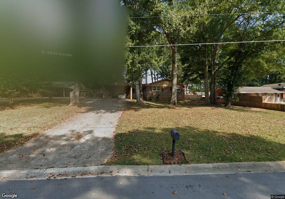
4863 Duncan Dr Powder Springs, GA 30127
Estimated Value: $326,000 - $384,000
3
Beds
2
Baths
2,033
Sq Ft
$173/Sq Ft
Est. Value
About This Home
This home is located at 4863 Duncan Dr, Powder Springs, GA 30127 and is currently estimated at $350,911, approximately $172 per square foot. 4863 Duncan Dr is a home located in Cobb County with nearby schools including Powder Springs Elementary School, Cooper Middle School, and McEachern High School.
Ownership History
Date
Name
Owned For
Owner Type
Purchase Details
Closed on
Sep 25, 2019
Sold by
Walker West Properties Llc
Bought by
Walker Jennifer
Current Estimated Value
Purchase Details
Closed on
Jun 10, 2010
Sold by
Federal Natl Mtg Assn Fnma
Bought by
Walker West Properties Llc
Purchase Details
Closed on
Apr 6, 2010
Sold by
Bank Of America
Bought by
Federal Natl Mtg Assn Fnma
Purchase Details
Closed on
Jun 4, 2004
Sold by
Moore Tommy J and Moore Susan P
Bought by
Knudsen Amanda M and Knudsen Ryan
Home Financials for this Owner
Home Financials are based on the most recent Mortgage that was taken out on this home.
Original Mortgage
$123,405
Interest Rate
5.88%
Mortgage Type
New Conventional
Create a Home Valuation Report for This Property
The Home Valuation Report is an in-depth analysis detailing your home's value as well as a comparison with similar homes in the area
Home Values in the Area
Average Home Value in this Area
Purchase History
| Date | Buyer | Sale Price | Title Company |
|---|---|---|---|
| Walker Jennifer | -- | -- | |
| Walker West Properties Llc | $51,500 | -- | |
| Federal Natl Mtg Assn Fnma | -- | -- | |
| Bank Of America | $110,285 | -- | |
| Knudsen Amanda M | $129,900 | -- | |
| Powder Springs United Pentecosta | -- | -- |
Source: Public Records
Mortgage History
| Date | Status | Borrower | Loan Amount |
|---|---|---|---|
| Previous Owner | Powder Springs United Pentecosta | $123,405 |
Source: Public Records
Tax History Compared to Growth
Tax History
| Year | Tax Paid | Tax Assessment Tax Assessment Total Assessment is a certain percentage of the fair market value that is determined by local assessors to be the total taxable value of land and additions on the property. | Land | Improvement |
|---|---|---|---|---|
| 2024 | $3,479 | $115,404 | $18,000 | $97,404 |
| 2023 | $2,195 | $115,404 | $18,000 | $97,404 |
| 2022 | $1,659 | $65,164 | $12,000 | $53,164 |
| 2021 | $1,659 | $65,164 | $12,000 | $53,164 |
| 2020 | $1,816 | $59,836 | $12,000 | $47,836 |
| 2019 | $1,816 | $59,836 | $12,000 | $47,836 |
| 2018 | $1,563 | $51,512 | $9,600 | $41,912 |
| 2017 | $1,295 | $45,056 | $9,600 | $35,456 |
| 2016 | $1,124 | $39,112 | $7,200 | $31,912 |
| 2015 | $1,144 | $38,824 | $4,800 | $34,024 |
| 2014 | $591 | $19,876 | $0 | $0 |
Source: Public Records
Map
Nearby Homes
- 4801 Brownsville Rd
- 4914 Howard Dr
- 4726 Brownsville Rd
- 0 Cherry Ln Unit 10590910
- 0 Cherry Ln Unit 7617854
- 5152 Rosetrace Cove
- 5218 Brown Leaf Trail
- 4825 Rollins Dr
- 4570 Meadows Rd
- 4772 Lewis Rd
- 4872 Lewis Rd
- 5052 Hiram Lithia Springs Rd
- 4940 Westridge Ln
- 5670 Lanny Dr
- 4573 Westview Dr
- 4942 Brown Leaf Dr
- 5119 Brown Crossing Way
- 4469 Caleb Crossing Unit 13
- 4853 Duncan Dr
- 4873 Duncan Dr
- 4828 Duncan Dr
- 4843 Duncan Dr
- 5017 Crider Creek Dr
- 4883 Duncan Dr
- 5007 Crider Creek Dr
- 4872 Duncan Dr
- 5027 Crider Creek Dr
- 4850 Cowart Ct
- 4997 Crider Creek Dr
- 4833 Duncan Dr
- 4833 Duncan Dr 0
- 4833 Duncan Drive 0
- 4893 Duncan Dr
- 4882 Duncan Dr
- 5037 Crider Creek Dr
- 5131 Cowart Ct
- 0 Cowart Ct Unit 7436824
- 0 Cowart Ct Unit 7381730