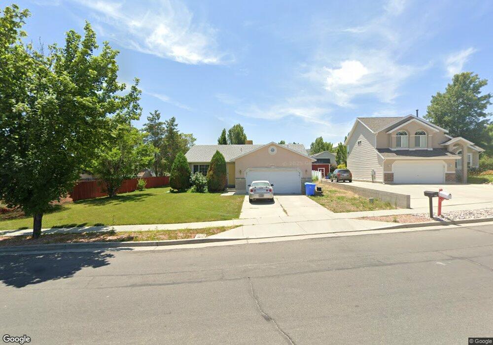
4865 Cedar Point Peak Dr Riverton, UT 84096
Estimated Value: $545,000 - $578,000
3
Beds
2
Baths
1,122
Sq Ft
$502/Sq Ft
Est. Value
About This Home
This home is located at 4865 Cedar Point Peak Dr, Riverton, UT 84096 and is currently estimated at $563,353, approximately $502 per square foot. 4865 Cedar Point Peak Dr is a home located in Salt Lake County with nearby schools including Foothills School, South Hills Middle School, and Mountain Ridge High School.
Ownership History
Date
Name
Owned For
Owner Type
Purchase Details
Closed on
Sep 24, 2010
Sold by
Anderson Shawn G and Anderson Patricia C
Bought by
Anderson Shawn Gayle and Anderson Patricia Corsina
Current Estimated Value
Home Financials for this Owner
Home Financials are based on the most recent Mortgage that was taken out on this home.
Original Mortgage
$171,200
Interest Rate
3.86%
Mortgage Type
New Conventional
Purchase Details
Closed on
Jul 21, 1997
Sold by
Royal View Homes Inc
Bought by
Anderson Shawn G and Anderson Patricia C
Home Financials for this Owner
Home Financials are based on the most recent Mortgage that was taken out on this home.
Original Mortgage
$122,188
Interest Rate
7.83%
Mortgage Type
FHA
Create a Home Valuation Report for This Property
The Home Valuation Report is an in-depth analysis detailing your home's value as well as a comparison with similar homes in the area
Home Values in the Area
Average Home Value in this Area
Purchase History
| Date | Buyer | Sale Price | Title Company |
|---|---|---|---|
| Anderson Shawn Gayle | -- | Bonneville Superior Title | |
| Anderson Shawn G | -- | -- |
Source: Public Records
Mortgage History
| Date | Status | Borrower | Loan Amount |
|---|---|---|---|
| Closed | Anderson Shawn Gayle | $171,200 | |
| Closed | Anderson Shawn G | $122,188 |
Source: Public Records
Tax History
| Year | Tax Paid | Tax Assessment Tax Assessment Total Assessment is a certain percentage of the fair market value that is determined by local assessors to be the total taxable value of land and additions on the property. | Land | Improvement |
|---|---|---|---|---|
| 2025 | $2,892 | $561,300 | $237,000 | $324,300 |
| 2024 | $2,892 | $500,500 | $217,700 | $282,800 |
| 2023 | $3,066 | $500,300 | $201,500 | $298,800 |
| 2022 | $3,159 | $505,600 | $197,600 | $308,000 |
| 2021 | $2,631 | $375,000 | $152,400 | $222,600 |
| 2020 | $2,544 | $338,000 | $118,500 | $219,500 |
| 2019 | $2,483 | $324,300 | $112,900 | $211,400 |
| 2016 | $2,186 | $262,900 | $104,300 | $158,600 |
Source: Public Records
Map
Nearby Homes
- 4722 W Cillian Ln Unit 2411
- 4722 W Cillian Ln
- 4714 W Cillian Ln
- 4714 W Cillian Ln Unit 2410
- 5030 Little Water Peak Dr
- 4688 W Cillian Ln Unit 2408
- 4688 W Cillian Ln
- 4682 W Cillian Ln
- 4682 W Cillian Ln Unit 2407
- 4676 W Cillian Ln Unit 2406
- 4676 W Cillian Ln
- 4662 W Cillian Ln Unit 2405
- 4638 W Cillian Ln Unit 2403
- 13713 S Hanley Ln Unit EE303
- 4626 W Cillian Ln Unit 2401
- 13687 S Hanley Ln Unit DD102
- 13687 S Hanley Ln Unit DD203
- 13878 S Shaggy Peak Dr
- 13597 S Firetip Ct
- 4596 W Watchmen Way Unit 1402
- 4879 Cedar Point Peak Dr
- 13836 Lookout Peak Dr
- 13848 Lookout Peak Dr
- 13863 Kessler Peak Dr
- 13866 S Lookout Peak Dr
- 13866 Lookout Peak Dr
- 4880 Cedar Point Peak Dr
- 13875 Kessler Peak Dr
- 4868 Cedar Point Peak Dr
- 13878 S Lookout Peak Dr
- 13878 Lookout Peak Dr
- 4856 Cedar Point Peak Dr
- 4856 W Cedar Point Peak Dr
- 4897 Cedar Point Peak Dr
- 13870 S Kessler Peak Dr
- 13870 Kessler Peak Dr
- 4840 Cedar Point Peak Dr
- 13849 S Lookout Peak Dr
- 13849 Lookout Peak Dr
- 4821 W Cedar Point Peak Dr