
Seller's Agent in 2025
Gary Spillman
Spillman Realty
(507) 298-0503
7 Total Sales
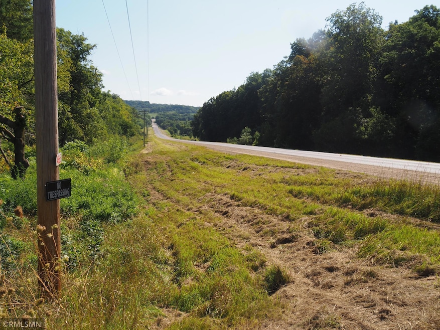


Rural building site with 13 acres in the Sogn valley. Bring your builder and maker your own private home on a wooded site with black top road access. Easy access to Hwy 52 from CR 9. Currently has a house considered to be salvage by county, DO NOT ENTER, it is considered to be unsafe. Driveway to CR 9 just west of downtown Sogn. Electrical at road frontage, no longer connected to building. Septic is non compliant and there is a well for potential use but not operational and not guaranteed as compliant or operational. Do not enter existing structure for you own safety. Sellers not liable for injury due to illegal access. Do not enter property without an appointment. MULTIPLE OFFERS SUBMITTED. WILL BE REVIEWING WITH SELLERS MONDAY MORNING 11/17/25 HAVE ALL HIGHEST AND BEST OFFERS IN!!
| Date | Type | Sale Price | Title Company |
|---|---|---|---|
| Warranty Deed | $175,000 | Knight Barry Title | |
| Deed | -- | -- |
| Date | Status | Loan Amount | Loan Type |
|---|---|---|---|
| Open | $140,000 | Balloon |
| Date | Event | Price | List to Sale | Price per Sq Ft |
|---|---|---|---|---|
| 12/05/2025 12/05/25 | Sold | $175,000 | +12.9% | -- |
| 11/17/2025 11/17/25 | Pending | -- | -- | -- |
| 11/13/2025 11/13/25 | For Sale | $155,000 | -- | -- |
| Year | Tax Paid | Tax Assessment Tax Assessment Total Assessment is a certain percentage of the fair market value that is determined by local assessors to be the total taxable value of land and additions on the property. | Land | Improvement |
|---|---|---|---|---|
| 2025 | $1,516 | $181,800 | $153,500 | $28,300 |
| 2024 | -- | $174,500 | $153,500 | $21,000 |
| 2023 | $1,446 | $167,200 | $146,900 | $20,300 |
| 2022 | $1,498 | $162,100 | $142,600 | $19,500 |
| 2021 | $1,526 | $150,300 | $124,000 | $26,300 |
| 2020 | $1,508 | $150,300 | $124,000 | $26,300 |
| 2019 | $1,540 | $147,400 | $121,600 | $25,800 |
| 2018 | $1,416 | $145,100 | $119,300 | $25,800 |
| 2017 | $1,410 | $135,100 | $109,300 | $25,800 |
| 2016 | $1,448 | $130,700 | $106,900 | $23,800 |
| 2015 | $1,564 | $130,700 | $106,900 | $23,800 |
| 2014 | -- | $156,600 | $106,900 | $49,700 |
Seller's Agent in 2025
Gary Spillman
Spillman Realty
(507) 298-0503
7 Total Sales
Buyer's Agent in 2025
Robert Siebenaler
WEICHERT REALTORS®-Carnel & Co.
(507) 298-0792
78 Total Sales
Source: NorthstarMLS
MLS Number: 6817549
APN: 45.023.1000
Disclaimer: Certain information contained herein is derived from information provided by parties other than Homes.com. All information provided is deemed reliable, but is not guaranteed to be accurate and should be independently verified.
![]() Based on information submitted to the MLS GRID. All data is obtained from various sources and may not have been verified by broker or MLS GRID. Supplied Open House Information is subject to change without notice. All information should be independently reviewed and verified for accuracy. Properties may or may not be listed by the office/agent presenting the information. Some IDX listings have been excluded from this website.
Based on information submitted to the MLS GRID. All data is obtained from various sources and may not have been verified by broker or MLS GRID. Supplied Open House Information is subject to change without notice. All information should be independently reviewed and verified for accuracy. Properties may or may not be listed by the office/agent presenting the information. Some IDX listings have been excluded from this website.
Based on information submitted to the MLS GRID
Ask me questions while you tour the home.