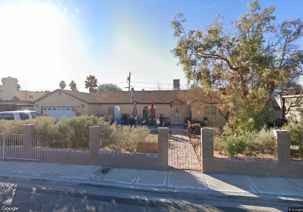
4865 Mohave Ave Las Vegas, NV 89104
Estimated Value: $397,000 - $468,000
4
Beds
2
Baths
2,036
Sq Ft
$208/Sq Ft
Est. Value
About This Home
This home is located at 4865 Mohave Ave, Las Vegas, NV 89104 and is currently estimated at $422,858, approximately $207 per square foot. 4865 Mohave Ave is a home located in Clark County with nearby schools including William E. Snyder Elementary School, Jerome Mack Middle School, and Las Vegas High School.
Ownership History
Date
Name
Owned For
Owner Type
Purchase Details
Closed on
Dec 16, 2022
Sold by
Townsend Bradley V and Townsend Julie D
Bought by
Townsend Family Living Trust
Current Estimated Value
Purchase Details
Closed on
Aug 10, 1994
Sold by
Roberts James A and Roberts Linda S
Bought by
Townsend Bradley V and Townsend Julie D
Home Financials for this Owner
Home Financials are based on the most recent Mortgage that was taken out on this home.
Original Mortgage
$97,750
Interest Rate
8.65%
Create a Home Valuation Report for This Property
The Home Valuation Report is an in-depth analysis detailing your home's value as well as a comparison with similar homes in the area
Home Values in the Area
Average Home Value in this Area
Purchase History
| Date | Buyer | Sale Price | Title Company |
|---|---|---|---|
| Townsend Family Living Trust | -- | -- | |
| Townsend Bradley V | $115,000 | Fidelity National Title |
Source: Public Records
Mortgage History
| Date | Status | Borrower | Loan Amount |
|---|---|---|---|
| Previous Owner | Townsend Bradley V | $97,750 |
Source: Public Records
Tax History Compared to Growth
Tax History
| Year | Tax Paid | Tax Assessment Tax Assessment Total Assessment is a certain percentage of the fair market value that is determined by local assessors to be the total taxable value of land and additions on the property. | Land | Improvement |
|---|---|---|---|---|
| 2025 | $1,193 | $81,487 | $28,875 | $52,612 |
| 2024 | $1,159 | $81,487 | $28,875 | $52,612 |
| 2023 | $1,159 | $83,292 | $32,725 | $50,567 |
| 2022 | $1,125 | $73,581 | $26,950 | $46,631 |
| 2021 | $1,092 | $67,797 | $23,100 | $44,697 |
| 2020 | $1,058 | $67,404 | $22,715 | $44,689 |
| 2019 | $1,027 | $65,285 | $21,175 | $44,110 |
| 2018 | $997 | $58,505 | $15,925 | $42,580 |
| 2017 | $1,737 | $59,224 | $15,925 | $43,299 |
| 2016 | $945 | $53,790 | $10,395 | $43,395 |
| 2015 | $942 | $41,987 | $8,470 | $33,517 |
| 2014 | $915 | $32,629 | $7,700 | $24,929 |
Source: Public Records
Map
Nearby Homes
- 4746 Yuma Ave
- 4939 Yuma Ave
- 4906 E Chicago Ave
- 1405 S Nellis Blvd Unit 1121
- 1405 S Nellis Blvd Unit 1008
- 1405 S Nellis Blvd Unit 2082
- 1405 S Nellis Blvd Unit 2117
- 1405 S Nellis Blvd Unit 2087
- 4928 E Philadelphia Ave
- 1300 S Arlington St Unit 113
- 1300 S Arlington St Unit 126
- 1300 S Arlington St Unit 120
- 1761 Arden St
- 1485 Arden St
- 5115 Blossom Ave
- 4496 Skyview Dr
- 4590 E Saint Louis Ave
- 5171 Wyoming Ave
- 4458 Skyview Dr
- 5083 Village Dr
- 4875 Mohave Ave
- 4845 Mohave Ave
- 4864 E Utah Ave
- 4858 E Utah Ave
- 4870 E Utah Ave
- 4846 E Utah Ave
- 1647 Frank St
- 4850 Mohave Ave
- 4860 Mohave Ave
- 4890 E Utah Ave
- 4835 Mohave Ave
- 4840 Mohave Ave
- 4880 Mohave Ave
- 4834 E Utah Ave
- 4890 Mohave Ave
- 4838 Mohave Ave
- 4871 E Imperial Ave
- 4861 E Imperial Ave
- 4863 E Utah Ave
- 4825 Mohave Ave