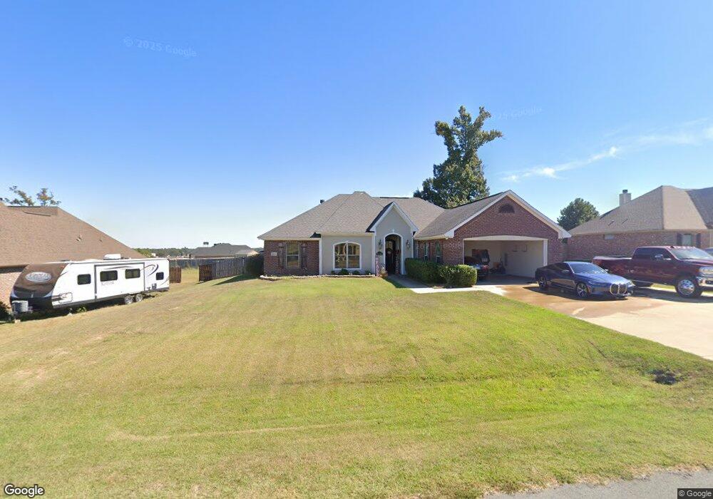
4865 Sandtrap Cir Shreveport, LA 71107
Estimated Value: $242,309 - $297,000
4
Beds
2
Baths
1,907
Sq Ft
$141/Sq Ft
Est. Value
About This Home
This home is located at 4865 Sandtrap Cir, Shreveport, LA 71107 and is currently estimated at $268,827, approximately $140 per square foot. 4865 Sandtrap Cir is a home located in Caddo Parish with nearby schools including Blanchard Elementary School, Judson Fundamental Elementary School, and Fairfield Magnet School.
Ownership History
Date
Name
Owned For
Owner Type
Purchase Details
Closed on
Nov 12, 2019
Sold by
Sims Gregory Paul and Sims Christine Michelle Goldman
Bought by
Ford Jessica Monique
Current Estimated Value
Home Financials for this Owner
Home Financials are based on the most recent Mortgage that was taken out on this home.
Original Mortgage
$220,040
Outstanding Balance
$195,054
Interest Rate
3.99%
Mortgage Type
FHA
Estimated Equity
$73,773
Purchase Details
Closed on
Sep 1, 2015
Sold by
Agnes Allen and Agnes Diana
Bought by
Sims Gregory Paul and Goldman Sims Christine Michelle
Home Financials for this Owner
Home Financials are based on the most recent Mortgage that was taken out on this home.
Original Mortgage
$221,938
Interest Rate
3.92%
Mortgage Type
New Conventional
Purchase Details
Closed on
May 17, 2010
Sold by
Ivy Terry and Ivy Laura Ann
Bought by
Agnes Allen
Home Financials for this Owner
Home Financials are based on the most recent Mortgage that was taken out on this home.
Original Mortgage
$210,429
Interest Rate
5%
Mortgage Type
VA
Purchase Details
Closed on
Feb 15, 2008
Sold by
Stroy Builders Roofing Llc
Bought by
Ivy Laura Ann and Ivy Terry
Home Financials for this Owner
Home Financials are based on the most recent Mortgage that was taken out on this home.
Original Mortgage
$196,000
Interest Rate
6.07%
Mortgage Type
Unknown
Purchase Details
Closed on
Jan 29, 2008
Sold by
Hano Cheryl
Bought by
Liberty Group Llc
Home Financials for this Owner
Home Financials are based on the most recent Mortgage that was taken out on this home.
Original Mortgage
$196,000
Interest Rate
6.07%
Mortgage Type
Unknown
Purchase Details
Closed on
Nov 13, 2007
Sold by
E & L Development Inc
Bought by
Stroy Builders & Roofing Inc
Home Financials for this Owner
Home Financials are based on the most recent Mortgage that was taken out on this home.
Original Mortgage
$196,000
Interest Rate
6.43%
Mortgage Type
Purchase Money Mortgage
Create a Home Valuation Report for This Property
The Home Valuation Report is an in-depth analysis detailing your home's value as well as a comparison with similar homes in the area
Home Values in the Area
Average Home Value in this Area
Purchase History
| Date | Buyer | Sale Price | Title Company |
|---|---|---|---|
| Ford Jessica Monique | $224,100 | None Available | |
| Sims Gregory Paul | $217,500 | Attorney | |
| Agnes Allen | $206,000 | None Available | |
| Ivy Laura Ann | $196,000 | None Available | |
| Liberty Group Llc | $27,000 | None Available | |
| Stroy Builders & Roofing Inc | $24,000 | None Available |
Source: Public Records
Mortgage History
| Date | Status | Borrower | Loan Amount |
|---|---|---|---|
| Open | Ford Jessica Monique | $220,040 | |
| Previous Owner | Sims Gregory Paul | $221,938 | |
| Previous Owner | Agnes Allen | $210,429 | |
| Previous Owner | Ivy Laura Ann | $196,000 | |
| Previous Owner | Liberty Group Llc | $151,875 | |
| Previous Owner | Stroy Builders & Roofing Inc | $196,000 |
Source: Public Records
Tax History Compared to Growth
Tax History
| Year | Tax Paid | Tax Assessment Tax Assessment Total Assessment is a certain percentage of the fair market value that is determined by local assessors to be the total taxable value of land and additions on the property. | Land | Improvement |
|---|---|---|---|---|
| 2024 | $3,766 | $23,970 | $2,919 | $21,051 |
| 2023 | $3,630 | $22,496 | $2,780 | $19,716 |
| 2022 | $3,630 | $22,496 | $2,780 | $19,716 |
| 2021 | $3,631 | $22,496 | $2,780 | $19,716 |
| 2020 | $3,632 | $22,496 | $2,780 | $19,716 |
| 2019 | $3,351 | $20,890 | $2,780 | $18,110 |
| 2018 | $2,027 | $20,890 | $2,780 | $18,110 |
| 2017 | $3,310 | $20,890 | $2,780 | $18,110 |
| 2015 | $2,060 | $20,800 | $2,780 | $18,020 |
| 2014 | $2,073 | $20,800 | $2,780 | $18,020 |
| 2013 | -- | $20,800 | $2,780 | $18,020 |
Source: Public Records
Map
Nearby Homes
- 4857 Sandtrap Cir
- 4840 Pin High Cir
- 4863 Chipshot Ln
- 4835 Bogey Ln
- 4821 Bogey Ln
- 4833 Bogey Ln
- 4845 Bogey Ln
- 5785 Bunker Way
- 4917 Players Loop
- 5862 Northwood Oaks Dr
- 5536 Northwood S
- 6105 Shadow Wood Dr
- Lot 94 Chickamauga Trail
- Lot 95 Chickamauga Trail
- 6026 Cherry Hill Ave
- 8308 Creekdale St
- 0 Buckingham Dr Unit 21060001
- TBD Northwood Rd S
- 6001 N Market St
- 6420 Sand Hill Ave
- 4869 Sandtrap Cir
- 4861 Sandtrap Cir
- 4834 Pin High Cir
- 4828 Pin High Cir
- 4873 Sandtrap Cir
- 4864 Sandtrap Cir
- 4860 Sandtrap Cir
- 4868 Sandtrap Cir
- 5798 Sandy Ridge
- 4822 Pin High Cir
- 4856 Sandtrap Cir
- 4853 Sandtrap Cir
- 4841 Pin High Cir
- 4816 Pin High Cir
- 4835 Pin High Cir
- 4872 Sandtrap Cir
- 4829 Pin High Cir
- 4810 Pin High Cir
- 4852 Sandtrap Cir
- 0 Drivers Unit 234832NL