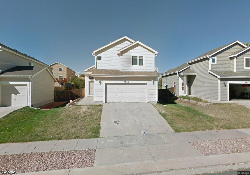
4866 Bittercreek Dr Colorado Springs, CO 80922
Stetson Hills NeighborhoodEstimated Value: $438,103 - $468,000
3
Beds
4
Baths
1,532
Sq Ft
$300/Sq Ft
Est. Value
About This Home
This home is located at 4866 Bittercreek Dr, Colorado Springs, CO 80922 and is currently estimated at $459,276, approximately $299 per square foot. 4866 Bittercreek Dr is a home located in El Paso County with nearby schools including Odyssey Elementary School, Skyview Middle School, and Vista Ridge High School.
Ownership History
Date
Name
Owned For
Owner Type
Purchase Details
Closed on
Mar 30, 2004
Sold by
Ferreira Paulo S and Ferreira Angelique L
Bought by
Bucher Youngher L
Current Estimated Value
Home Financials for this Owner
Home Financials are based on the most recent Mortgage that was taken out on this home.
Original Mortgage
$143,600
Outstanding Balance
$63,833
Interest Rate
4.87%
Mortgage Type
Unknown
Estimated Equity
$395,443
Purchase Details
Closed on
Jun 12, 1998
Sold by
U S Home Corp
Bought by
Ferreira Paulo S and Ferreira Angelique L
Home Financials for this Owner
Home Financials are based on the most recent Mortgage that was taken out on this home.
Original Mortgage
$125,051
Interest Rate
7.17%
Mortgage Type
FHA
Create a Home Valuation Report for This Property
The Home Valuation Report is an in-depth analysis detailing your home's value as well as a comparison with similar homes in the area
Home Values in the Area
Average Home Value in this Area
Purchase History
| Date | Buyer | Sale Price | Title Company |
|---|---|---|---|
| Bucher Youngher L | $179,000 | Stewart Title | |
| Ferreira Paulo S | $126,300 | Stewart Title |
Source: Public Records
Mortgage History
| Date | Status | Borrower | Loan Amount |
|---|---|---|---|
| Open | Bucher Youngher L | $143,600 | |
| Previous Owner | Ferreira Paulo S | $125,051 |
Source: Public Records
Tax History Compared to Growth
Tax History
| Year | Tax Paid | Tax Assessment Tax Assessment Total Assessment is a certain percentage of the fair market value that is determined by local assessors to be the total taxable value of land and additions on the property. | Land | Improvement |
|---|---|---|---|---|
| 2025 | $1,728 | $31,180 | -- | -- |
| 2024 | $1,628 | $31,150 | $4,620 | $26,530 |
| 2023 | $1,628 | $31,150 | $4,620 | $26,530 |
| 2022 | $1,393 | $22,410 | $4,170 | $18,240 |
| 2021 | $1,450 | $23,050 | $4,290 | $18,760 |
| 2020 | $1,247 | $19,600 | $3,580 | $16,020 |
| 2019 | $1,235 | $19,600 | $3,580 | $16,020 |
| 2018 | $1,083 | $16,870 | $3,020 | $13,850 |
| 2017 | $1,088 | $16,870 | $3,020 | $13,850 |
| 2016 | $1,069 | $16,350 | $2,950 | $13,400 |
| 2015 | $1,070 | $16,350 | $2,950 | $13,400 |
| 2014 | $1,006 | $15,090 | $2,790 | $12,300 |
Source: Public Records
Map
Nearby Homes
- 4855 Bittercreek Dr
- 4886 Sweetgrass Ln
- 4801 Sweetgrass Ln
- 5057 Sweetgrass Ln
- 4716 Skywriter Cir
- 4815 Saddle Ridge Dr
- 4732 Laramie Sky Dr
- 4767 High Stone Place
- 4668 Laramie Sky Dr
- 6385 Boscomb Place
- 5053 Blackcloud Loop
- 6350 Naturita Trail
- 5209 Palomino Ranch Point
- 6315 Basalt Ct
- 5169 Palomino Ranch Point
- 5137 Palomino Ranch Point
- 4698 High Springs Ct
- 4626 High Springs Ct
- 4763 Yarrow Place
- 4690 Badlands Ct
- 4872 Bittercreek Dr
- 4860 Bittercreek Dr
- 4878 Bittercreek Dr
- 4843 Sweetgrass Ln
- 4854 Bittercreek Dr
- 4837 Sweetgrass Ln
- 4849 Sweetgrass Ln
- 4831 Sweetgrass Ln
- 4848 Bittercreek Dr
- 4884 Bittercreek Dr
- 4861 Bittercreek Dr
- 4855 Sweetgrass Ln
- 4849 Bittercreek Dr
- 4825 Sweetgrass Ln
- 4867 Bittercreek Dr
- 4843 Bittercreek Dr
- 4842 Bittercreek Dr
- 4861 Sweetgrass Ln
- 4890 Bittercreek Dr
- 4873 Bittercreek Dr