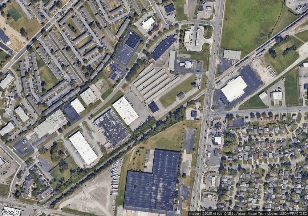
487 Georgesville Rd Columbus, OH 43228
--
Bed
--
Bath
8,340
Sq Ft
2.34
Acres
About This Home
This home is located at 487 Georgesville Rd, Columbus, OH 43228. 487 Georgesville Rd is a home located in Franklin County with nearby schools including Stiles Elementary School, Galloway Ridge Intermediate School, and Norton Middle School.
Ownership History
Date
Name
Owned For
Owner Type
Purchase Details
Closed on
Mar 20, 2007
Sold by
Dematteo Steve M and Dematteo Products
Bought by
Dematteo Steven
Purchase Details
Closed on
Aug 4, 1994
Sold by
Stewart Sandwiches Inc
Bought by
Steven M Dematteo Productions
Home Financials for this Owner
Home Financials are based on the most recent Mortgage that was taken out on this home.
Original Mortgage
$75,000
Interest Rate
8.53%
Mortgage Type
Commercial
Create a Home Valuation Report for This Property
The Home Valuation Report is an in-depth analysis detailing your home's value as well as a comparison with similar homes in the area
Home Values in the Area
Average Home Value in this Area
Purchase History
| Date | Buyer | Sale Price | Title Company |
|---|---|---|---|
| Dematteo Steven | -- | Northwest Title | |
| Steven M Dematteo Productions | $100,000 | -- |
Source: Public Records
Mortgage History
| Date | Status | Borrower | Loan Amount |
|---|---|---|---|
| Closed | Steven M Dematteo Productions | $75,000 |
Source: Public Records
Tax History Compared to Growth
Tax History
| Year | Tax Paid | Tax Assessment Tax Assessment Total Assessment is a certain percentage of the fair market value that is determined by local assessors to be the total taxable value of land and additions on the property. | Land | Improvement |
|---|---|---|---|---|
| 2024 | $12,998 | $84,670 | $8,680 | $75,990 |
| 2023 | $7,728 | $84,665 | $8,680 | $75,985 |
| 2022 | $16,112 | $77,180 | $6,930 | $70,250 |
| 2021 | $7,720 | $77,180 | $6,930 | $70,250 |
| 2020 | $7,676 | $77,180 | $6,930 | $70,250 |
| 2019 | $7,773 | $73,510 | $6,620 | $66,890 |
| 2018 | $7,767 | $73,510 | $6,620 | $66,890 |
| 2017 | $7,832 | $73,510 | $6,620 | $66,890 |
| 2016 | $8,132 | $73,510 | $6,620 | $66,890 |
| 2015 | $7,704 | $73,510 | $6,620 | $66,890 |
| 2014 | $7,685 | $73,510 | $6,620 | $66,890 |
| 2013 | $3,827 | $73,500 | $6,615 | $66,885 |
Source: Public Records
Map
Nearby Homes
- 4202 Atlanta Dr
- 673 Roth Ave
- 4146 Sexton Dr
- 4190 Salem Dr
- 829 Crevis Ln
- 4006 Halsey Place
- 4715 Sullivant Ave Unit 46
- 488 Lombard Rd
- 3874 Eakin Rd
- 299 Lombard Rd
- 4763 Hafey Ave
- 4778 Hafey Ave
- 970 Tenbrook Place
- 638 Fairmoor Place
- 4789 Dolan Place
- 4518 Hall Rd
- 3879 Lynward Rd
- 164 Alice Rita St
- 4848 Deephollow Dr
- 435 Redmond Rd
- 435 Georgesville Rd
- 500 Industrial Mile Rd
- 491 Georgesville Rd
- 520 Industrial Mile Rd
- 0 Industrial Mile Rd
- 440 Industrial Mile Rd
- 511 Industrial Mile Rd
- 455 Industrial Mile Rd
- 411 Georgesville Rd
- 4216 Dixie Ct
- 4225 Dixie Ct
- 540 Industrial Mile Rd
- 4215 Dixie Ct
- 4208 Dixie Ct
- 4228 Atlanta Dr
- 425 Industrial Mile Rd
- 4220 Atlanta Dr
- 4200 Dixie Ct
- 4199 Sullivant Ave
- 4209 Dixie Ct
