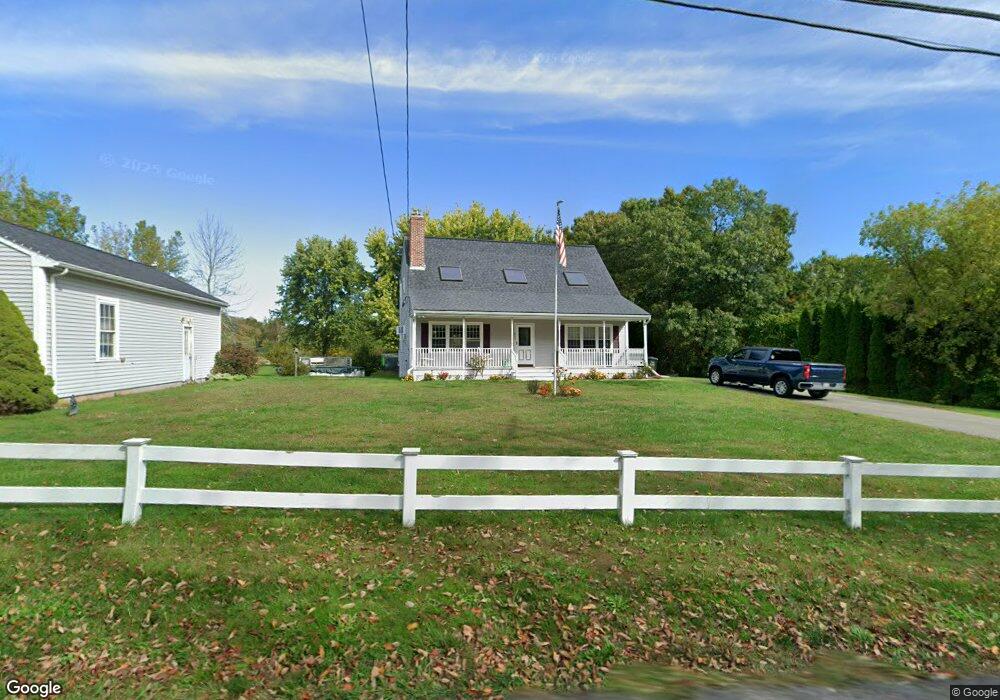
487 Locust St Swansea, MA 02777
West Swansea NeighborhoodEstimated Value: $601,000 - $696,000
3
Beds
2
Baths
1,809
Sq Ft
$357/Sq Ft
Est. Value
About This Home
This home is located at 487 Locust St, Swansea, MA 02777 and is currently estimated at $645,150, approximately $356 per square foot. 487 Locust St is a home located in Bristol County with nearby schools including Joseph Case High School and Swansea Wood School.
Create a Home Valuation Report for This Property
The Home Valuation Report is an in-depth analysis detailing your home's value as well as a comparison with similar homes in the area
Home Values in the Area
Average Home Value in this Area
Tax History Compared to Growth
Tax History
| Year | Tax Paid | Tax Assessment Tax Assessment Total Assessment is a certain percentage of the fair market value that is determined by local assessors to be the total taxable value of land and additions on the property. | Land | Improvement |
|---|---|---|---|---|
| 2025 | $6,330 | $531,000 | $176,000 | $355,000 |
| 2024 | $6,295 | $525,000 | $176,000 | $349,000 |
| 2023 | $5,826 | $443,700 | $128,700 | $315,000 |
| 2022 | $5,608 | $389,700 | $117,000 | $272,700 |
| 2021 | $5,274 | $337,400 | $117,000 | $220,400 |
| 2020 | $5,300 | $340,200 | $117,000 | $223,200 |
| 2019 | $5,007 | $322,800 | $104,400 | $218,400 |
| 2018 | $4,906 | $321,100 | $102,700 | $218,400 |
| 2017 | $4,390 | $330,600 | $102,700 | $227,900 |
| 2016 | $4,103 | $303,500 | $88,400 | $215,100 |
| 2015 | $3,804 | $289,700 | $88,400 | $201,300 |
| 2014 | $3,658 | $284,900 | $88,400 | $196,500 |
Source: Public Records
Map
Nearby Homes
- 283 Plain St
- 51 Sophia Dr
- 50 Sophia Dr
- 49 Sophia Dr
- 850 Hortonville Rd
- 47 Spring St
- 4 Meadowbrook Ave
- 7 Johnnies Way
- 3 Johnnies Way
- 3b Johnnies Way
- 16 Martin St
- 3a Johnnies Way
- 129 Cameron Way
- 16 Ashlynn Way
- 383 Vinnicum Rd
- 0B Cummings Rd
- 0A Cummings Rd
- 75 Martin St
- Lot 11 Lynch
- 0 Proprietors Way Unit 73324662