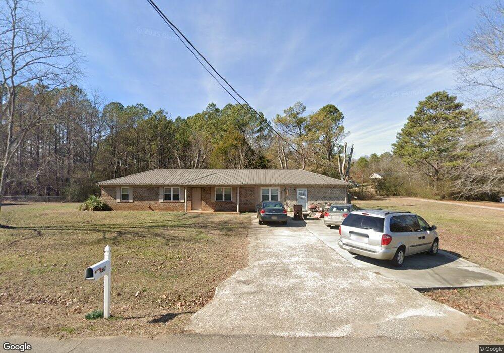
487 Ruby Johnson Dr Scottsboro, AL 35769
Estimated Value: $168,000 - $262,000
Studio
--
Bath
1,475
Sq Ft
$140/Sq Ft
Est. Value
About This Home
This home is located at 487 Ruby Johnson Dr, Scottsboro, AL 35769 and is currently estimated at $206,498, approximately $139 per square foot. 487 Ruby Johnson Dr is a home located in Jackson County with nearby schools including Hollywood Elementary School and North Jackson High School.
Ownership History
Date
Name
Owned For
Owner Type
Purchase Details
Closed on
Jun 20, 2006
Sold by
Looney Barbara Denise
Bought by
Potter Douglas L and Potter Patricia
Current Estimated Value
Home Financials for this Owner
Home Financials are based on the most recent Mortgage that was taken out on this home.
Original Mortgage
$63,040
Outstanding Balance
$36,623
Interest Rate
6.55%
Mortgage Type
Purchase Money Mortgage
Estimated Equity
$169,875
Create a Home Valuation Report for This Property
The Home Valuation Report is an in-depth analysis detailing your home's value as well as a comparison with similar homes in the area
Purchase History
| Date | Buyer | Sale Price | Title Company |
|---|---|---|---|
| Potter Douglas L | $78,800 | -- |
Source: Public Records
Mortgage History
| Date | Status | Borrower | Loan Amount |
|---|---|---|---|
| Open | Potter Douglas L | $63,040 | |
| Closed | Potter Douglas L | $15,760 |
Source: Public Records
Tax History
| Year | Tax Paid | Tax Assessment Tax Assessment Total Assessment is a certain percentage of the fair market value that is determined by local assessors to be the total taxable value of land and additions on the property. | Land | Improvement |
|---|---|---|---|---|
| 2025 | $344 | $11,220 | $0 | $0 |
| 2024 | $344 | $10,500 | $0 | $0 |
| 2023 | $319 | $10,500 | $0 | $0 |
| 2022 | $279 | $9,380 | $0 | $0 |
| 2021 | $279 | $9,380 | $0 | $0 |
| 2020 | $232 | $8,040 | $0 | $0 |
| 2019 | $232 | $8,040 | $0 | $0 |
| 2018 | $232 | $8,040 | $0 | $0 |
| 2017 | $232 | $80,300 | $0 | $0 |
| 2016 | $218 | $76,100 | $0 | $0 |
| 2015 | $218 | $76,100 | $0 | $0 |
| 2014 | $218 | $76,100 | $0 | $0 |
| 2013 | -- | $76,100 | $0 | $0 |
Source: Public Records
Map
Nearby Homes
- 3.30 ACRES Highway 72
- 0 Highway 72 Unit RTC3093512
- 905 County Road 33
- 206 Linwood St
- 5989 County Road 33
- 5976 with 1 ac County Road 33
- 5976 with 4 ac County Road 33
- 1646 Gant Rd
- 417 McFoilton Ln
- 346 Scenic Dr
- 610 E Willow St
- 10 Scenic Dr
- 14.5 ac County Road 42
- 3802 Edmonds Dr
- Lots 122 & 123 River Dr
- 1812 E Willow St
- 1289 Ridgedale Rd
- 00 Hwy 72
- 175 Drew Dr
- 714 Forrest Ave
- 474 Ruby Johnson Dr
- 486 Ruby Johnson Dr
- 521 Ruby Johnson Dr
- 508 Ruby Johnson Dr
- 439 Ruby Johnson Dr
- 528 Ruby Johnson Dr
- 434 Ruby Johnson Dr
- 551 Ruby Johnson Dr
- 548 Ruby Johnson Dr
- 409 Ruby Johnson Dr
- 350 Ruby Johnson Dr
- 64 Bobby Rogers St
- 568 Ruby Johnson Dr
- 568 Ruby Johnson Dr Unit 1
- 82 Bobby Rodgers Rd
- 41 Bobby Rogers St
- 90 Bobby Rogers St
- 63 Bobby Rogers St
- 85 Bobby Rodgers Rd
- 590 Ruby Johnson Dr
Your Personal Tour Guide
Ask me questions while you tour the home.