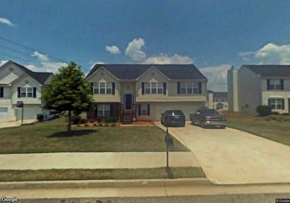
487 Sawtooth Ln Unit 2 McDonough, GA 30253
Estimated Value: $283,262 - $303,000
3
Beds
2
Baths
1,772
Sq Ft
$166/Sq Ft
Est. Value
About This Home
This home is located at 487 Sawtooth Ln Unit 2, McDonough, GA 30253 and is currently estimated at $294,816, approximately $166 per square foot. 487 Sawtooth Ln Unit 2 is a home located in Henry County with nearby schools including Union Grove Middle School, Union Grove High School, and Hickory Flat Elementary School.
Ownership History
Date
Name
Owned For
Owner Type
Purchase Details
Closed on
Feb 20, 2002
Sold by
Majestic Resdntl Llc
Bought by
Martin Tori L
Current Estimated Value
Home Financials for this Owner
Home Financials are based on the most recent Mortgage that was taken out on this home.
Original Mortgage
$143,959
Outstanding Balance
$59,062
Interest Rate
6.95%
Mortgage Type
FHA
Estimated Equity
$235,754
Create a Home Valuation Report for This Property
The Home Valuation Report is an in-depth analysis detailing your home's value as well as a comparison with similar homes in the area
Home Values in the Area
Average Home Value in this Area
Purchase History
| Date | Buyer | Sale Price | Title Company |
|---|---|---|---|
| Martin Tori L | $145,100 | -- |
Source: Public Records
Mortgage History
| Date | Status | Borrower | Loan Amount |
|---|---|---|---|
| Open | Martin Tori L | $143,959 |
Source: Public Records
Tax History Compared to Growth
Tax History
| Year | Tax Paid | Tax Assessment Tax Assessment Total Assessment is a certain percentage of the fair market value that is determined by local assessors to be the total taxable value of land and additions on the property. | Land | Improvement |
|---|---|---|---|---|
| 2025 | $3,489 | $117,600 | $14,000 | $103,600 |
| 2024 | $3,489 | $114,800 | $14,000 | $100,800 |
| 2023 | $4,618 | $108,760 | $12,000 | $96,760 |
| 2022 | $3,543 | $86,680 | $12,000 | $74,680 |
| 2021 | $2,987 | $72,080 | $12,000 | $60,080 |
| 2020 | $2,801 | $67,200 | $12,000 | $55,200 |
| 2019 | $2,569 | $62,720 | $10,000 | $52,720 |
| 2018 | $2,376 | $57,680 | $8,800 | $48,880 |
| 2016 | $1,971 | $47,120 | $8,800 | $38,320 |
| 2015 | $1,918 | $44,360 | $8,000 | $36,360 |
| 2014 | $1,603 | $35,960 | $8,000 | $27,960 |
Source: Public Records
Map
Nearby Homes
- 172 Summit View Dr
- 479 Sawtooth Ln
- 221 Summit View Dr
- 176 Cranapple Ln
- 1181 Paramount Dr
- 466 Astoria Way
- 113 Glenmore Ln
- 441 Aviemore Loop
- 209 Braemar Ct
- 124 Crown Walk
- 401 Crosshaven Way
- 212 Himalaya Way
- 248 Cranapple Ln
- 146 Himalaya Way
- 236 Himalaya Way
- 1872 Hwy 42 N
- 152 Rockport Dr
- 153 Rockport Dr
- 479 Crosshaven Way
- 1125 Strath Clyde Way
- 491 Sawtooth Ln
- 483 Sawtooth Ln
- 168 Summit View Dr
- 486 Sawtooth Ln Unit II
- 495 Sawtooth Ln Unit 2
- 641 Aspen Brook Dr Unit 2
- 490 Sawtooth Ln
- 482 Sawtooth Ln
- 482 Sawtooth Ln
- 494 Sawtooth Ln
- 475 Sawtooth Ln
- 478 Sawtooth Ln
- 533 Cascade Walk Unit 11
- 533 Cascade Walk Unit 2
- 529 Cascade Walk
- 660 Aspen Brook Dr Unit 2
- 471 Sawtooth Ln
- 471 Sawtooth Ln
- 629 Aspen Brook Dr
- 656 Aspen Brook Dr Unit 2