Estimated Value: $183,562 - $486,000
3
Beds
1
Bath
917
Sq Ft
$297/Sq Ft
Est. Value
About This Home
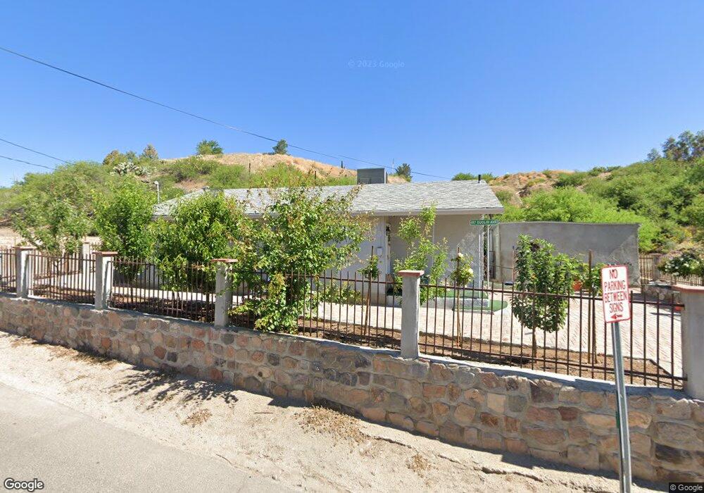
This home is located at 487 W Euclid Ave, Globe, AZ 85501 and is currently estimated at $271,891, approximately $296 per square foot. 487 W Euclid Ave is a home located in Gila County with nearby schools including Copper Rim Elementary School, High Desert Middle School, and Globe High School.
Ownership History
Date
Name
Owned For
Owner Type
Purchase Details
Closed on
Mar 28, 2025
Sold by
Zoha David G and Appel Marlene
Bought by
Peters Zachary J
Current Estimated Value
Home Financials for this Owner
Home Financials are based on the most recent Mortgage that was taken out on this home.
Original Mortgage
$230,909
Outstanding Balance
$228,838
Interest Rate
6.67%
Mortgage Type
New Conventional
Estimated Equity
$43,053
Purchase Details
Closed on
Jul 25, 2019
Sold by
Albo Joe A and Estate Of Angela Tewksbury
Bought by
Zoha David G
Create a Home Valuation Report for This Property
The Home Valuation Report is an in-depth analysis detailing your home's value as well as a comparison with similar homes in the area
Home Values in the Area
Average Home Value in this Area
Purchase History
| Date | Buyer | Sale Price | Title Company |
|---|---|---|---|
| Peters Zachary J | $228,600 | Pioneer Title | |
| Zoha David G | $110,000 | None Available |
Source: Public Records
Mortgage History
| Date | Status | Borrower | Loan Amount |
|---|---|---|---|
| Open | Peters Zachary J | $230,909 |
Source: Public Records
Tax History
| Year | Tax Paid | Tax Assessment Tax Assessment Total Assessment is a certain percentage of the fair market value that is determined by local assessors to be the total taxable value of land and additions on the property. | Land | Improvement |
|---|---|---|---|---|
| 2026 | $456 | $8,411 | $941 | $7,470 |
| 2025 | $456 | -- | -- | -- |
| 2024 | $424 | $6,753 | $785 | $5,968 |
| 2023 | $424 | $5,021 | $635 | $4,386 |
| 2022 | $415 | $4,583 | $635 | $3,948 |
| 2021 | $424 | $4,583 | $635 | $3,948 |
| 2020 | $397 | $0 | $0 | $0 |
| 2019 | $391 | $0 | $0 | $0 |
| 2018 | $378 | $0 | $0 | $0 |
| 2017 | $367 | $0 | $0 | $0 |
| 2016 | $328 | $0 | $0 | $0 |
| 2015 | $312 | $0 | $0 | $0 |
Source: Public Records
Map
Nearby Homes
- 360 W Bailey St
- 610 N Broad St
- 396 N Broad St
- 300 N Broad St
- 254 N Broad St
- 415 N Hill St
- 267 E North St
- 840 N Devereaux St
- 196 E Cedar St
- 0000 Bailey -- Unit 1
- 00 Highway 60
- 1069 N Devereaux St
- 339 N Devereaux St
- 1021 High
- 523 E Copper Hills Rd
- 501 E Mesquite St
- 258 S Sutherland St
- 543 E Mesquite St
- 385 S Broad St
- 0 Cottonwood Unit 1806700
- 478 W Euclid Ave
- 479 W Euclid Ave
- 698 N Euclid Hill
- 497 W Euclid Ave
- 535 Euclid Ave
- 492 W Euclid Ave
- 474 W Euclid Ave
- 472 W Euclid Ave
- 494 W Euclid Ave
- 695 N Euclid Hill
- 482 W Banker Ave
- 486 W Banker Ave
- 500 W Euclid Ave
- 519 W Euclid Ave
- 490 W Banker Ave
- 499 N Euclid Hill
- 522 W Euclid Ave
- 579 W Hackney Hill Rd
- 463 W Euclid Ave
- 664 N Euclid Hill
Your Personal Tour Guide
Ask me questions while you tour the home.