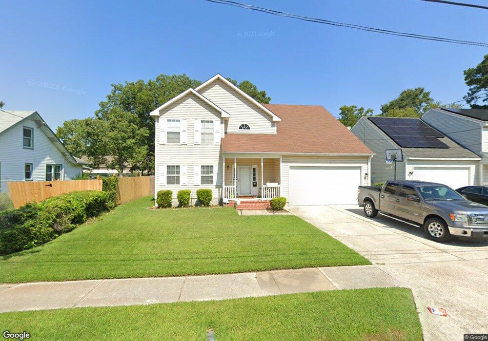
4870 Hampshire Ave Norfolk, VA 23513
Brandon Place NeighborhoodEstimated Value: $369,000 - $408,735
4
Beds
3
Baths
2,122
Sq Ft
$183/Sq Ft
Est. Value
About This Home
This home is located at 4870 Hampshire Ave, Norfolk, VA 23513 and is currently estimated at $388,684, approximately $183 per square foot. 4870 Hampshire Ave is a home located in Norfolk City with nearby schools including Sherwood Forest Elementary School, Norview Middle School, and Norview High School.
Ownership History
Date
Name
Owned For
Owner Type
Purchase Details
Closed on
Jul 12, 2019
Sold by
Equity Trustees Llc
Bought by
The Secretary Of Veterans Affairs
Current Estimated Value
Purchase Details
Closed on
Mar 30, 2016
Sold by
Barnes Walter W
Bought by
Wilson Jermaine A
Home Financials for this Owner
Home Financials are based on the most recent Mortgage that was taken out on this home.
Original Mortgage
$250,267
Interest Rate
3.65%
Mortgage Type
VA
Create a Home Valuation Report for This Property
The Home Valuation Report is an in-depth analysis detailing your home's value as well as a comparison with similar homes in the area
Home Values in the Area
Average Home Value in this Area
Purchase History
| Date | Buyer | Sale Price | Title Company |
|---|---|---|---|
| The Secretary Of Veterans Affairs | $201,720 | None Available | |
| Wilson Jermaine A | $245,000 | Sage Title Group Llc |
Source: Public Records
Mortgage History
| Date | Status | Borrower | Loan Amount |
|---|---|---|---|
| Previous Owner | Wilson Jermaine A | $250,267 |
Source: Public Records
Tax History Compared to Growth
Tax History
| Year | Tax Paid | Tax Assessment Tax Assessment Total Assessment is a certain percentage of the fair market value that is determined by local assessors to be the total taxable value of land and additions on the property. | Land | Improvement |
|---|---|---|---|---|
| 2025 | $5,028 | $402,200 | $109,000 | $293,200 |
| 2024 | $4,855 | $394,700 | $109,000 | $285,700 |
| 2023 | $4,541 | $363,300 | $109,000 | $254,300 |
| 2022 | $4,070 | $325,600 | $77,900 | $247,700 |
| 2021 | $3,679 | $294,300 | $67,700 | $226,600 |
| 2020 | $3,403 | $272,200 | $56,000 | $216,200 |
| 2019 | $3,273 | $261,800 | $56,000 | $205,800 |
| 2018 | $3,218 | $257,400 | $56,000 | $201,400 |
| 2017 | $2,914 | $253,400 | $49,500 | $203,900 |
| 2016 | $2,914 | $224,700 | $49,500 | $175,200 |
| 2015 | $2,584 | $224,700 | $49,500 | $175,200 |
| 2014 | $2,584 | $224,700 | $49,500 | $175,200 |
Source: Public Records
Map
Nearby Homes
- 3609 Sewells Point Rd
- 3516 Wellington St
- 3665 Hyde Cir
- 6245 Alexander St
- 3607 Hyde Cir
- 6262 Alexander St
- 3441 Wellington St
- 3420 Sewells Point Rd
- 3419 Bell St
- 5200 Texas Ave
- 3617 Sharpley Ave
- 1088 Norview Ave
- 1085 Hugo St
- 1345 Strand St
- 3426 Essex Cir
- 5230 Texas Ave
- 3325 Herbert St
- 3517 Essex Cir
- 3321 Herbert St
- 3316 Herbert St
- 4874 Hampshire Ave
- 4878 Hampshire Ave
- 4860 Hampshire Ave Unit AVE
- 1283 Pall Mall (1285 & 1287) St
- 1283 Paul Mall (1285 & 1287) St
- 1283 +1285 & 1287 Paul Mall St
- 1017+ Bland (1021 & 1025) St
- .11ac N Harper (N S ) St
- .11ac N S Harper St
- 6421 Patridge St
- MM Pretty Lake Pointe
- 4815 Woosley St
- 4248 Robin Hood Rd
- MM Chestnut N
- MM Chestnut W
- MM Oak
- MM Chestnut R
- MM Magnolia II R
- MM Magnolia II P
- MM Chestnut P