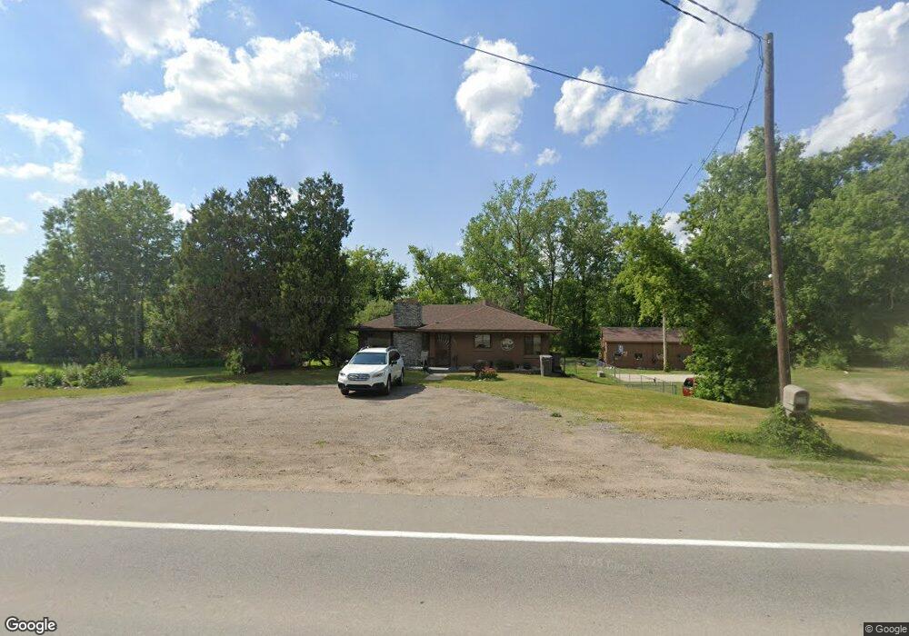
4871 Coit Ave NE Grand Rapids, MI 49525
Northview NeighborhoodEstimated Value: $509,000 - $586,227
3
Beds
2
Baths
3,756
Sq Ft
$147/Sq Ft
Est. Value
About This Home
This home is located at 4871 Coit Ave NE, Grand Rapids, MI 49525 and is currently estimated at $553,057, approximately $147 per square foot. 4871 Coit Ave NE is a home located in Kent County with nearby schools including West Oakview Elementary School, North Oakview Elementary School, and East Oakview Elementary School.
Ownership History
Date
Name
Owned For
Owner Type
Purchase Details
Closed on
Jun 15, 2010
Sold by
Taylor Carol F
Bought by
Topp Matthew Wayne and Topp Amy Elizabeth
Current Estimated Value
Home Financials for this Owner
Home Financials are based on the most recent Mortgage that was taken out on this home.
Original Mortgage
$148,000
Outstanding Balance
$98,212
Interest Rate
4.77%
Mortgage Type
New Conventional
Estimated Equity
$454,845
Create a Home Valuation Report for This Property
The Home Valuation Report is an in-depth analysis detailing your home's value as well as a comparison with similar homes in the area
Home Values in the Area
Average Home Value in this Area
Purchase History
| Date | Buyer | Sale Price | Title Company |
|---|---|---|---|
| Topp Matthew Wayne | $185,000 | Nta |
Source: Public Records
Mortgage History
| Date | Status | Borrower | Loan Amount |
|---|---|---|---|
| Open | Topp Matthew Wayne | $148,000 |
Source: Public Records
Tax History Compared to Growth
Tax History
| Year | Tax Paid | Tax Assessment Tax Assessment Total Assessment is a certain percentage of the fair market value that is determined by local assessors to be the total taxable value of land and additions on the property. | Land | Improvement |
|---|---|---|---|---|
| 2025 | $3,599 | $262,000 | $0 | $0 |
| 2024 | $3,599 | $230,600 | $0 | $0 |
| 2023 | $3,443 | $218,600 | $0 | $0 |
| 2022 | $5,037 | $187,800 | $0 | $0 |
| 2021 | $4,905 | $171,400 | $0 | $0 |
| 2020 | $3,172 | $157,700 | $0 | $0 |
| 2019 | $4,793 | $149,600 | $0 | $0 |
| 2018 | $4,691 | $161,900 | $0 | $0 |
| 2017 | $4,568 | $150,900 | $0 | $0 |
| 2016 | $4,412 | $148,800 | $0 | $0 |
| 2015 | $4,362 | $148,800 | $0 | $0 |
| 2013 | -- | $138,200 | $0 | $0 |
Source: Public Records
Map
Nearby Homes
- 5011 Coit Ave NE
- 5073 Coit Ave NE
- 4750 Hunsberger Ave NE
- 4372 Hunsberger Ave NE
- 2233 Airway St NE
- 4148 Chadwick Ave NE
- 1940 Eldon St NE
- 2285-2289 Airway St NE
- 2289 Airway St NE
- 2285 Airway St NE
- 980 River Rock Dr NE
- 5788 W River Dr NE
- 5555 Skyway Dr NE
- 4847 Ridgeline Dr NE
- 5605 Coit Ave NE
- 4611 Plainfield Ave NE
- VL Par C Buth Dr NE
- VL Par B Buth Dr NE
- VL Par D Buth Dr NE
- 5856 Hillbrook Ct NE
- 4885 Coit Ave NE
- 4846 Coit Ave NE
- 4895 Coit Ave NE
- 4921 Coit Ave NE
- 4898 Coit Ave NE
- 4920 Coit Ave NE
- 4937 Coit Ave NE
- 1723 Solitude Ct
- 4804 Coit Ave NE
- 4801 Coit Ave NE
- 1727 Solitude Ct
- 4801 Roaming Dr NE
- 1711 Solitude Dr NE
- 4967 Coit Ave NE
- 1720 Solitude Ct
- 4787 Roaming Dr NE
- 4844 Roaming Dr NE
- 1733 Solitude Ct
- 4828 Roaming Dr NE
- 1717 Solitude Dr NE