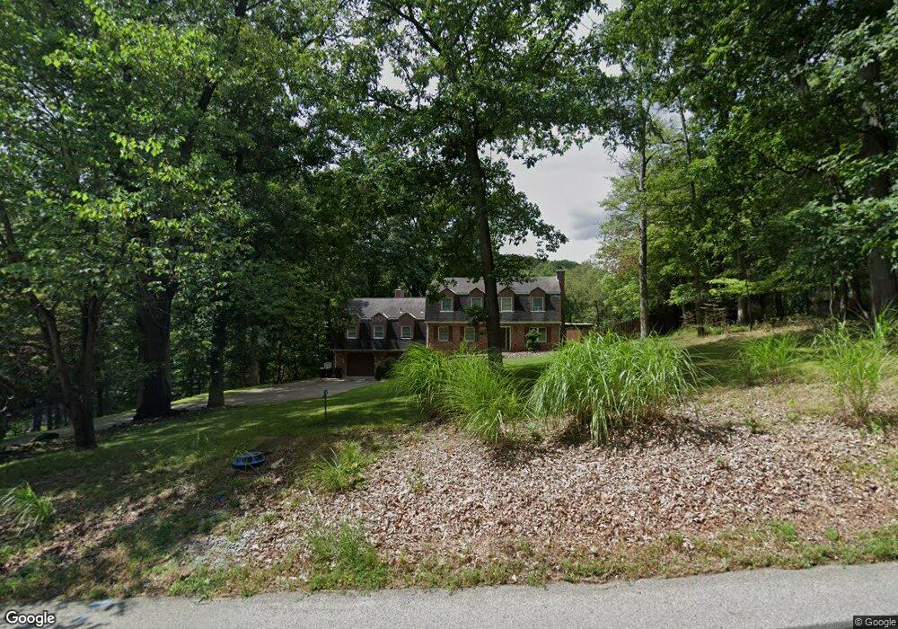
4872 Cole Rd Murrysville, PA 15668
Estimated Value: $207,240 - $574,000
4
Beds
4
Baths
--
Sq Ft
1.2
Acres
About This Home
This home is located at 4872 Cole Rd, Murrysville, PA 15668 and is currently estimated at $448,060. 4872 Cole Rd is a home located in Westmoreland County with nearby schools including Franklin Regional Senior High School and Mother of Sorrows School.
Ownership History
Date
Name
Owned For
Owner Type
Purchase Details
Closed on
May 21, 2010
Sold by
Demauro Frank and Marshall Kathy J
Bought by
Lazzaro Jonathan D and Lazzaro Jennifer L
Current Estimated Value
Home Financials for this Owner
Home Financials are based on the most recent Mortgage that was taken out on this home.
Original Mortgage
$267,500
Outstanding Balance
$179,908
Interest Rate
5.12%
Mortgage Type
New Conventional
Estimated Equity
$268,152
Purchase Details
Closed on
Nov 23, 2007
Sold by
Kendall Joanne M
Bought by
Demauro Frank and Marshall Kathy J
Home Financials for this Owner
Home Financials are based on the most recent Mortgage that was taken out on this home.
Original Mortgage
$212,000
Interest Rate
6.37%
Mortgage Type
Purchase Money Mortgage
Create a Home Valuation Report for This Property
The Home Valuation Report is an in-depth analysis detailing your home's value as well as a comparison with similar homes in the area
Home Values in the Area
Average Home Value in this Area
Purchase History
| Date | Buyer | Sale Price | Title Company |
|---|---|---|---|
| Lazzaro Jonathan D | $286,000 | None Available | |
| Demauro Frank | $265,000 | None Available |
Source: Public Records
Mortgage History
| Date | Status | Borrower | Loan Amount |
|---|---|---|---|
| Open | Lazzaro Jonathan D | $267,500 | |
| Previous Owner | Demauro Frank | $212,000 |
Source: Public Records
Tax History Compared to Growth
Tax History
| Year | Tax Paid | Tax Assessment Tax Assessment Total Assessment is a certain percentage of the fair market value that is determined by local assessors to be the total taxable value of land and additions on the property. | Land | Improvement |
|---|---|---|---|---|
| 2025 | $7,903 | $51,860 | $6,000 | $45,860 |
| 2024 | $7,721 | $51,860 | $6,000 | $45,860 |
| 2023 | $7,255 | $51,860 | $6,000 | $45,860 |
| 2022 | $7,113 | $51,860 | $6,000 | $45,860 |
| 2021 | $6,957 | $51,860 | $6,000 | $45,860 |
| 2020 | $6,825 | $51,860 | $6,000 | $45,860 |
| 2019 | $6,685 | $51,860 | $6,000 | $45,860 |
| 2018 | $6,569 | $51,860 | $6,000 | $45,860 |
| 2017 | $6,432 | $51,860 | $6,000 | $45,860 |
| 2016 | $6,304 | $51,860 | $6,000 | $45,860 |
| 2015 | $6,304 | $51,860 | $6,000 | $45,860 |
| 2014 | $6,261 | $51,860 | $6,000 | $45,860 |
Source: Public Records
Map
Nearby Homes
- 4830 Dargate Ln
- 3913 Bridgewood Cir
- 4838 Sardis Rd
- 3424 Lashan Dr
- 3513 Lashan Dr
- Lot 4 Shag Bark Grove
- 4400 Twin Oaks Dr
- 4306 Michel Ct
- 4941 Bulltown Rd
- 5150 Mamont Rd
- 4201 Bulltown Rd
- Lot 1 Sardis Rd
- Lot 2 Sardis Rd
- 4974 Longview Ct
- 4309 Bulltown Rd
- 4610 Bulltown Rd
- 278 Ridge Ln
- 264 Ridge Ln
- Lot 1 Shag Bark Grove Mamont Rd
- Lot 3 Shag Bark Grove Mamont Rd
- 4874 Cole Rd
- 4875 Cole Rd
- 1202 Twelve Oaks Ct
- 4033 Sr Hwy
- 4877 Cole Rd
- 1206 Twelve Oaks Ct
- 4500 Sardis Rd
- 1208 Twelve Oaks Ct
- 4720 Spring Ridge Ln
- 4740 Sardis Rd
- 4612 Sardis Rd
- 4880 Cole Rd
- 4033 Sr Hwy
- 4748 Sardis Rd
- 4618 Sardis Rd
- 1210 Twelve Oaks Ct
- 1214 Twelve Oaks Ct
- 1201 Twelve Oaks Ct
- 4810 Dargate Ln
- 1203 Twelve Oaks Ct