Estimated Value: $353,665 - $410,000
4
Beds
3
Baths
2,169
Sq Ft
$172/Sq Ft
Est. Value
About This Home
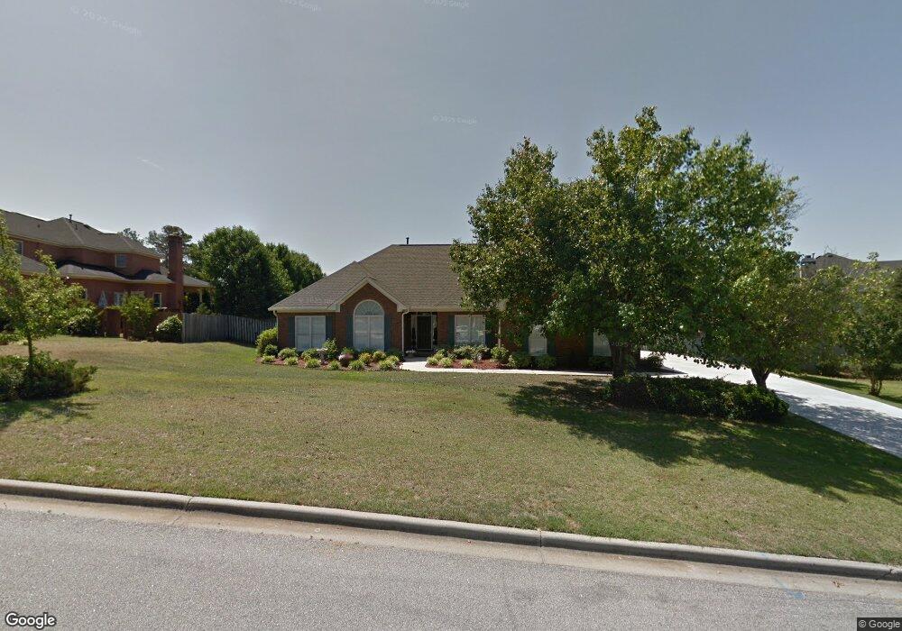
This home is located at 4872 Rolling Hill Rd, Evans, GA 30809 and is currently estimated at $372,666, approximately $171 per square foot. 4872 Rolling Hill Rd is a home located in Columbia County with nearby schools including Evans Elementary School, Evans Middle School, and Evans High School.
Ownership History
Date
Name
Owned For
Owner Type
Purchase Details
Closed on
Aug 10, 2020
Sold by
Eddie Ervin Lee
Bought by
Moseley Thomas H and Moseley Pamela O
Current Estimated Value
Home Financials for this Owner
Home Financials are based on the most recent Mortgage that was taken out on this home.
Original Mortgage
$60,000
Outstanding Balance
$53,104
Interest Rate
3%
Mortgage Type
New Conventional
Estimated Equity
$319,562
Create a Home Valuation Report for This Property
The Home Valuation Report is an in-depth analysis detailing your home's value as well as a comparison with similar homes in the area
Home Values in the Area
Average Home Value in this Area
Purchase History
| Date | Buyer | Sale Price | Title Company |
|---|---|---|---|
| Moseley Thomas H | $273,000 | -- |
Source: Public Records
Mortgage History
| Date | Status | Borrower | Loan Amount |
|---|---|---|---|
| Open | Moseley Thomas H | $60,000 |
Source: Public Records
Tax History
| Year | Tax Paid | Tax Assessment Tax Assessment Total Assessment is a certain percentage of the fair market value that is determined by local assessors to be the total taxable value of land and additions on the property. | Land | Improvement |
|---|---|---|---|---|
| 2025 | $1,109 | $139,828 | $29,804 | $110,024 |
| 2024 | $1,066 | $129,640 | $26,604 | $103,036 |
| 2023 | $1,066 | $137,538 | $23,204 | $114,334 |
| 2022 | $1,046 | $116,249 | $26,204 | $90,045 |
| 2021 | $956 | $100,555 | $20,404 | $80,151 |
| 2020 | $2,510 | $90,239 | $19,304 | $70,935 |
| 2019 | $2,524 | $90,756 | $19,504 | $71,252 |
| 2018 | $2,301 | $82,396 | $20,204 | $62,192 |
| 2017 | $2,263 | $80,763 | $17,204 | $63,559 |
| 2016 | $2,171 | $80,341 | $17,680 | $62,661 |
| 2015 | $2,160 | $79,796 | $16,980 | $62,816 |
| 2014 | $2,052 | $74,872 | $16,980 | $57,892 |
Source: Public Records
Map
Nearby Homes
- 4876 Rolling Hill Rd
- 4854 Hereford Farm Rd
- 1764 Davenport Dr
- 209 Mineral Ct
- 349 Farmington Dr E
- 208 Mineral Ct
- 510 Farmington Cir
- 4724 Canterbury Ln
- 4817 Tanner Oaks Dr
- 952 Lillian Park Dr Unit Lp127
- 329 Holly Oak Way Unit SC79
- 327 Holly Oak Way Unit SC80
- 944 Lillian Park Dr Unit Lp124
- 940 Lillian Park Dr Unit Lp122
- 2140 Sinclair Dr Unit Sc85
- 609 Bunchgrass St
- 606 Bunchgrass St
- 2170 Sinclair Dr Unit Sc97
- 5458 Everlook Cir
- 2172 Sinclair Dr Unit Sc98
- 4874 Rolling Hill Rd
- 4870 Rolling Hill Rd
- 386 Farmington Dr E
- 4873 Rolling Hill Rd
- 4875 Rolling Hill Rd
- 392 Farmington Dr E
- 384 Farmington Dr E
- 4877 Rolling Hill Rd
- 383 Farmington Dr E
- 4878 Rolling Hill Rd
- 385 Farmington Dr E
- 4879 Rolling Hill Rd
- 4861 Birdwood Ct
- 382 Farmington Dr E
- 4881 Rolling Hill Rd
- 4860 Birdwood Ct
- 4880 Rolling Hill Rd
- 398 Farmington Dr E
- 4855 Birdwood Ct
- 4862 Hereford Farm Rd