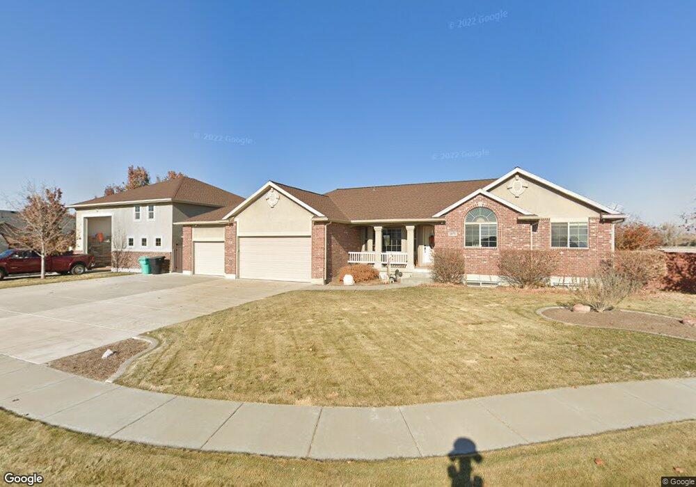
4872 W 375 N West Point, UT 84015
Estimated Value: $639,000 - $890,395
3
Beds
3
Baths
3,496
Sq Ft
$222/Sq Ft
Est. Value
About This Home
This home is located at 4872 W 375 N, West Point, UT 84015 and is currently estimated at $775,099, approximately $221 per square foot. 4872 W 375 N is a home located in Davis County with nearby schools including West Point School, West Point Junior High School, and Syracuse High School.
Ownership History
Date
Name
Owned For
Owner Type
Purchase Details
Closed on
Nov 6, 2014
Sold by
Rumsey Carl D and Rumsey Mary
Bought by
The Carl D Rumsey And Mary M Rumsey Revo and Rumsey Mary M
Current Estimated Value
Purchase Details
Closed on
Apr 2, 2012
Sold by
Telford Gary and Telford Jill
Bought by
Rumsey Carl D and Rumsey Mary
Home Financials for this Owner
Home Financials are based on the most recent Mortgage that was taken out on this home.
Original Mortgage
$248,000
Outstanding Balance
$170,683
Interest Rate
3.91%
Mortgage Type
New Conventional
Estimated Equity
$604,416
Purchase Details
Closed on
Nov 21, 2005
Sold by
Telford L Gary and Telford Jalene F
Bought by
Telford Gary and Telford Jill
Home Financials for this Owner
Home Financials are based on the most recent Mortgage that was taken out on this home.
Original Mortgage
$75,000
Interest Rate
5.97%
Mortgage Type
New Conventional
Purchase Details
Closed on
Oct 3, 2005
Sold by
Abrams Doyle Dahl and Abrams Florence K
Bought by
Telford L Gary and Telford Jalene F
Home Financials for this Owner
Home Financials are based on the most recent Mortgage that was taken out on this home.
Original Mortgage
$75,000
Interest Rate
5.97%
Mortgage Type
New Conventional
Create a Home Valuation Report for This Property
The Home Valuation Report is an in-depth analysis detailing your home's value as well as a comparison with similar homes in the area
Home Values in the Area
Average Home Value in this Area
Purchase History
| Date | Buyer | Sale Price | Title Company |
|---|---|---|---|
| The Carl D Rumsey And Mary M Rumsey Revo | -- | None Available | |
| Rumsey Carl D | -- | Hickman Land Title C | |
| Telford Gary | -- | Inwest Title Services Inc | |
| Telford L Gary | -- | Bonneville Title Company |
Source: Public Records
Mortgage History
| Date | Status | Borrower | Loan Amount |
|---|---|---|---|
| Open | Rumsey Carl D | $248,000 | |
| Previous Owner | Telford Gary | $75,000 |
Source: Public Records
Tax History Compared to Growth
Tax History
| Year | Tax Paid | Tax Assessment Tax Assessment Total Assessment is a certain percentage of the fair market value that is determined by local assessors to be the total taxable value of land and additions on the property. | Land | Improvement |
|---|---|---|---|---|
| 2025 | $5,050 | $464,750 | $176,389 | $288,361 |
| 2024 | $4,886 | $451,550 | $158,400 | $293,150 |
| 2023 | $4,502 | $765,000 | $223,253 | $541,747 |
| 2022 | $4,936 | $459,250 | $124,034 | $335,216 |
| 2021 | $4,435 | $617,000 | $164,587 | $452,413 |
| 2020 | $3,913 | $536,000 | $143,259 | $392,741 |
| 2019 | $3,779 | $510,000 | $137,483 | $372,517 |
| 2018 | $3,612 | $480,000 | $126,878 | $353,122 |
| 2016 | $2,794 | $194,810 | $49,542 | $145,268 |
| 2015 | $2,746 | $181,445 | $49,542 | $131,903 |
| 2014 | -- | $162,810 | $49,542 | $113,268 |
| 2013 | -- | $145,693 | $54,796 | $90,897 |
Source: Public Records
Map
Nearby Homes
- 4719 W 650 N
- 477 N 4500 W
- 4669 W 75 N
- 4594 W 75 N Unit 405
- 128 N 4500 W
- 4352 W 300 N
- 4366 W 200 N
- 4325 W 75 N
- 120 N 4325 W
- 4362 West St Unit 106
- 4358 West St Unit 105
- 357 N 4000 W
- 356 S 4300 W Unit 611
- 364 S 4300 W Unit 610
- 3949 W 250 N
- 4469 W 1000 N Unit 120
- Charleston Plan at Bluff View
- 3932 W 825 N Unit WF5
- 3918 W 825 N Unit WF6
- 114 3830 W