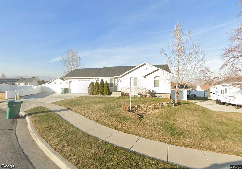
4872 W Murdoch Peak Cir Riverton, UT 84096
Estimated Value: $564,000 - $602,981
3
Beds
2
Baths
2,744
Sq Ft
$212/Sq Ft
Est. Value
About This Home
This home is located at 4872 W Murdoch Peak Cir, Riverton, UT 84096 and is currently estimated at $582,495, approximately $212 per square foot. 4872 W Murdoch Peak Cir is a home located in Salt Lake County with nearby schools including Foothills School, South Hills Middle School, and Mountain Ridge High School.
Ownership History
Date
Name
Owned For
Owner Type
Purchase Details
Closed on
Apr 5, 2019
Sold by
Power Kyle Richard and Power Alicia Daun
Bought by
Power Kyle and Power Alicia
Current Estimated Value
Home Financials for this Owner
Home Financials are based on the most recent Mortgage that was taken out on this home.
Original Mortgage
$307,302
Outstanding Balance
$270,173
Interest Rate
4.3%
Mortgage Type
Closed End Mortgage
Estimated Equity
$312,322
Purchase Details
Closed on
Mar 22, 2018
Sold by
Candelaria Michael C
Bought by
Power Kyle Richard and Power Alicia Duan
Home Financials for this Owner
Home Financials are based on the most recent Mortgage that was taken out on this home.
Original Mortgage
$304,000
Interest Rate
4.32%
Mortgage Type
New Conventional
Purchase Details
Closed on
Feb 23, 2015
Sold by
Sanders Mark
Bought by
Candelaria Michael C
Home Financials for this Owner
Home Financials are based on the most recent Mortgage that was taken out on this home.
Original Mortgage
$9,300
Interest Rate
3.66%
Mortgage Type
Stand Alone Second
Purchase Details
Closed on
Nov 7, 2001
Sold by
Hellstrom April and Sanders Mark
Bought by
Sanders Mark
Home Financials for this Owner
Home Financials are based on the most recent Mortgage that was taken out on this home.
Original Mortgage
$136,000
Interest Rate
6.73%
Purchase Details
Closed on
Sep 16, 1998
Sold by
Majestic Homes Inc
Bought by
Hellstrom April and Sanders Mark
Home Financials for this Owner
Home Financials are based on the most recent Mortgage that was taken out on this home.
Original Mortgage
$136,589
Interest Rate
6.89%
Purchase Details
Closed on
May 20, 1998
Sold by
Development Associates Inc
Bought by
Sanders Mark A and Helstrom April
Home Financials for this Owner
Home Financials are based on the most recent Mortgage that was taken out on this home.
Original Mortgage
$116,000
Interest Rate
7.1%
Mortgage Type
Construction
Create a Home Valuation Report for This Property
The Home Valuation Report is an in-depth analysis detailing your home's value as well as a comparison with similar homes in the area
Home Values in the Area
Average Home Value in this Area
Purchase History
| Date | Buyer | Sale Price | Title Company |
|---|---|---|---|
| Power Kyle | -- | Meridian Title | |
| Power Kyle Richard | -- | North American Title Llc | |
| Candelaria Michael C | -- | Meridian Title | |
| Sanders Mark | -- | Bonneville Title Co | |
| Hellstrom April | -- | -- | |
| Majestic Homes Inc | -- | -- | |
| Sanders Mark A | -- | -- |
Source: Public Records
Mortgage History
| Date | Status | Borrower | Loan Amount |
|---|---|---|---|
| Open | Power Kyle | $307,302 | |
| Closed | Power Kyle Richard | $304,000 | |
| Previous Owner | Candelaria Michael C | $9,300 | |
| Previous Owner | Candelaria Michael C | $241,530 | |
| Previous Owner | Sanders Mark | $136,000 | |
| Previous Owner | Hellstrom April | $136,589 | |
| Previous Owner | Sanders Mark A | $116,000 | |
| Closed | Sanders Mark A | $9,500 |
Source: Public Records
Tax History Compared to Growth
Tax History
| Year | Tax Paid | Tax Assessment Tax Assessment Total Assessment is a certain percentage of the fair market value that is determined by local assessors to be the total taxable value of land and additions on the property. | Land | Improvement |
|---|---|---|---|---|
| 2025 | $2,869 | $551,100 | $209,900 | $341,200 |
| 2024 | $2,869 | $496,500 | $192,800 | $303,700 |
| 2023 | $3,036 | $495,300 | $178,500 | $316,800 |
| 2022 | $3,131 | $501,200 | $175,000 | $326,200 |
| 2021 | $2,601 | $370,700 | $135,000 | $235,700 |
| 2020 | $2,545 | $338,200 | $105,000 | $233,200 |
| 2019 | $2,483 | $324,400 | $100,000 | $224,400 |
| 2018 | $2,326 | $299,200 | $92,400 | $206,800 |
| 2017 | $2,210 | $277,000 | $92,400 | $184,600 |
| 2016 | $2,109 | $253,600 | $92,400 | $161,200 |
| 2015 | $2,042 | $238,100 | $92,400 | $145,700 |
| 2014 | $1,962 | $224,300 | $88,100 | $136,200 |
Source: Public Records
Map
Nearby Homes
- 4999 W Cave Peak Dr
- 4827 Boulder Meadow Dr
- 14048 van Cott Peak Cir
- 13863 S Kessler Peak Dr
- 14054 Elk Horn Peak Dr
- 14254 S Amber Rose Ln
- 4567 W Watchmen Way Unit 1334
- 4722 W Cillian Ln Unit 2411
- 4722 W Cillian Ln
- 4714 W Cillian Ln
- 4714 W Cillian Ln Unit 2410
- 4698 W Cillian Ln
- 4698 W Cillian Ln Unit 2409
- 4541 W Watchmen Way
- 4688 W Cillian Ln Unit 2408
- 4688 W Cillian Ln
- 4682 W Cillian Ln
- 4682 W Cillian Ln Unit 2407
- 13908 S 5180 W
- 4541 W Ruple Ridge Ln
- 4872 Murdoch Peak Cir
- 4858 W Murdoch Peak Cir
- 4858 W Murdoch Peak Cir Unit 39
- 4858 Murdoch Peak Cir
- 4877 Grand View Peak Dr
- 4877 W Grand View Peak Dr
- 4882 W Murdoch Peak Cir
- 4882 Murdoch Peak Cir
- 4867 Grand View Peak Dr
- 4867 W Grand View Peak Dr
- 4889 Grand View Peak Dr
- 4853 W Grand View Peak Dr
- 4853 Grand View Peak Dr
- 4881 Murdoch Peak Cir
- 4863 Murdoch Peak Cir
- 4842 Murdoch Peak Cir
- 4842 W Murdoch Peak Cir
- 4873 W Murdoch Peak Cir
- 4873 Murdoch Peak Cir
- 14077 S Grand View Peak Cir