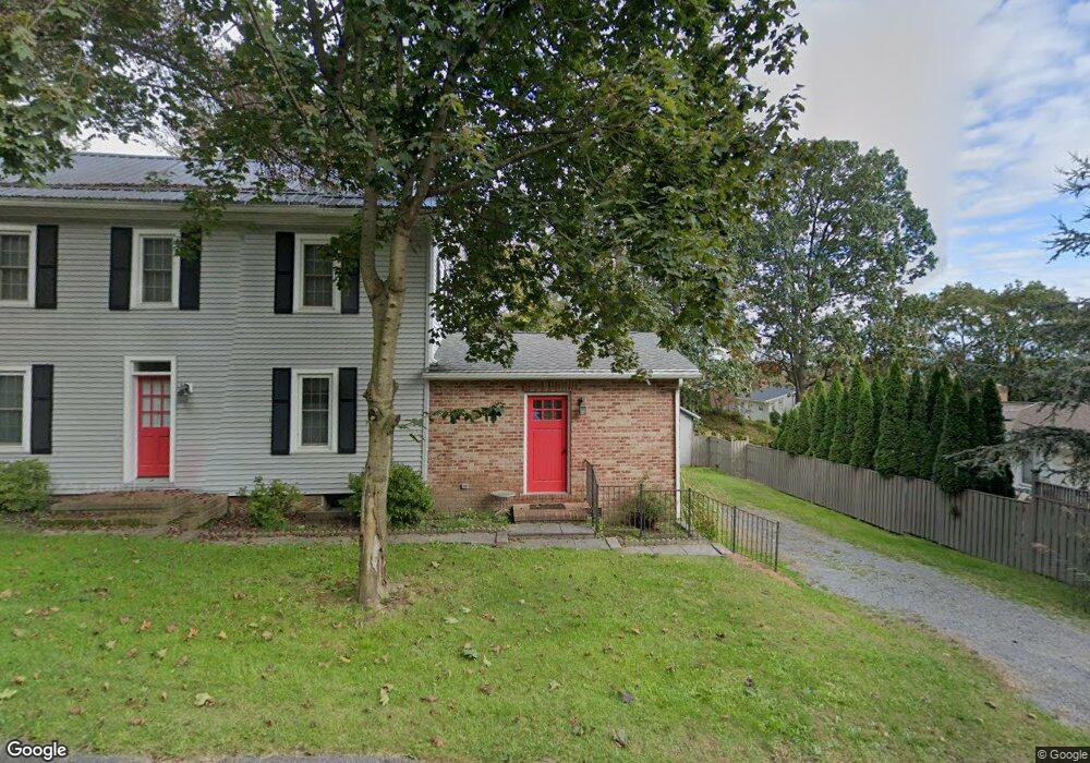
488 App Rd Selinsgrove, PA 17870
Estimated Value: $157,275 - $398,000
--
Bed
--
Bath
--
Sq Ft
10,454
Sq Ft Lot
About This Home
This home is located at 488 App Rd, Selinsgrove, PA 17870 and is currently estimated at $277,069. 488 App Rd is a home located in Snyder County with nearby schools including Selinsgrove Area Elementary School, Selinsgrove Intermediate School, and Selinsgrove Area Middle School.
Ownership History
Date
Name
Owned For
Owner Type
Purchase Details
Closed on
Oct 5, 2020
Sold by
Mtchell Myron C and Mtchell Michele H
Bought by
Kelly Michael
Current Estimated Value
Home Financials for this Owner
Home Financials are based on the most recent Mortgage that was taken out on this home.
Original Mortgage
$171,338
Outstanding Balance
$152,396
Interest Rate
2.9%
Mortgage Type
FHA
Estimated Equity
$124,673
Create a Home Valuation Report for This Property
The Home Valuation Report is an in-depth analysis detailing your home's value as well as a comparison with similar homes in the area
Home Values in the Area
Average Home Value in this Area
Purchase History
| Date | Buyer | Sale Price | Title Company |
|---|---|---|---|
| Kelly Michael | $174,500 | None Available |
Source: Public Records
Mortgage History
| Date | Status | Borrower | Loan Amount |
|---|---|---|---|
| Open | Kelly Michael | $171,338 |
Source: Public Records
Tax History Compared to Growth
Tax History
| Year | Tax Paid | Tax Assessment Tax Assessment Total Assessment is a certain percentage of the fair market value that is determined by local assessors to be the total taxable value of land and additions on the property. | Land | Improvement |
|---|---|---|---|---|
| 2025 | $2,941 | $30,280 | $8,470 | $21,810 |
| 2024 | $2,856 | $30,280 | $8,470 | $21,810 |
| 2023 | $721 | $30,280 | $8,470 | $21,810 |
| 2022 | $2,719 | $30,280 | $8,470 | $21,810 |
| 2021 | $2,719 | $30,280 | $8,470 | $21,810 |
| 2020 | $2,719 | $30,280 | $8,470 | $21,810 |
| 2019 | $2,719 | $30,280 | $8,470 | $21,810 |
| 2018 | $2,719 | $30,280 | $8,470 | $21,810 |
| 2017 | $2,689 | $30,280 | $8,470 | $21,810 |
| 2016 | $782 | $30,280 | $8,470 | $21,810 |
| 2015 | $66,048 | $30,280 | $8,470 | $21,810 |
| 2014 | $66,048 | $30,280 | $8,470 | $21,810 |
Source: Public Records
Map
Nearby Homes
- 7 Lost Creek Dr
- 84 Limerick Ln
- 86 Limerick Ln Unit B
- 86 Limerick Ln
- 88 Limerick Ln
- 90 Limerick Ln
- 90 Limerick Ln Unit D
- 79 St Andrews Way
- 79 Saint Andrews Way
- 81 St Andrews Way
- 81 Saint Andrews Way
- 107 St Andrews Way
- 107 Saint Andrews Way
- The Abilene Plan at Springfield
- The Clarksville Plan at The Woods At Shoals Creek - The Woods at Shoals Creek
- The Fenwick Plan at The Woods At Shoals Creek - The Woods at Shoals Creek
- The Greenville Plan at The Woods At Shoals Creek - The Woods at Shoals Creek
- The Knoxville Plan at Springfield
- The Roanoke Plan at Autumn Ridge
- The Cumberland Plan at Springfield
- 2 Meadowbrook Dr
- 1 Kingswood Dr
- 1 Fairway Dr
- 4 Meadowbrook Dr
- 3 Fairway Dr
- 1 Meadowbrook Dr
- 6 Meadowbrook Dr
- 3 Kingswood Dr
- 3 Meadowbrook Dr
- 2 Fairway Dr
- 8 Meadowbrook Dr
- 4 Kingswood Dr
- 2 Lost Creek Dr
- 5 Meadowbrook Dr
- 4 Lost Creek Dr
- 2 Kingswood Dr
- 12 Kingswood Dr
- 5 Fairway Dr
- 22 Limerick Ln
- 6 Lost Creek Dr