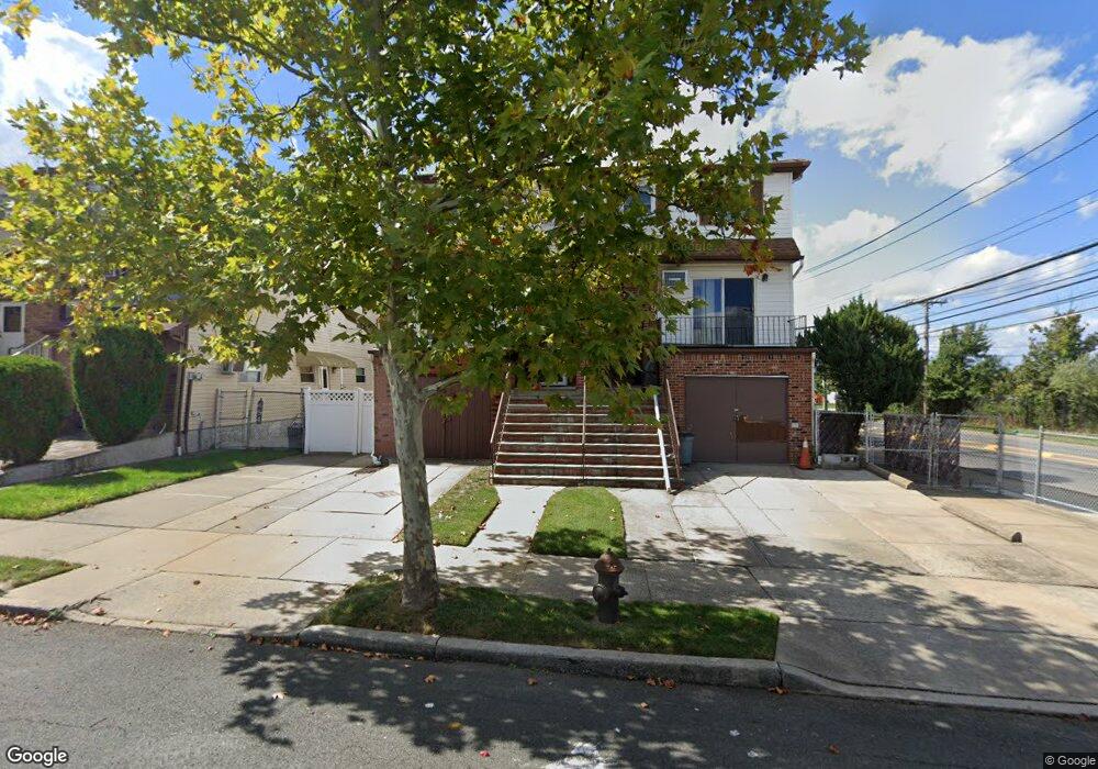
488 Colon Ave Staten Island, NY 10308
Great Kills NeighborhoodEstimated Value: $802,772 - $908,000
4
Beds
5
Baths
2,592
Sq Ft
$329/Sq Ft
Est. Value
About This Home
This home is located at 488 Colon Ave, Staten Island, NY 10308 and is currently estimated at $853,693, approximately $329 per square foot. 488 Colon Ave is a home located in Richmond County with nearby schools including P.S. 32 The Gifford School, I.S. 075 Frank D. Paulo, and Susan E Wagner High School.
Ownership History
Date
Name
Owned For
Owner Type
Purchase Details
Closed on
May 20, 2023
Sold by
Madigan Lori
Bought by
Madigan Lori
Current Estimated Value
Purchase Details
Closed on
Dec 18, 2001
Sold by
Bittner Louis and Bittner Lorraine
Bought by
Madigan Sean and Madigan Lori
Home Financials for this Owner
Home Financials are based on the most recent Mortgage that was taken out on this home.
Original Mortgage
$130,000
Interest Rate
7.08%
Mortgage Type
Purchase Money Mortgage
Create a Home Valuation Report for This Property
The Home Valuation Report is an in-depth analysis detailing your home's value as well as a comparison with similar homes in the area
Home Values in the Area
Average Home Value in this Area
Purchase History
| Date | Buyer | Sale Price | Title Company |
|---|---|---|---|
| Madigan Lori | -- | Fidelity National Title | |
| Madigan Sean | $325,000 | Old Republic Natl Title Ins |
Source: Public Records
Mortgage History
| Date | Status | Borrower | Loan Amount |
|---|---|---|---|
| Previous Owner | Madigan Sean | $130,000 |
Source: Public Records
Tax History Compared to Growth
Tax History
| Year | Tax Paid | Tax Assessment Tax Assessment Total Assessment is a certain percentage of the fair market value that is determined by local assessors to be the total taxable value of land and additions on the property. | Land | Improvement |
|---|---|---|---|---|
| 2025 | $7,653 | $45,660 | $8,332 | $37,328 |
| 2024 | $7,653 | $39,960 | $8,982 | $30,978 |
| 2023 | $7,300 | $35,946 | $8,239 | $27,707 |
| 2022 | $6,483 | $40,140 | $9,420 | $30,720 |
| 2021 | $6,834 | $39,240 | $9,420 | $29,820 |
| 2020 | $6,828 | $38,400 | $9,420 | $28,980 |
| 2019 | $6,349 | $33,360 | $9,420 | $23,940 |
| 2018 | $5,809 | $29,955 | $9,239 | $20,716 |
| 2017 | $5,461 | $28,260 | $9,420 | $18,840 |
| 2016 | $5,352 | $28,320 | $9,420 | $18,900 |
| 2015 | $5,080 | $28,260 | $8,400 | $19,860 |
| 2014 | $5,080 | $28,062 | $8,134 | $19,928 |
Source: Public Records
Map
Nearby Homes
- 466 Doane Ave
- 379 Brookfield Ave
- 350 Brookfield Ave
- 87 Pemberton Ave
- 72 Eric Ln
- 414 Elverton Ave
- 26 E Brandis Ave
- 132 Elkhart St
- 420 Arthur Kill Rd
- 339 Abingdon Ave
- 345 Colon Ave
- 74 E Brandis Ave
- 259 Brookfield Ave
- 307 Abingdon Ave
- 919 Armstrong Ave
- 68 Elkhart St
- 62 Daleham St
- 924 Armstrong Ave Unit 2-3
- 467 Ridgewood Ave
- 12 Troy St
- 484 Colon Ave
- 490 Colon Ave
- 482 Colon Ave
- 480 Colon Ave
- 399 Brookfield Ave
- 401 Brookfield Ave
- 397 Brookfield Ave
- 478 Colon Ave
- 395-495 Brookfield Ave
- 395 Brookfield Ave Unit 495
- 391 Brookfield Ave
- 474 Colon Ave
- 389 Brookfield Ave
- 472 Colon Ave Unit Building
- 385 Brookfield Ave
- 485 Colon Ave
- 468 Colon Ave
- 481 Colon Ave
- 383 Brookfield Ave