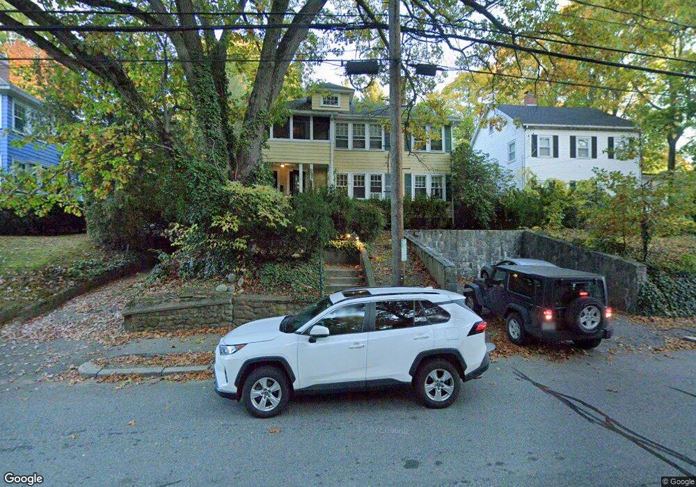
488 Lowell Ave Unit 490 Newtonville, MA 02460
Newtonville NeighborhoodEstimated Value: $1,366,000 - $1,613,781
4
Beds
2
Baths
2,642
Sq Ft
$566/Sq Ft
Est. Value
About This Home
This home is located at 488 Lowell Ave Unit 490, Newtonville, MA 02460 and is currently estimated at $1,495,945, approximately $566 per square foot. 488 Lowell Ave Unit 490 is a home located in Middlesex County with nearby schools including Cabot Elementary School, F.A. Day Middle School, and Newton North High School.
Ownership History
Date
Name
Owned For
Owner Type
Purchase Details
Closed on
Aug 10, 1999
Sold by
Gmm Nt and Fricks Erminia M
Bought by
Butterworth Andrea M
Current Estimated Value
Home Financials for this Owner
Home Financials are based on the most recent Mortgage that was taken out on this home.
Original Mortgage
$210,000
Outstanding Balance
$59,828
Interest Rate
7.54%
Mortgage Type
Purchase Money Mortgage
Estimated Equity
$1,436,117
Create a Home Valuation Report for This Property
The Home Valuation Report is an in-depth analysis detailing your home's value as well as a comparison with similar homes in the area
Home Values in the Area
Average Home Value in this Area
Purchase History
| Date | Buyer | Sale Price | Title Company |
|---|---|---|---|
| Butterworth Andrea M | $340,000 | -- |
Source: Public Records
Mortgage History
| Date | Status | Borrower | Loan Amount |
|---|---|---|---|
| Open | Butterworth Andrea M | $210,000 |
Source: Public Records
Tax History Compared to Growth
Tax History
| Year | Tax Paid | Tax Assessment Tax Assessment Total Assessment is a certain percentage of the fair market value that is determined by local assessors to be the total taxable value of land and additions on the property. | Land | Improvement |
|---|---|---|---|---|
| 2025 | $10,854 | $1,107,500 | $931,800 | $175,700 |
| 2024 | $10,494 | $1,075,200 | $904,700 | $170,500 |
| 2023 | $9,965 | $978,900 | $723,400 | $255,500 |
| 2022 | $9,535 | $906,400 | $669,800 | $236,600 |
| 2021 | $8,948 | $831,600 | $614,500 | $217,100 |
| 2020 | $8,682 | $831,600 | $614,500 | $217,100 |
| 2019 | $8,122 | $777,200 | $574,300 | $202,900 |
| 2018 | $8,054 | $744,400 | $539,400 | $205,000 |
| 2017 | $7,594 | $682,900 | $494,900 | $188,000 |
| 2016 | $7,130 | $626,500 | $454,000 | $172,500 |
| 2015 | $6,798 | $585,500 | $424,300 | $161,200 |
Source: Public Records
Map
Nearby Homes
- 61 Lakeview Ave
- 308 Prince St
- 34 Morton Rd
- 887 Commonwealth Ave
- 39 Valentine Park
- 22 Walnut Place Unit 1
- 123-125 Mount Vernon St
- 123 Mount Vernon St Unit 2
- 3 Cedar St
- 300 Cabot St
- 54 Garland Rd
- 957 Washington St Unit 1
- 935 Washington St Unit 8
- 318 Austin St Unit A
- 127-129 Withington Rd Unit 1
- 95 Blake St
- 911 Washington St
- 12 Wiswall St
- 4 Wiswall St
- 10 Washington Park
- 490 Lowell Ave
- 490 Lowell Ave Unit 1
- 484 Lowell Ave Unit 2
- 484 Lowell Ave Unit 1
- 478 Lowell Ave Unit 480
- 103 Beaumont Ave
- 500 Lowell Ave Unit 2
- 500 Lowell Ave Unit 1
- 500 Lowell Ave
- 487 Lowell Ave Unit 2
- 487 Lowell Ave Unit 1
- 97 Beaumont Ave
- 107 Beaumont Ave
- 495 Lowell Ave
- 495 Lowell Ave Unit 1
- 497 Lowell Ave
- 497 Lowell Ave Unit 2
- 497 Lowell Ave Unit 1
- 93 Beaumont Ave
- 476 Lowell Ave Unit 2