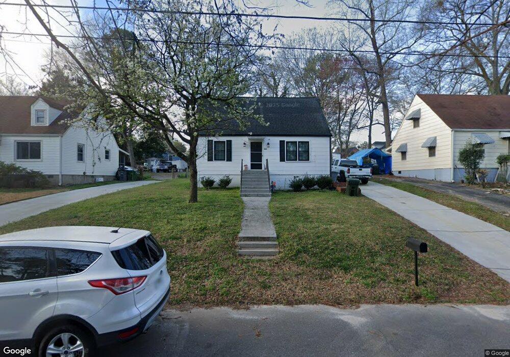
488 Radar Dr Atlanta, GA 30354
Estimated Value: $246,056 - $306,000
4
Beds
2
Baths
1,256
Sq Ft
$224/Sq Ft
Est. Value
About This Home
This home is located at 488 Radar Dr, Atlanta, GA 30354 and is currently estimated at $281,264, approximately $223 per square foot. 488 Radar Dr is a home located in Fulton County with nearby schools including Hapeville Elementary School, Paul D. West Middle School, and Tri-Cities High School.
Ownership History
Date
Name
Owned For
Owner Type
Purchase Details
Closed on
Jan 30, 2020
Sold by
Russell Billy
Bought by
Russell Billy and Russell Christine Nicole
Current Estimated Value
Home Financials for this Owner
Home Financials are based on the most recent Mortgage that was taken out on this home.
Original Mortgage
$125,300
Outstanding Balance
$111,196
Interest Rate
3.72%
Mortgage Type
New Conventional
Estimated Equity
$170,068
Purchase Details
Closed on
Jan 15, 2020
Sold by
Russell Billy Joe Sr Estate
Bought by
Russell Billy
Home Financials for this Owner
Home Financials are based on the most recent Mortgage that was taken out on this home.
Original Mortgage
$125,300
Outstanding Balance
$111,196
Interest Rate
3.72%
Mortgage Type
New Conventional
Estimated Equity
$170,068
Purchase Details
Closed on
Oct 1, 2019
Sold by
Russell Sheila Lovella
Bought by
Russell Robby Joe
Create a Home Valuation Report for This Property
The Home Valuation Report is an in-depth analysis detailing your home's value as well as a comparison with similar homes in the area
Home Values in the Area
Average Home Value in this Area
Purchase History
| Date | Buyer | Sale Price | Title Company |
|---|---|---|---|
| Russell Billy | -- | -- | |
| Russell Billy | -- | -- | |
| Russell Robby Joe | -- | -- | |
| Russell Billy | -- | -- |
Source: Public Records
Mortgage History
| Date | Status | Borrower | Loan Amount |
|---|---|---|---|
| Open | Russell Billy | $125,300 |
Source: Public Records
Tax History Compared to Growth
Tax History
| Year | Tax Paid | Tax Assessment Tax Assessment Total Assessment is a certain percentage of the fair market value that is determined by local assessors to be the total taxable value of land and additions on the property. | Land | Improvement |
|---|---|---|---|---|
| 2025 | $777 | $79,160 | $16,680 | $62,480 |
| 2023 | $2,029 | $71,880 | $15,040 | $56,840 |
| 2022 | $1,221 | $71,880 | $15,040 | $56,840 |
| 2021 | $1,547 | $56,720 | $14,280 | $42,440 |
| 2020 | $2,086 | $56,040 | $14,120 | $41,920 |
| 2019 | $646 | $50,080 | $10,760 | $39,320 |
| 2018 | $445 | $26,640 | $5,080 | $21,560 |
| 2017 | $286 | $17,200 | $3,360 | $13,840 |
| 2016 | $285 | $17,200 | $3,360 | $13,840 |
| 2015 | $406 | $17,200 | $3,360 | $13,840 |
| 2014 | $287 | $17,200 | $3,360 | $13,840 |
Source: Public Records
Map
Nearby Homes
- 3378 Lavista Dr
- 52 Central Park Dr
- 3311 Lavista Dr
- 371 Kings Landing
- 373 Kings Landing
- 351 Colorado Ave
- 3439 Old Jonesboro Rd
- 226 College Cir Unit 1014
- 226 College Cir
- 3323 Russell St
- 2110 Lavista Cir
- 3317 Russell St
- 204 College Cir
- 224 College Cir Unit 1013
- 222 College Cir Unit 1012
- 218 College Cir Unit 1010
- 216 College Cir Unit 1009
- 214 College St Unit 1008
- 492 Radar Dr
- 484 Radar Dr
- 0 Radar Dr Unit 8328706
- 0 Radar Dr
- 496 Radar Dr
- 480 Radar Dr
- 3438 Parkview Place
- 3437 Louise St
- 3430 Parkview Place
- 3442 Parkview Place
- 476 Radar Dr Unit 26
- 476 Radar Dr
- 3441 Louise St
- 3426 Parkview Place
- 3450 Parkview Place
- 3445 Louise St
- 485 Radar Dr
- 3421 Louise St
- 3431 Parkview Place
- 3433 Parkview Place