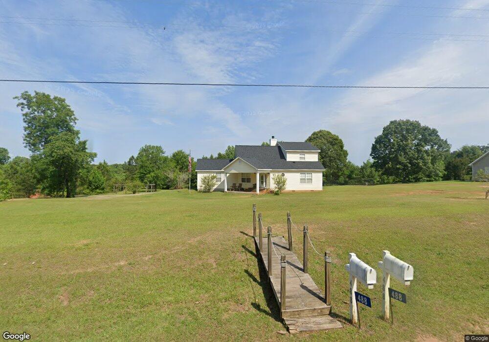
488 Riggins Mill Rd Dry Branch, GA 31020
Estimated Value: $183,000 - $262,000
--
Bed
1
Bath
2,002
Sq Ft
$106/Sq Ft
Est. Value
About This Home
This home is located at 488 Riggins Mill Rd, Dry Branch, GA 31020 and is currently estimated at $211,923, approximately $105 per square foot. 488 Riggins Mill Rd is a home with nearby schools including Jeffersonville Elementary School, Twiggs Middle School, and Twiggs County High School.
Ownership History
Date
Name
Owned For
Owner Type
Purchase Details
Closed on
Mar 8, 2012
Sold by
Berry Patrick J
Bought by
Mcwilliams Tracy M
Current Estimated Value
Home Financials for this Owner
Home Financials are based on the most recent Mortgage that was taken out on this home.
Original Mortgage
$102,338
Outstanding Balance
$69,895
Interest Rate
3.75%
Mortgage Type
FHA
Estimated Equity
$142,028
Purchase Details
Closed on
May 12, 2011
Sold by
Berry Joseph E
Bought by
Berry Patrick J and Berry Cheryl Tate
Create a Home Valuation Report for This Property
The Home Valuation Report is an in-depth analysis detailing your home's value as well as a comparison with similar homes in the area
Home Values in the Area
Average Home Value in this Area
Purchase History
| Date | Buyer | Sale Price | Title Company |
|---|---|---|---|
| Mcwilliams Tracy M | $105,000 | -- | |
| Berry Patrick J | -- | -- |
Source: Public Records
Mortgage History
| Date | Status | Borrower | Loan Amount |
|---|---|---|---|
| Open | Mcwilliams Tracy M | $102,338 |
Source: Public Records
Tax History Compared to Growth
Tax History
| Year | Tax Paid | Tax Assessment Tax Assessment Total Assessment is a certain percentage of the fair market value that is determined by local assessors to be the total taxable value of land and additions on the property. | Land | Improvement |
|---|---|---|---|---|
| 2024 | $1,824 | $56,928 | $2,000 | $54,928 |
| 2023 | $1,827 | $56,928 | $2,000 | $54,928 |
| 2022 | $2,060 | $56,928 | $2,000 | $54,928 |
| 2021 | $2,061 | $56,928 | $2,000 | $54,928 |
| 2020 | $2,061 | $56,928 | $2,000 | $54,928 |
| 2019 | $2,061 | $56,928 | $2,000 | $54,928 |
| 2018 | $1,890 | $56,928 | $2,000 | $54,928 |
| 2017 | $1,890 | $56,928 | $2,000 | $54,928 |
| 2016 | $0 | $54,928 | $0 | $54,928 |
| 2015 | -- | $44,502 | $2,000 | $42,502 |
| 2014 | -- | $44,502 | $2,000 | $42,502 |
| 2013 | -- | $0 | $0 | $0 |
Source: Public Records
Map
Nearby Homes
- 0 Hwy 80 Unit LotWP003 23115930
- 0 Hwy 80
- 000 Parker Rd
- 0 Parker Rd Unit 10461595
- 0 Us Highway 80 Unit LOT 1 10495040
- 0 Us Highway 80 Unit 23234269
- 0 Knollwood Rd Unit LotWP004
- 0 Knollwood Rd Unit 10495049
- 32 Knollwood Rd
- 0 Highway 80 Unit LOT 2 10495048
- 0 Highway 80 Unit LotWP001 23115925
- 385 Redbud Dr
- Hwy 129
- 83 Troon Dr
- 5757 Jeffersonville Rd
- 4912 Old Gordon Rd
- 5503 Jeffersonville Rd
- 3741 Franklinton Rd
- 6051 Marion Rd
- 0 Old Gordon Rd Unit 179400
- 422 Riggins Mill Rd
- 390 Riggins Mill Rd
- 587 Riggins Mill Rd
- 348 Riggins Mill Rd
- 419 Riggins Mill Rd
- 208 Sapp Rd
- 0 Riggins Mill Rd Unit 3286518
- 0 Riggins Mill Rd Unit 173403
- 276 Riggins Mill Rd
- 242 Sapp Rd
- 111 Sapp Rd
- 338 Sapp Rd
- 655 Riggins Mill Rd
- 689 Riggins Mill Rd
- 651 Riggins Mill Rd
- 60 Riggins Mill Rd
- 625 Riggins Mill Rd
- 332 Sapp Rd
- 80 Riggins Mill Rd
- 501 Sapp Rd