Estimated Value: $510,000 - $904,000
About This Home
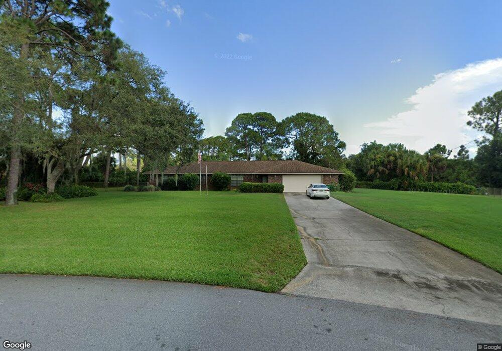
This home is located at 4881 Bridge Rd, Cocoa, FL 32927 and is currently estimated at $609,058, approximately $244 per square foot. 4881 Bridge Rd is a home located in Brevard County with nearby schools including Challenger 7 Elementary School, Space Coast Junior/Senior High School, and East Atlantic Prep of Brevard County.
Ownership History
We collect this data history from publicly available records. To have your information removed, we recommend requesting removal directly through your county’s website.
Purchase Details
Home Financials for this Owner
Home Financials are based on the most recent Mortgage that was taken out on this home.Purchase Details
Home Values in the Area
Average Home Value in this Area
Purchase History
We collect this data history from publicly available records. To have your information removed, we recommend requesting removal directly through your county’s website.
| Date | Buyer | Sale Price | Title Company |
|---|---|---|---|
| $340,000 | Fidelity Natl Title Ins Co | ||
| $150,000 | -- |
Mortgage History
We collect this data history from publicly available records. To have your information removed, we recommend requesting removal directly through your county’s website.
| Date | Status | Borrower | Loan Amount |
|---|---|---|---|
| Open | $300,000 |
Tax History
We collect this data history from publicly available records. To have your information removed, we recommend requesting removal directly through your county’s website.
| Year | Tax Paid | Tax Assessment Tax Assessment Total Assessment is a certain percentage of the fair market value that is determined by local assessors to be the total taxable value of land and additions on the property. | Land | Improvement |
|---|---|---|---|---|
| 2025 | $2,226 | $158,310 | -- | -- |
| 2024 | $2,182 | $153,850 | -- | -- |
| 2023 | $2,182 | $149,370 | $0 | $0 |
| 2022 | $2,045 | $145,020 | $0 | $0 |
| 2021 | $2,066 | $140,800 | $0 | $0 |
| 2020 | $1,982 | $138,860 | $0 | $0 |
| 2019 | $3,903 | $235,700 | $52,500 | $183,200 |
| 2018 | $1,847 | $128,260 | $0 | $0 |
| 2017 | $1,849 | $125,630 | $0 | $0 |
| 2016 | $1,863 | $123,050 | $36,000 | $87,050 |
| 2015 | $1,898 | $122,200 | $30,000 | $92,200 |
| 2014 | $1,904 | $121,230 | $22,000 | $99,230 |
Map
- 6162 Rena Ave
- 5915 Clearfield Ave
- 6180 Grissom Pkwy
- 5950 Ackard Ave
- 6074 Aires Ave
- 0 Unassigned Unit MFRTB8466891
- 6240 Grissom Pkwy
- 6020 Cannon Ave
- 6310 Depot Ave
- 5221 Carrick Rd
- 6350 Depot Ave
- 6165 Alden Ave
- 4485 Fay Blvd
- 5209 Holden Rd
- 4297 Canela Rd
- 5220 Holden Rd
- 6375 Cable Ave
- 5945 Coker Ave
- 6170 Janina Rd
- 4721 Fairsun St
- 4897 Bridge Rd
- 4873 Bridge Rd
- 5910 Barranco Ave
- 4900 Bridge Rd
- 5930 Barranco Ave
- 5950 Barranco Ave
- 4913 Bridge Rd
- 4735 Sugartown St
- 4857 Bridge Rd
- 4860 Bridge Rd
- 5905 Rena Ave
- 5970 Barranco Ave
- 4921 Bridge Rd
- 5935 Barranco Ave
- 4852 Bridge Rd
- 4849 Bridge Rd
- 4725 Sugartown St
- 5990 Barranco Ave
- 5965 Barranco Ave
- 5941 Rena Ave
Ask me questions while you tour the home.