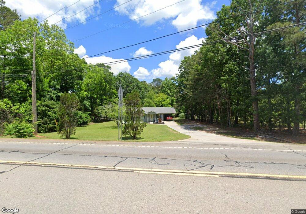
4883 Highway 42 S Locust Grove, GA 30248
Estimated Value: $196,000 - $241,000
3
Beds
1
Bath
1,053
Sq Ft
$206/Sq Ft
Est. Value
About This Home
This home is located at 4883 Highway 42 S, Locust Grove, GA 30248 and is currently estimated at $216,789, approximately $205 per square foot. 4883 Highway 42 S is a home located in Henry County with nearby schools including Locust Grove Elementary School, Locust Grove Middle School, and Locust Grove High School.
Ownership History
Date
Name
Owned For
Owner Type
Purchase Details
Closed on
Nov 20, 2012
Sold by
United Staes Of America
Bought by
Pope John Taylor and Pope Donna L
Current Estimated Value
Home Financials for this Owner
Home Financials are based on the most recent Mortgage that was taken out on this home.
Original Mortgage
$24,225
Interest Rate
3.45%
Mortgage Type
New Conventional
Purchase Details
Closed on
Oct 2, 2001
Sold by
Usda
Bought by
Swearingen Jimmy R and Swearingen Carolyn P
Home Financials for this Owner
Home Financials are based on the most recent Mortgage that was taken out on this home.
Original Mortgage
$62,000
Interest Rate
6.87%
Mortgage Type
New Conventional
Create a Home Valuation Report for This Property
The Home Valuation Report is an in-depth analysis detailing your home's value as well as a comparison with similar homes in the area
Home Values in the Area
Average Home Value in this Area
Purchase History
| Date | Buyer | Sale Price | Title Company |
|---|---|---|---|
| Pope John Taylor | -- | -- | |
| Swearingen Jimmy R | $40,000 | -- |
Source: Public Records
Mortgage History
| Date | Status | Borrower | Loan Amount |
|---|---|---|---|
| Closed | Pope John Taylor | $24,225 | |
| Previous Owner | Swearingen Jimmy R | $62,000 |
Source: Public Records
Tax History Compared to Growth
Tax History
| Year | Tax Paid | Tax Assessment Tax Assessment Total Assessment is a certain percentage of the fair market value that is determined by local assessors to be the total taxable value of land and additions on the property. | Land | Improvement |
|---|---|---|---|---|
| 2025 | $2,864 | $73,160 | $15,680 | $57,480 |
| 2024 | $2,864 | $75,560 | $14,280 | $61,280 |
| 2023 | $2,597 | $71,280 | $13,760 | $57,520 |
| 2022 | $1,967 | $53,360 | $12,680 | $40,680 |
| 2021 | $1,543 | $41,560 | $10,880 | $30,680 |
| 2020 | $1,371 | $36,800 | $10,280 | $26,520 |
| 2019 | $1,250 | $32,920 | $9,720 | $23,200 |
| 2018 | $1,132 | $29,920 | $9,000 | $20,920 |
| 2016 | $933 | $23,280 | $6,760 | $16,520 |
| 2015 | $847 | $20,400 | $6,840 | $13,560 |
| 2014 | $699 | $16,480 | $6,840 | $9,640 |
Source: Public Records
Map
Nearby Homes
- 0 Jackson St Unit 10554689
- 0 Locust Rd Unit 10495072
- 0 Locust Rd Unit 19967321
- 208 Umber Rd
- 212 Umber Rd
- 1537 Jackson St
- 213 Umber Rd
- 73 Weymouth Dr
- 71 Weymouth Dr
- 75 Weymouth Dr
- 69 Weymouth Dr
- Avion Plan at Bridle Creek
- Elle Plan at Bridle Creek
- 65 Weymouth Dr
- Halton Plan at Bridle Creek
- 632 Kimberwick Dr
- Mansfield Plan at Bridle Creek
- Denton Plan at Bridle Creek
- Hanover Plan at Bridle Creek
- 704 Curb Ct
- 4866 Highway 42
- 4933 Highway 42
- 4871 Highway 42
- 4850 Highway 42
- 413 Grove Park Dr
- 413 Grove Park Dr
- 413 Grove Park Dr Unit 2
- 409 Grove Park Dr
- 417 Grove Park Dr Unit 2
- 405 Grove Park Dr
- 421 Grove Park Dr Unit 2
- 40 Cottonfield Rd
- 59 Cottonfield Rd
- 425 Grove Park Dr Unit 2
- 429 Grove Park Dr
- 408 Grove Park Dr Unit 2
- 414 Grove Park Dr
- 406 Grove Park Dr Unit 2
- 410 Grove Park Dr
- 433 Grove Park Dr